Lohrville Topo Map Iowa
To zoom in, hover over the map of Lohrville
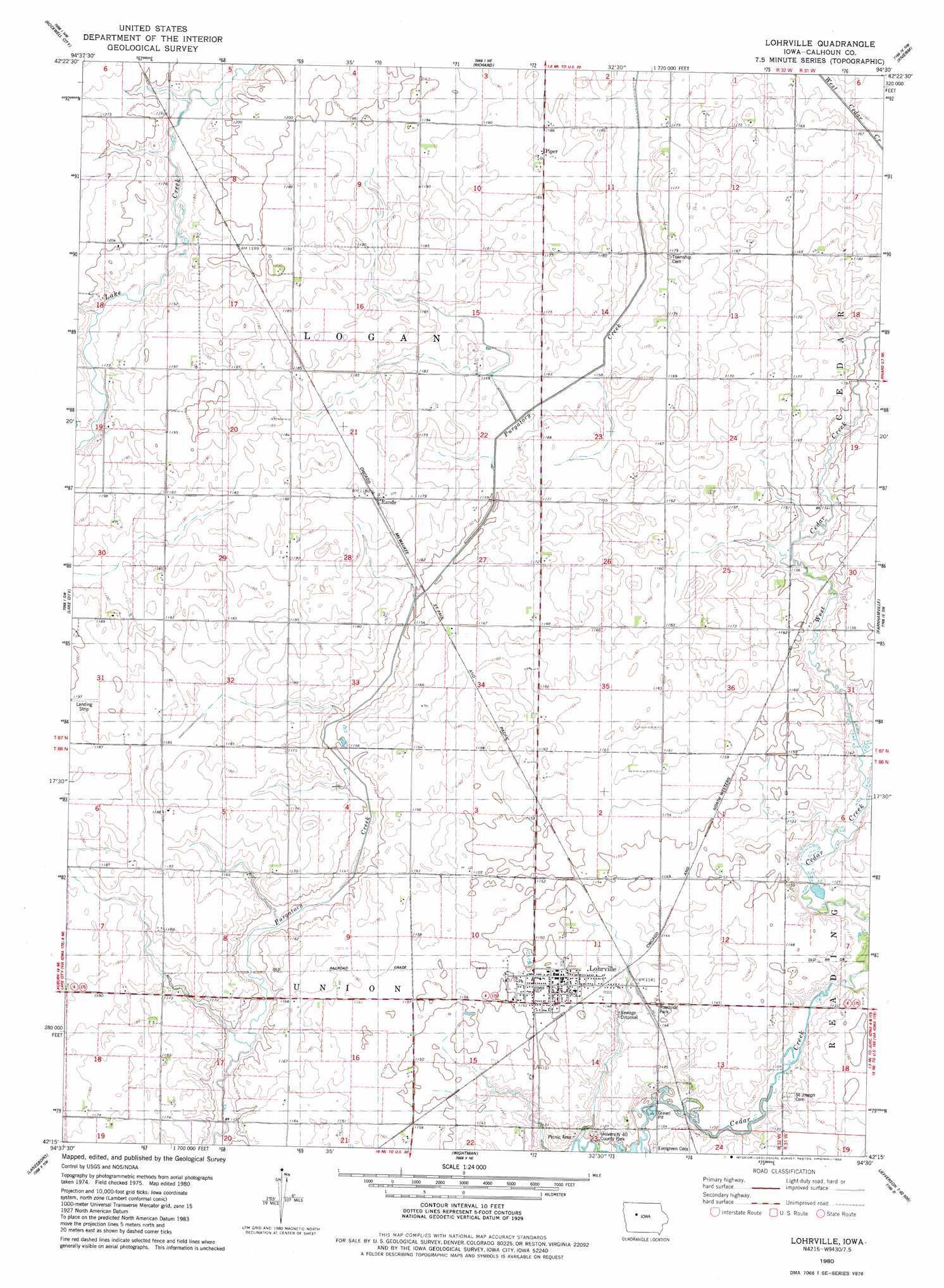
USGS Topo Quad 42094c5 - 1:24,000 scale
| Topo Map Name: | Lohrville |
| USGS Topo Quad ID: | 42094c5 |
| Print Size: | ca. 21 1/4" wide x 27" high |
| Southeast Coordinates: | 42.25° N latitude / 94.5° W longitude |
| Map Center Coordinates: | 42.3125° N latitude / 94.5625° W longitude |
| U.S. State: | IA |
| Filename: | o42094c5.jpg |
| Download Map JPG Image: | Lohrville topo map 1:24,000 scale |
| Map Type: | Topographic |
| Topo Series: | 7.5´ |
| Map Scale: | 1:24,000 |
| Source of Map Images: | United States Geological Survey (USGS) |
| Alternate Map Versions: |
Lohrville IA 1980, updated 1980 Download PDF Buy paper map Lohrville IA 2010 Download PDF Buy paper map Lohrville IA 2013 Download PDF Buy paper map Lohrville IA 2015 Download PDF Buy paper map |
1:24,000 Topo Quads surrounding Lohrville
Fonda |
Pomeroy |
Manson |
Gilmore City Sw |
Clare |
Lytton |
Rockwell City |
Richard |
Knierim |
Moorland |
Yetter |
Lake City |
Lohrville |
Farnhamville |
Gowrie |
Carroll Ne |
Lanesboro |
Wightman |
Churdan |
Paton |
Carroll East |
Glidden |
Scranton |
Jefferson West |
Jefferson East |
> Back to 42094a1 at 1:100,000 scale
> Back to 42094a1 at 1:250,000 scale
> Back to U.S. Topo Maps home
Lohrville topo map: Gazetteer
Lohrville: Parks
Johnson Prairie elevation 359m 1177′University Forty County Park elevation 342m 1122′
Lohrville: Populated Places
Lohrville elevation 351m 1151′Piper elevation 363m 1190′
Rands elevation 360m 1181′
Stimsons (historical) elevation 366m 1200′
Lohrville: Post Offices
Calhoun Post Office (historical) elevation 348m 1141′Lohrville Post Office elevation 351m 1151′
Rands Post Office (historical) elevation 360m 1181′
Lohrville: Streams
East Cedar Creek elevation 340m 1115′West Cedar Creek elevation 340m 1115′
Lohrville digital topo map on disk
Buy this Lohrville topo map showing relief, roads, GPS coordinates and other geographical features, as a high-resolution digital map file on DVD: