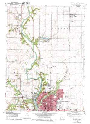
Fort Dodge North Topo Map Iowa
To zoom in, hover over the map of Fort Dodge North
USGS Topo Quad 42094e2 - 1:24,000 scale
| Topo Map Name: | Fort Dodge North |
| USGS Topo Quad ID: | 42094e2 |
| Print Size: | ca. 21 1/4" wide x 27" high |
| Southeast Coordinates: | 42.5° N latitude / 94.125° W longitude |
| Map Center Coordinates: | 42.5625° N latitude / 94.1875° W longitude |
| U.S. State: | IA |
| Filename: | o42094e2.jpg |
| Download Map JPG Image: | Fort Dodge North topo map 1:24,000 scale |
| Map Type: | Topographic |
| Topo Series: | 7.5´ |
| Map Scale: | 1:24,000 |
| Source of Map Images: | United States Geological Survey (USGS) |
| Alternate Map Versions: |
Fort Dodge North IA 1979, updated 1979 Download PDF Buy paper map Fort Dodge North IA 2010 Download PDF Buy paper map Fort Dodge North IA 2013 Download PDF Buy paper map Fort Dodge North IA 2015 Download PDF Buy paper map |
1:24,000 Topo Quads surrounding Fort Dodge North
> Back to 42094e1 at 1:100,000 scale
> Back to 42094a1 at 1:250,000 scale
> Back to U.S. Topo Maps home
Fort Dodge North topo map: Gazetteer
Fort Dodge North: Airports
Fort Dodge Municipal Airport elevation 340m 1115′Fort Dodge North: Mines
Fort Dodge Mine elevation 311m 1020′Fort Dodge North: Parks
Becker Wildlife Area elevation 311m 1020′City Square Park elevation 330m 1082′
Deer Creek Area elevation 322m 1056′
Dodger Stadium elevation 339m 1112′
Fort Dodge Military Post Historical Marker elevation 330m 1082′
Harlan Rogers Park elevation 351m 1151′
Haskell Park elevation 319m 1046′
Hydro Electric Park elevation 303m 994′
Island Park elevation 296m 971′
Jonathan P Dolliver State Historical Marker elevation 336m 1102′
Kennedy Brown Park elevation 341m 1118′
Kennedy Memorial County Park elevation 328m 1076′
Knollcrest Park elevation 340m 1115′
Loomis Park elevation 308m 1010′
McCarville Park elevation 335m 1099′
Phinny Park elevation 326m 1069′
RD Mitchell Park elevation 340m 1115′
Reynolds Park elevation 337m 1105′
Snell-Crawford Park elevation 315m 1033′
Veterans Memorial Park elevation 339m 1112′
Fort Dodge North: Populated Places
Badger elevation 351m 1151′Fort Dodge North: Post Offices
Badger Post Office elevation 351m 1151′Fort Dodge Post Office elevation 332m 1089′
Latham Post Office (historical) elevation 315m 1033′
Fort Dodge North: Reservoirs
Badger Lake elevation 328m 1076′Fort Dodge North: Streams
Badger Creek elevation 315m 1033′Bass Creek elevation 310m 1017′
Bradys Creek elevation 307m 1007′
Deer Creek elevation 314m 1030′
Lizard Creek elevation 297m 974′
Soldier Creek elevation 299m 980′
South Branch Lizard Creek elevation 306m 1003′
Fort Dodge North digital topo map on disk
Buy this Fort Dodge North topo map showing relief, roads, GPS coordinates and other geographical features, as a high-resolution digital map file on DVD:


