Pomeroy Topo Map Iowa
To zoom in, hover over the map of Pomeroy
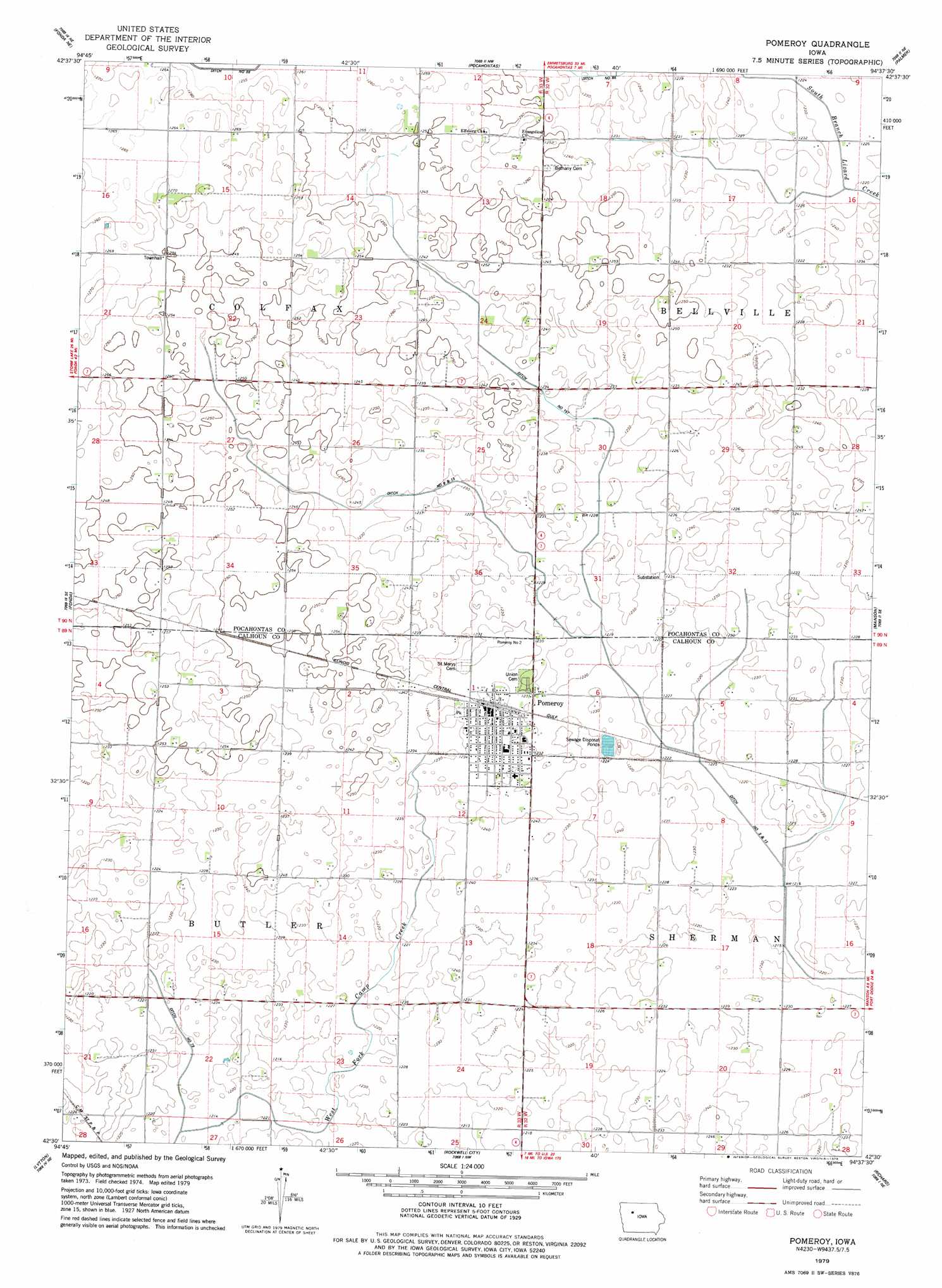
USGS Topo Quad 42094e6 - 1:24,000 scale
| Topo Map Name: | Pomeroy |
| USGS Topo Quad ID: | 42094e6 |
| Print Size: | ca. 21 1/4" wide x 27" high |
| Southeast Coordinates: | 42.5° N latitude / 94.625° W longitude |
| Map Center Coordinates: | 42.5625° N latitude / 94.6875° W longitude |
| U.S. State: | IA |
| Filename: | o42094e6.jpg |
| Download Map JPG Image: | Pomeroy topo map 1:24,000 scale |
| Map Type: | Topographic |
| Topo Series: | 7.5´ |
| Map Scale: | 1:24,000 |
| Source of Map Images: | United States Geological Survey (USGS) |
| Alternate Map Versions: |
Pomeroy IA 1979, updated 1979 Download PDF Buy paper map Pomeroy IA 2010 Download PDF Buy paper map Pomeroy IA 2013 Download PDF Buy paper map Pomeroy IA 2015 Download PDF Buy paper map |
1:24,000 Topo Quads surrounding Pomeroy
Albert City |
Laurens |
Havelock |
Rolfe |
Bradgate |
Varina |
Fonda Ne |
Pocahontas |
Palmer |
Gilmore City |
Newell East |
Fonda |
Pomeroy |
Manson |
Gilmore City Sw |
Sac City East |
Lytton |
Rockwell City |
Richard |
Knierim |
Grant City |
Yetter |
Lake City |
Lohrville |
Farnhamville |
> Back to 42094e1 at 1:100,000 scale
> Back to 42094a1 at 1:250,000 scale
> Back to U.S. Topo Maps home
Pomeroy topo map: Gazetteer
Pomeroy: Canals
Drainage Ditch 157 elevation 375m 1230′Drainage Ditch 66 elevation 381m 1250′
Drainage Ditch 79 elevation 369m 1210′
Joint Drainage Ditch 9-13 elevation 373m 1223′
Pomeroy: Populated Places
Pomeroy elevation 378m 1240′Pomeroy: Post Offices
Pomeroy Post Office elevation 378m 1240′Pomeroy digital topo map on disk
Buy this Pomeroy topo map showing relief, roads, GPS coordinates and other geographical features, as a high-resolution digital map file on DVD: