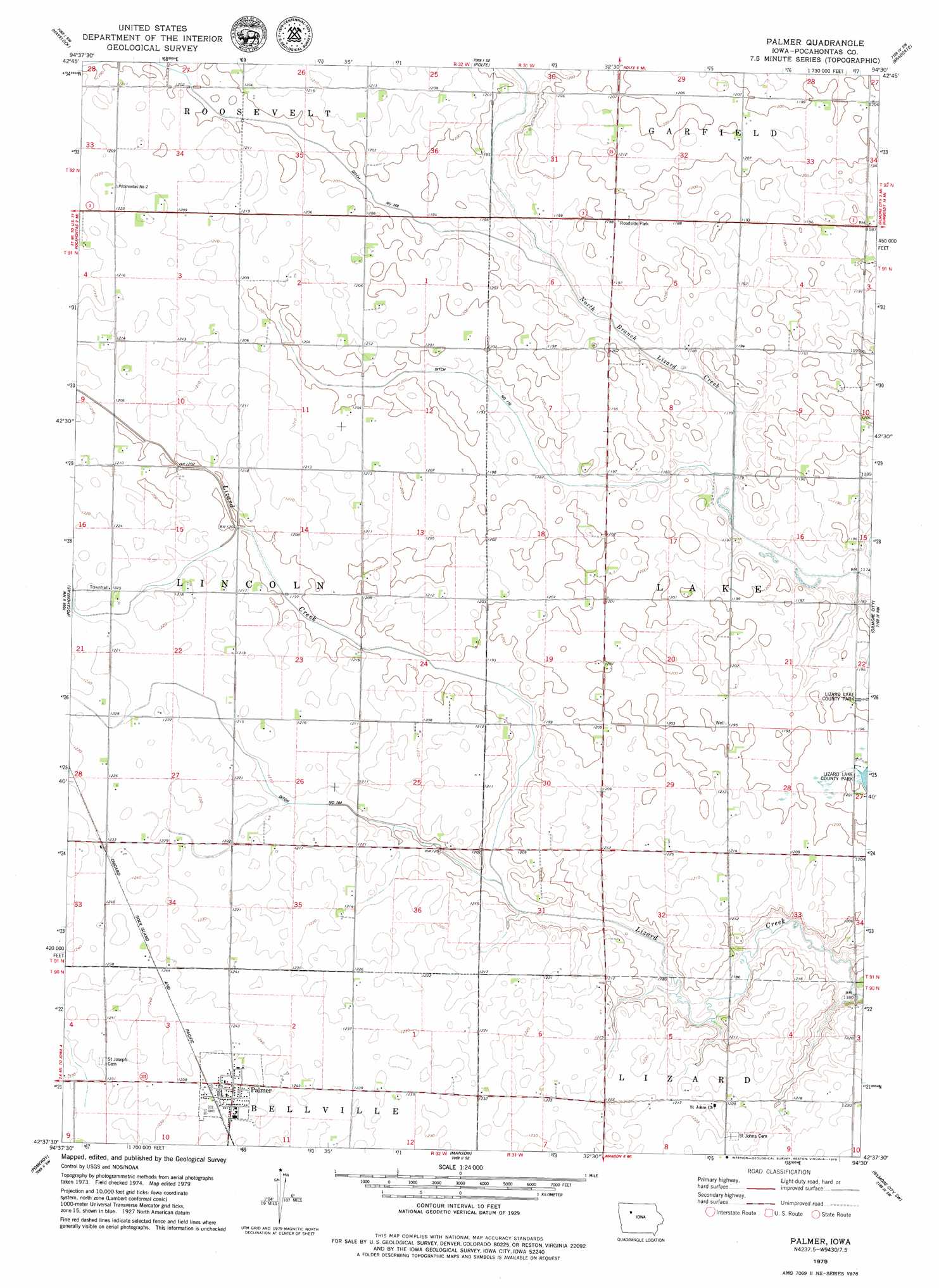
Palmer Topo Map Iowa
To zoom in, hover over the map of Palmer
USGS Topo Quad 42094f5 - 1:24,000 scale
| Topo Map Name: | Palmer |
| USGS Topo Quad ID: | 42094f5 |
| Print Size: | ca. 21 1/4" wide x 27" high |
| Southeast Coordinates: | 42.625° N latitude / 94.5° W longitude |
| Map Center Coordinates: | 42.6875° N latitude / 94.5625° W longitude |
| U.S. State: | IA |
| Filename: | o42094f5.jpg |
| Download Map JPG Image: | Palmer topo map 1:24,000 scale |
| Map Type: | Topographic |
| Topo Series: | 7.5´ |
| Map Scale: | 1:24,000 |
| Source of Map Images: | United States Geological Survey (USGS) |
| Alternate Map Versions: |
Palmer IA 2010 Download PDF Buy paper map Palmer IA 2013 Download PDF Buy paper map Palmer IA 2015 Download PDF Buy paper map |
1:24,000 Topo Quads surrounding Palmer
Rush Lake East |
Mallard |
Plover |
Unique |
West Bend Ne |
Laurens |
Havelock |
Rolfe |
Bradgate |
Bode |
Fonda Ne |
Pocahontas |
Palmer |
Gilmore City |
Umque |
Fonda |
Pomeroy |
Manson |
Gilmore City Sw |
Clare |
Lytton |
Rockwell City |
Richard |
Knierim |
Moorland |
> Back to 42094e1 at 1:100,000 scale
> Back to 42094a1 at 1:250,000 scale
> Back to U.S. Topo Maps home
Palmer topo map: Gazetteer
Palmer: Canals
Drainage Ditch Number 116 elevation 361m 1184′Drainage Ditch Number 164 elevation 368m 1207′
Drainage Ditch Number 169 elevation 363m 1190′
Palmer: Lakes
Lizard Lake elevation 366m 1200′Palmer: Parks
Toben Wildlife Preserve elevation 369m 1210′Palmer: Populated Places
Lizard (historical) elevation 365m 1197′Palmer elevation 378m 1240′
Palmer: Post Offices
Buda Post Office (historical) elevation 369m 1210′Palmer Post Office elevation 378m 1240′
Palmer digital topo map on disk
Buy this Palmer topo map showing relief, roads, GPS coordinates and other geographical features, as a high-resolution digital map file on DVD: