Bode Topo Map Iowa
To zoom in, hover over the map of Bode
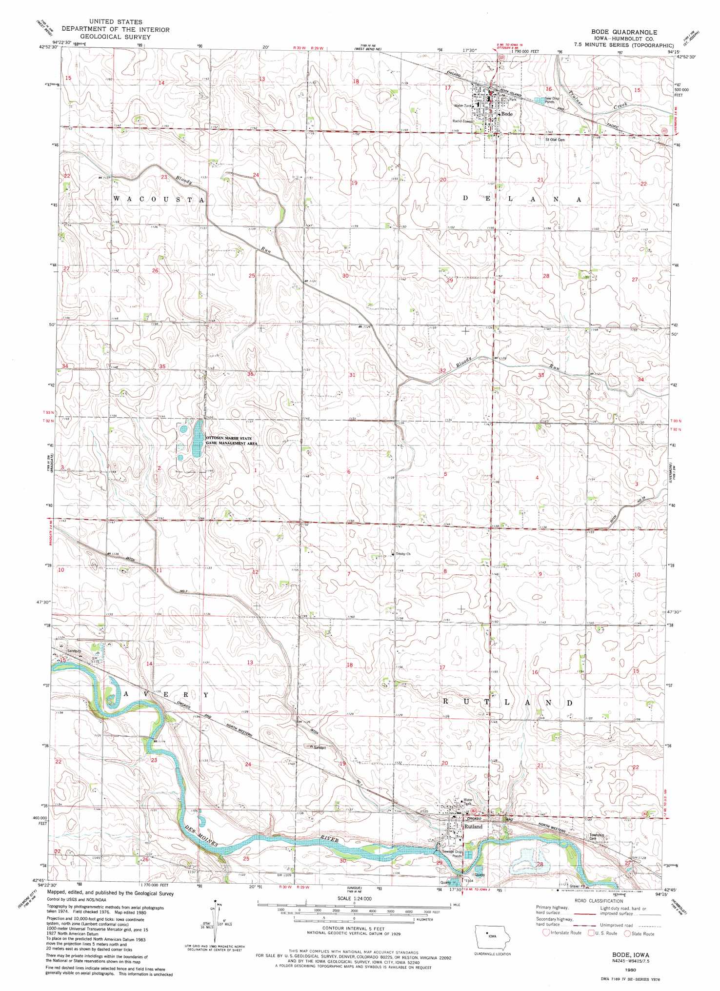
USGS Topo Quad 42094g3 - 1:24,000 scale
| Topo Map Name: | Bode |
| USGS Topo Quad ID: | 42094g3 |
| Print Size: | ca. 21 1/4" wide x 27" high |
| Southeast Coordinates: | 42.75° N latitude / 94.25° W longitude |
| Map Center Coordinates: | 42.8125° N latitude / 94.3125° W longitude |
| U.S. State: | IA |
| Filename: | o42094g3.jpg |
| Download Map JPG Image: | Bode topo map 1:24,000 scale |
| Map Type: | Topographic |
| Topo Series: | 7.5´ |
| Map Scale: | 1:24,000 |
| Source of Map Images: | United States Geological Survey (USGS) |
| Alternate Map Versions: |
Bode IA 1980, updated 1981 Download PDF Buy paper map Bode IA 2010 Download PDF Buy paper map Bode IA 2013 Download PDF Buy paper map Bode IA 2015 Download PDF Buy paper map |
1:24,000 Topo Quads surrounding Bode
Cylinder |
Whittemore |
Hobarton |
Algona |
Sexton |
Plover |
Unique |
West Bend Ne |
Saint Joseph |
Lu Verne |
Rolfe |
Bradgate |
Bode |
Livermore |
Hardy |
Palmer |
Gilmore City |
Umque |
Humboldt |
Thor |
Manson |
Gilmore City Sw |
Clare |
Fort Dodge North |
Vincent |
> Back to 42094e1 at 1:100,000 scale
> Back to 42094a1 at 1:250,000 scale
> Back to U.S. Topo Maps home
Bode topo map: Gazetteer
Bode: Canals
Ditch Number 7 elevation 343m 1125′Bode: Dams
Rutland Dam elevation 331m 1085′Bode: Parks
Ottosen Marsh State Game Management Area elevation 349m 1145′Bode: Populated Places
Bode elevation 353m 1158′Rutland elevation 336m 1102′
Bode: Post Offices
Bode Post Office elevation 352m 1154′Nora Post Office (historical) elevation 351m 1151′
Pleasant View Post Office (historical) elevation 343m 1125′
Rutland Post Office elevation 336m 1102′
Bode: Swamps
Rutland Marsh elevation 343m 1125′Bode digital topo map on disk
Buy this Bode topo map showing relief, roads, GPS coordinates and other geographical features, as a high-resolution digital map file on DVD: