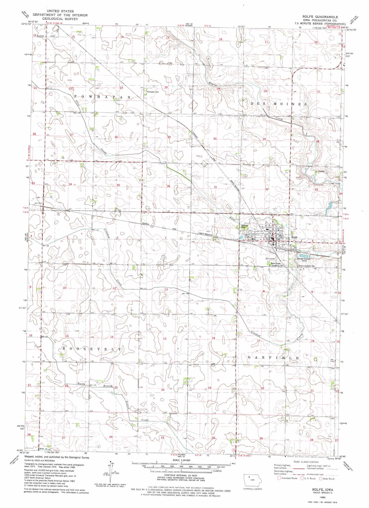
Rolfe Topo Map Iowa
To zoom in, hover over the map of Rolfe
USGS Topo Quad 42094g5 - 1:24,000 scale
| Topo Map Name: | Rolfe |
| USGS Topo Quad ID: | 42094g5 |
| Print Size: | ca. 21 1/4" wide x 27" high |
| Southeast Coordinates: | 42.75° N latitude / 94.5° W longitude |
| Map Center Coordinates: | 42.8125° N latitude / 94.5625° W longitude |
| U.S. State: | IA |
| Filename: | o42094g5.jpg |
| Download Map JPG Image: | Rolfe topo map 1:24,000 scale |
| Map Type: | Topographic |
| Topo Series: | 7.5´ |
| Map Scale: | 1:24,000 |
| Source of Map Images: | United States Geological Survey (USGS) |
| Alternate Map Versions: |
Rolfe IA 1980, updated 1980 Download PDF Buy paper map Rolfe IA 2010 Download PDF Buy paper map Rolfe IA 2013 Download PDF Buy paper map Rolfe IA 2015 Download PDF Buy paper map |
1:24,000 Topo Quads surrounding Rolfe
Ayrshire |
Emmetsburg |
Cylinder |
Whittemore |
Hobarton |
Rush Lake East |
Mallard |
Plover |
Unique |
West Bend Ne |
Laurens |
Havelock |
Rolfe |
Bradgate |
Bode |
Fonda Ne |
Pocahontas |
Palmer |
Gilmore City |
Umque |
Fonda |
Pomeroy |
Manson |
Gilmore City Sw |
Clare |
> Back to 42094e1 at 1:100,000 scale
> Back to 42094a1 at 1:250,000 scale
> Back to U.S. Topo Maps home
Rolfe topo map: Gazetteer
Rolfe: Parks
Feldman Park elevation 360m 1181′Plover Wildlife Area elevation 369m 1210′
Streit Park elevation 358m 1174′
Tiernan Homestead Natural Area elevation 363m 1190′
Rolfe: Populated Places
Rolfe elevation 361m 1184′Rubens Siding elevation 363m 1190′
Rolfe: Post Offices
Rolfe Post Office elevation 362m 1187′Rubens Post Office (historical) elevation 364m 1194′
Rolfe: Streams
Crooked Creek elevation 351m 1151′Rolfe digital topo map on disk
Buy this Rolfe topo map showing relief, roads, GPS coordinates and other geographical features, as a high-resolution digital map file on DVD: