West Bend Ne Topo Map Iowa
To zoom in, hover over the map of West Bend Ne
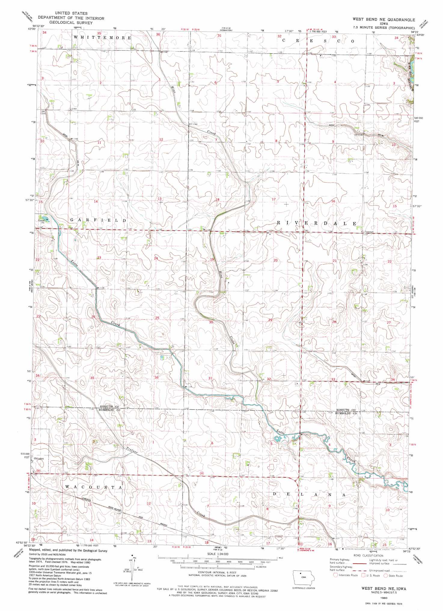
USGS Topo Quad 42094h3 - 1:24,000 scale
| Topo Map Name: | West Bend Ne |
| USGS Topo Quad ID: | 42094h3 |
| Print Size: | ca. 21 1/4" wide x 27" high |
| Southeast Coordinates: | 42.875° N latitude / 94.25° W longitude |
| Map Center Coordinates: | 42.9375° N latitude / 94.3125° W longitude |
| U.S. State: | IA |
| Filename: | o42094h3.jpg |
| Download Map JPG Image: | West Bend Ne topo map 1:24,000 scale |
| Map Type: | Topographic |
| Topo Series: | 7.5´ |
| Map Scale: | 1:24,000 |
| Source of Map Images: | United States Geological Survey (USGS) |
| Alternate Map Versions: |
West Bend NE IA 1980, updated 1981 Download PDF Buy paper map West Bend NE IA 2010 Download PDF Buy paper map West Bend NE IA 2013 Download PDF Buy paper map West Bend NE IA 2015 Download PDF Buy paper map |
1:24,000 Topo Quads surrounding West Bend Ne
Depew |
Fenton |
Lone Rock |
Burt |
Titonka |
Cylinder |
Whittemore |
Hobarton |
Algona |
Sexton |
Plover |
Unique |
West Bend Ne |
Saint Joseph |
Lu Verne |
Rolfe |
Bradgate |
Bode |
Livermore |
Hardy |
Palmer |
Gilmore City |
Umque |
Humboldt |
Thor |
> Back to 42094e1 at 1:100,000 scale
> Back to 42094a1 at 1:250,000 scale
> Back to U.S. Topo Maps home
West Bend Ne topo map: Gazetteer
West Bend Ne: Canals
Ditch Number 79 elevation 349m 1145′Ditch Number 94 elevation 339m 1112′
West Bend Ne: Streams
Hine Creek elevation 339m 1112′West Bend Ne digital topo map on disk
Buy this West Bend Ne topo map showing relief, roads, GPS coordinates and other geographical features, as a high-resolution digital map file on DVD: