Mapleton Se Topo Map Iowa
To zoom in, hover over the map of Mapleton Se
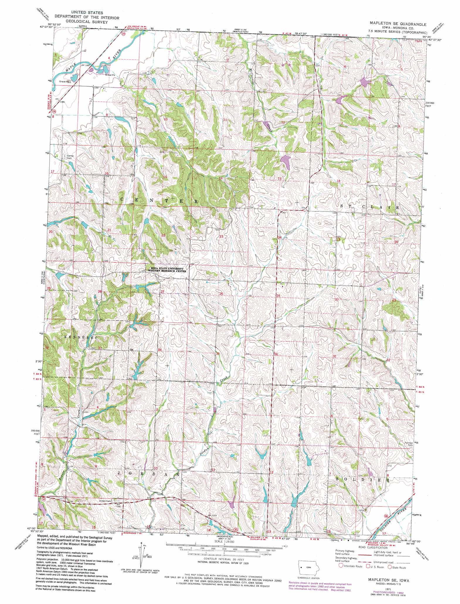
USGS Topo Quad 42095a7 - 1:24,000 scale
| Topo Map Name: | Mapleton Se |
| USGS Topo Quad ID: | 42095a7 |
| Print Size: | ca. 21 1/4" wide x 27" high |
| Southeast Coordinates: | 42° N latitude / 95.75° W longitude |
| Map Center Coordinates: | 42.0625° N latitude / 95.8125° W longitude |
| U.S. State: | IA |
| Filename: | o42095a7.jpg |
| Download Map JPG Image: | Mapleton Se topo map 1:24,000 scale |
| Map Type: | Topographic |
| Topo Series: | 7.5´ |
| Map Scale: | 1:24,000 |
| Source of Map Images: | United States Geological Survey (USGS) |
| Alternate Map Versions: |
Mapleton SE IA 1971, updated 1973 Download PDF Buy paper map Mapleton SE IA 1971, updated 1983 Download PDF Buy paper map Mapleton SE IA 2010 Download PDF Buy paper map Mapleton SE IA 2013 Download PDF Buy paper map Mapleton SE IA 2015 Download PDF Buy paper map |
1:24,000 Topo Quads surrounding Mapleton Se
Climbing Hill |
Oto |
Correctionville Se |
Holstein Sw |
Battle Creek |
Hornick |
Smithland |
Mapleton |
Danbury |
Ricketts |
Onawa |
Castana |
Mapleton Se |
Ute |
Charter Oak |
Blencoe |
Moorhead Nw |
Moorhead |
Dunlap Nw |
Dunlap Ne |
Little Sioux |
Pisgah |
Moorhead Se |
Dunlap Sw |
Dunlap |
> Back to 42095a1 at 1:100,000 scale
> Back to 42094a1 at 1:250,000 scale
> Back to U.S. Topo Maps home
Mapleton Se topo map: Gazetteer
Mapleton Se: Dams
Site H-4-4 Davis-Battle Creek Dam elevation 380m 1246′Mapleton Se: Parks
Gray's Landing Wildlife Area elevation 342m 1122′Oldham Recreation Area elevation 370m 1213′
Mapleton Se digital topo map on disk
Buy this Mapleton Se topo map showing relief, roads, GPS coordinates and other geographical features, as a high-resolution digital map file on DVD: