Ricketts Topo Map Iowa
To zoom in, hover over the map of Ricketts
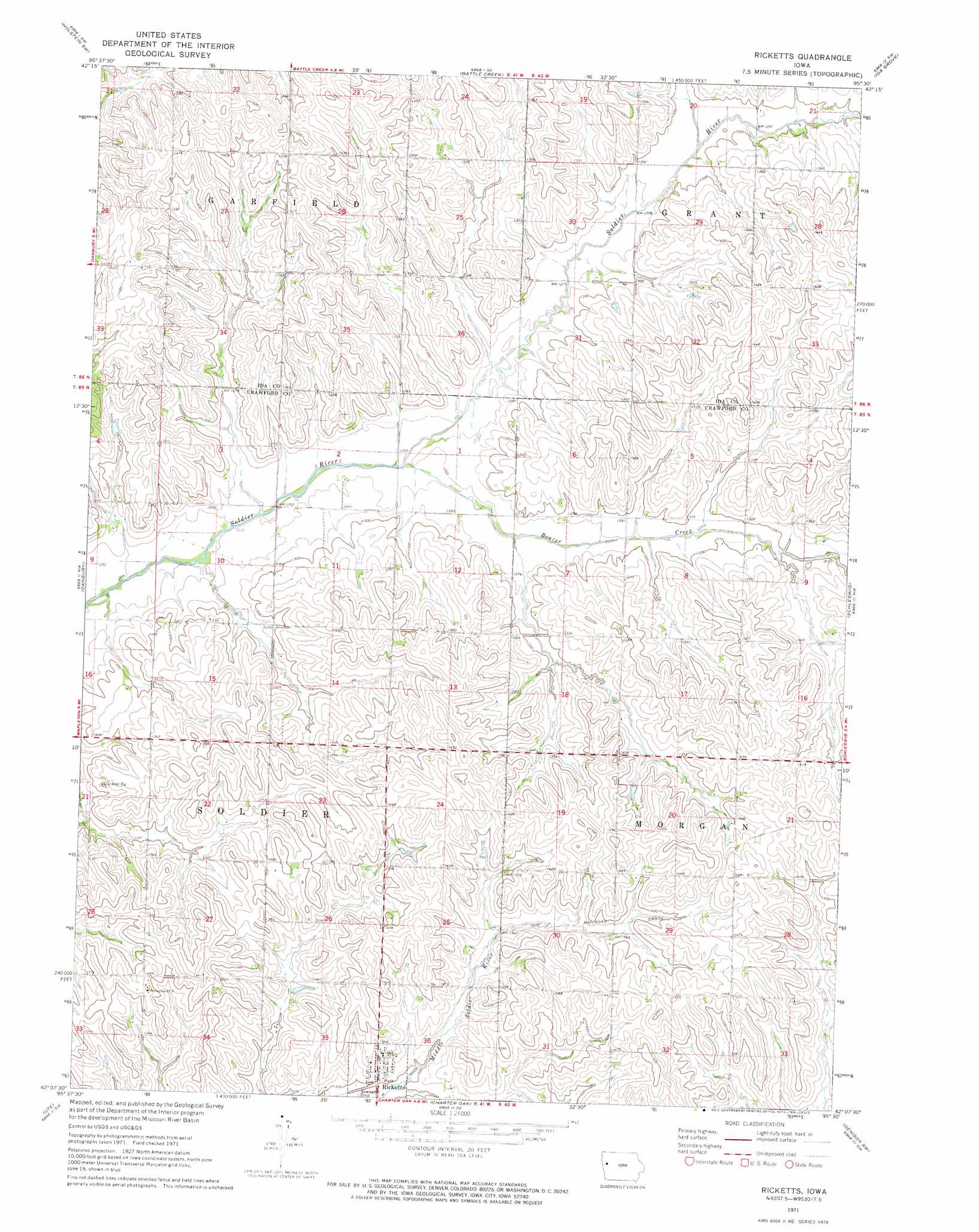
USGS Topo Quad 42095b5 - 1:24,000 scale
| Topo Map Name: | Ricketts |
| USGS Topo Quad ID: | 42095b5 |
| Print Size: | ca. 21 1/4" wide x 27" high |
| Southeast Coordinates: | 42.125° N latitude / 95.5° W longitude |
| Map Center Coordinates: | 42.1875° N latitude / 95.5625° W longitude |
| U.S. State: | IA |
| Filename: | o42095b5.jpg |
| Download Map JPG Image: | Ricketts topo map 1:24,000 scale |
| Map Type: | Topographic |
| Topo Series: | 7.5´ |
| Map Scale: | 1:24,000 |
| Source of Map Images: | United States Geological Survey (USGS) |
| Alternate Map Versions: |
Ricketts IA 1971, updated 1973 Download PDF Buy paper map Ricketts IA 2010 Download PDF Buy paper map Ricketts IA 2013 Download PDF Buy paper map Ricketts IA 2015 Download PDF Buy paper map |
1:24,000 Topo Quads surrounding Ricketts
Correctionville |
Cushing |
Holstein |
Ida Grove Nw |
Schaller South |
Correctionville Se |
Holstein Sw |
Battle Creek |
Ida Grove |
Odebolt West |
Mapleton |
Danbury |
Ricketts |
Schleswig |
Kiron |
Mapleton Se |
Ute |
Charter Oak |
Denison Sw |
Denison |
Moorhead |
Dunlap Nw |
Dunlap Ne |
Dow City |
Earling Ne |
> Back to 42095a1 at 1:100,000 scale
> Back to 42094a1 at 1:250,000 scale
> Back to U.S. Topo Maps home
Ricketts topo map: Gazetteer
Ricketts: Bridges
Beaver Creek Bridge elevation 392m 1286′Ricketts: Populated Places
Ricketts elevation 398m 1305′Ricketts: Post Offices
Ricketts Post Office elevation 398m 1305′Ricketts: Streams
Beaver Creek elevation 378m 1240′Ricketts digital topo map on disk
Buy this Ricketts topo map showing relief, roads, GPS coordinates and other geographical features, as a high-resolution digital map file on DVD: