Smithland Topo Map Iowa
To zoom in, hover over the map of Smithland
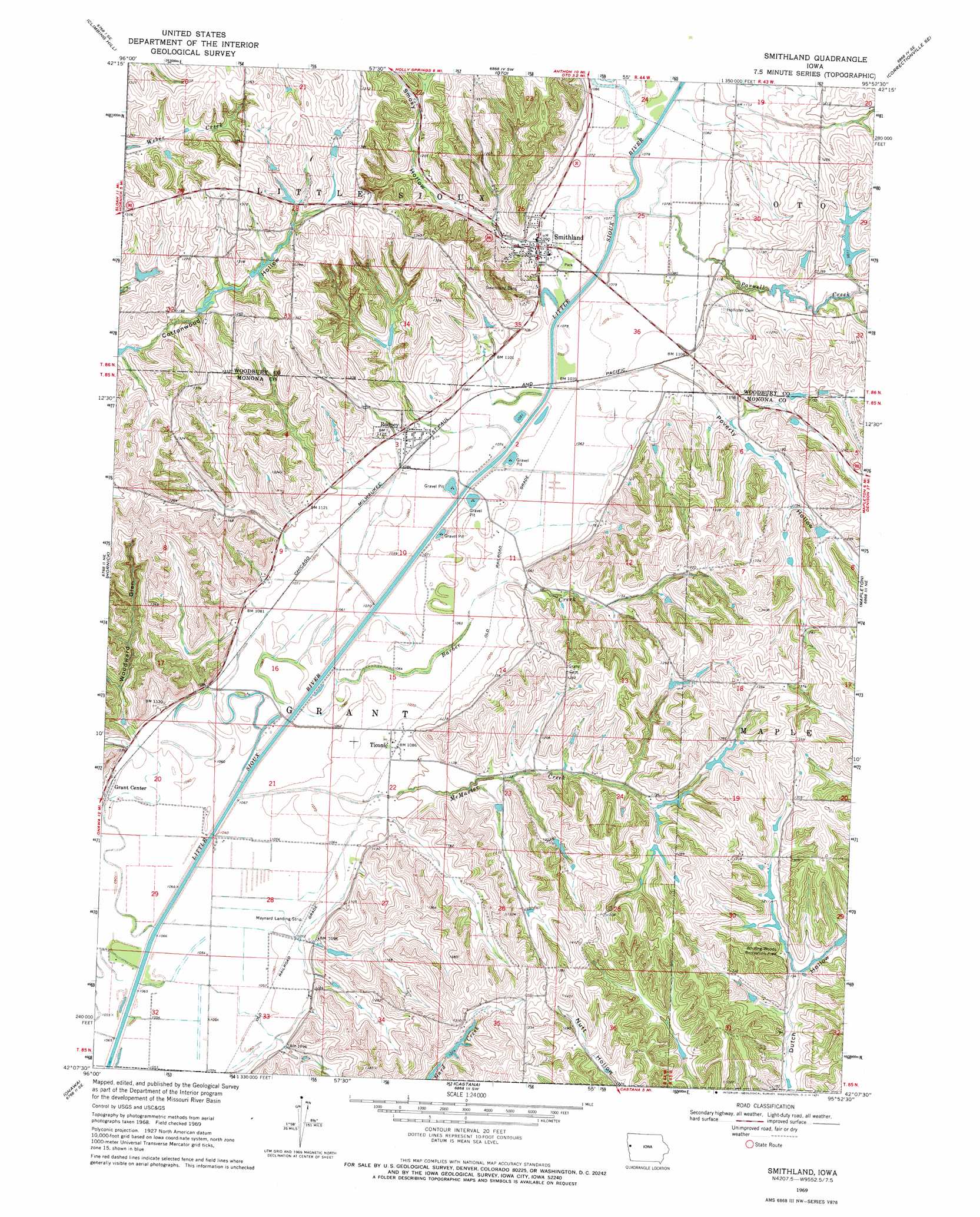
USGS Topo Quad 42095b8 - 1:24,000 scale
| Topo Map Name: | Smithland |
| USGS Topo Quad ID: | 42095b8 |
| Print Size: | ca. 21 1/4" wide x 27" high |
| Southeast Coordinates: | 42.125° N latitude / 95.875° W longitude |
| Map Center Coordinates: | 42.1875° N latitude / 95.9375° W longitude |
| U.S. State: | IA |
| Filename: | o42095b8.jpg |
| Download Map JPG Image: | Smithland topo map 1:24,000 scale |
| Map Type: | Topographic |
| Topo Series: | 7.5´ |
| Map Scale: | 1:24,000 |
| Source of Map Images: | United States Geological Survey (USGS) |
| Alternate Map Versions: |
Smithland IA 1969, updated 1971 Download PDF Buy paper map Smithland IA 2010 Download PDF Buy paper map Smithland IA 2013 Download PDF Buy paper map Smithland IA 2015 Download PDF Buy paper map |
1:24,000 Topo Quads surrounding Smithland
Lawton |
Moville |
Correctionville Nw |
Correctionville |
Cushing |
Luton |
Climbing Hill |
Oto |
Correctionville Se |
Holstein Sw |
Sloan |
Hornick |
Smithland |
Mapleton |
Danbury |
Onawa Sw |
Onawa |
Castana |
Mapleton Se |
Ute |
Tekamah Nw |
Blencoe |
Moorhead Nw |
Moorhead |
Dunlap Nw |
> Back to 42095a1 at 1:100,000 scale
> Back to 42094a1 at 1:250,000 scale
> Back to U.S. Topo Maps home
Smithland topo map: Gazetteer
Smithland: Airports
Maynard Airport elevation 332m 1089′Smithland: Parks
Rodney Pits Recreation Area elevation 326m 1069′Site of First School in Woodbury County Historical Marker elevation 346m 1135′
Whiting Woods Recreation Area elevation 358m 1174′
Smithland: Populated Places
Rodney elevation 340m 1115′Smithland elevation 331m 1085′
Ticonic elevation 330m 1082′
Smithland: Post Offices
Grant Center Post Office (historical) elevation 323m 1059′Rodney Post Office elevation 340m 1115′
Smithland Post Office elevation 331m 1085′
Ticonic Post Office (historical) elevation 327m 1072′
Smithland: Streams
Barber Creek elevation 319m 1046′McMaster Creek elevation 318m 1043′
Parnell Creek elevation 323m 1059′
Smithland: Valleys
Poverty Hollow elevation 335m 1099′Smoky Hollow elevation 339m 1112′
Woodward Glen elevation 329m 1079′
Smithland digital topo map on disk
Buy this Smithland topo map showing relief, roads, GPS coordinates and other geographical features, as a high-resolution digital map file on DVD: