Correctionville Se Topo Map Iowa
To zoom in, hover over the map of Correctionville Se
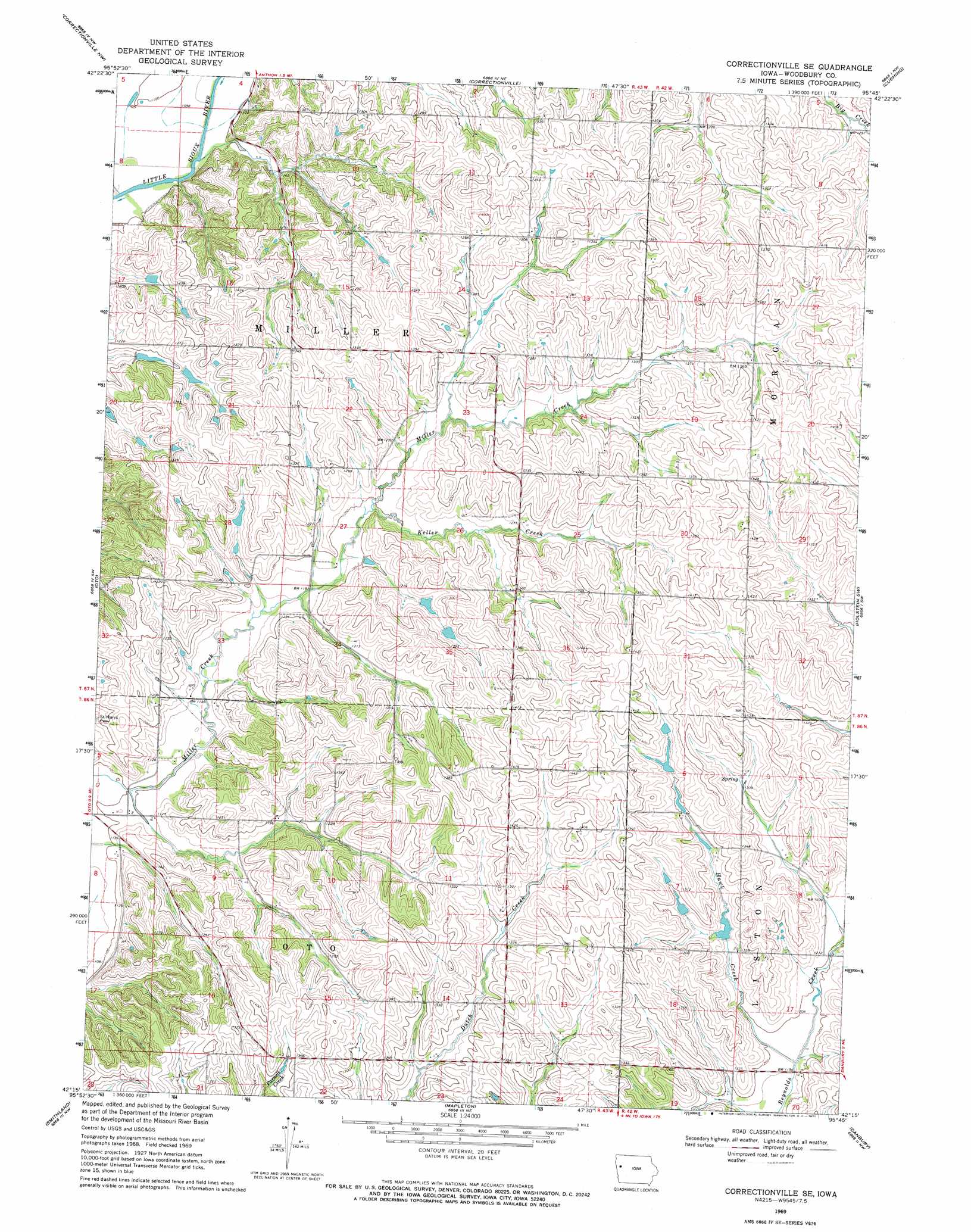
USGS Topo Quad 42095c7 - 1:24,000 scale
| Topo Map Name: | Correctionville Se |
| USGS Topo Quad ID: | 42095c7 |
| Print Size: | ca. 21 1/4" wide x 27" high |
| Southeast Coordinates: | 42.25° N latitude / 95.75° W longitude |
| Map Center Coordinates: | 42.3125° N latitude / 95.8125° W longitude |
| U.S. State: | IA |
| Filename: | o42095c7.jpg |
| Download Map JPG Image: | Correctionville Se topo map 1:24,000 scale |
| Map Type: | Topographic |
| Topo Series: | 7.5´ |
| Map Scale: | 1:24,000 |
| Source of Map Images: | United States Geological Survey (USGS) |
| Alternate Map Versions: |
Correctionville SE IA 1969, updated 1971 Download PDF Buy paper map Correctionville SE IA 2010 Download PDF Buy paper map Correctionville SE IA 2013 Download PDF Buy paper map Correctionville SE IA 2015 Download PDF Buy paper map |
1:24,000 Topo Quads surrounding Correctionville Se
Union Center Se |
Kingsley |
Pierson |
Washta |
Quimby Se |
Moville |
Correctionville Nw |
Correctionville |
Cushing |
Holstein |
Climbing Hill |
Oto |
Correctionville Se |
Holstein Sw |
Battle Creek |
Hornick |
Smithland |
Mapleton |
Danbury |
Ricketts |
Onawa |
Castana |
Mapleton Se |
Ute |
Charter Oak |
> Back to 42095a1 at 1:100,000 scale
> Back to 42094a1 at 1:250,000 scale
> Back to U.S. Topo Maps home
Correctionville Se topo map: Gazetteer
Correctionville Se: Parks
Curtin Timber elevation 395m 1295′Correctionville Se: Streams
Hawk Creek elevation 360m 1181′Keller Creek elevation 364m 1194′
Correctionville Se digital topo map on disk
Buy this Correctionville Se topo map showing relief, roads, GPS coordinates and other geographical features, as a high-resolution digital map file on DVD: