Holstein Topo Map Iowa
To zoom in, hover over the map of Holstein
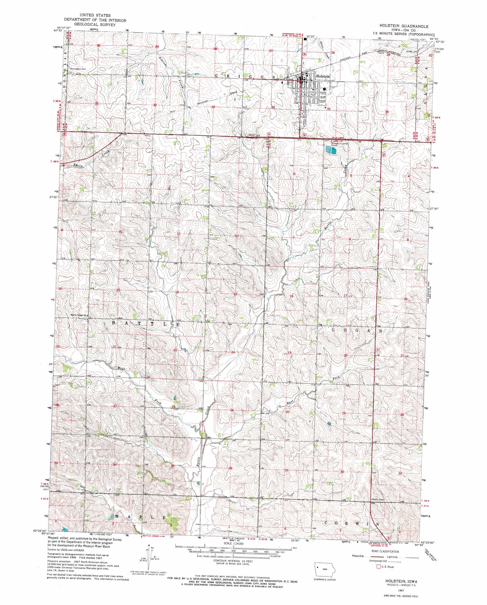
USGS Topo Quad 42095d5 - 1:24,000 scale
| Topo Map Name: | Holstein |
| USGS Topo Quad ID: | 42095d5 |
| Print Size: | ca. 21 1/4" wide x 27" high |
| Southeast Coordinates: | 42.375° N latitude / 95.5° W longitude |
| Map Center Coordinates: | 42.4375° N latitude / 95.5625° W longitude |
| U.S. State: | IA |
| Filename: | o42095d5.jpg |
| Download Map JPG Image: | Holstein topo map 1:24,000 scale |
| Map Type: | Topographic |
| Topo Series: | 7.5´ |
| Map Scale: | 1:24,000 |
| Source of Map Images: | United States Geological Survey (USGS) |
| Alternate Map Versions: |
Holstein IA 1967, updated 1968 Download PDF Buy paper map Holstein IA 2010 Download PDF Buy paper map Holstein IA 2013 Download PDF Buy paper map Holstein IA 2015 Download PDF Buy paper map |
1:24,000 Topo Quads surrounding Holstein
Fielding |
Quimby |
Cherokee South |
Aurelia |
Alta |
Pierson |
Washta |
Quimby Se |
Galva |
Schaller North |
Correctionville |
Cushing |
Holstein |
Ida Grove Nw |
Schaller South |
Correctionville Se |
Holstein Sw |
Battle Creek |
Ida Grove |
Odebolt West |
Mapleton |
Danbury |
Ricketts |
Schleswig |
Kiron |
> Back to 42095a1 at 1:100,000 scale
> Back to 42094a1 at 1:250,000 scale
> Back to U.S. Topo Maps home
Holstein topo map: Gazetteer
Holstein: Populated Places
Holstein elevation 442m 1450′Holstein: Post Offices
Cornelia Post Office (historical) elevation 428m 1404′Holstein Post Office elevation 443m 1453′
Willow Dale Post Office (historical) elevation 418m 1371′
Holstein: Streams
East Fork Battle Creek elevation 378m 1240′West Fork Battle Creek elevation 381m 1250′
Holstein digital topo map on disk
Buy this Holstein topo map showing relief, roads, GPS coordinates and other geographical features, as a high-resolution digital map file on DVD: