Cushing Topo Map Iowa
To zoom in, hover over the map of Cushing
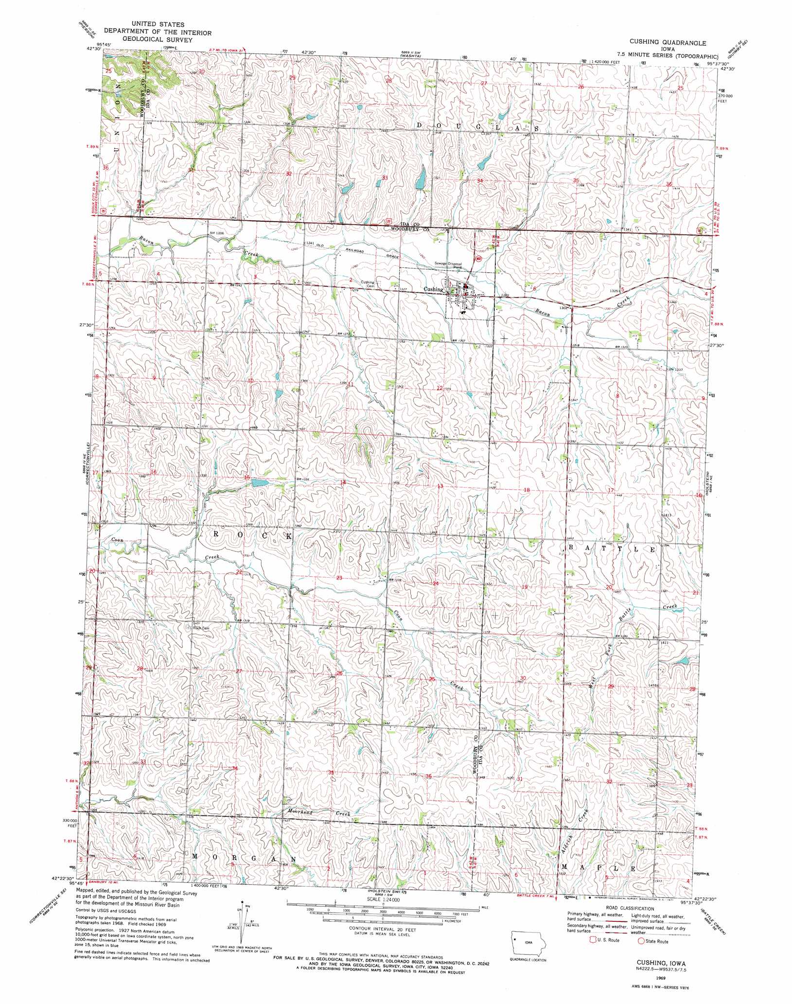
USGS Topo Quad 42095d6 - 1:24,000 scale
| Topo Map Name: | Cushing |
| USGS Topo Quad ID: | 42095d6 |
| Print Size: | ca. 21 1/4" wide x 27" high |
| Southeast Coordinates: | 42.375° N latitude / 95.625° W longitude |
| Map Center Coordinates: | 42.4375° N latitude / 95.6875° W longitude |
| U.S. State: | IA |
| Filename: | o42095d6.jpg |
| Download Map JPG Image: | Cushing topo map 1:24,000 scale |
| Map Type: | Topographic |
| Topo Series: | 7.5´ |
| Map Scale: | 1:24,000 |
| Source of Map Images: | United States Geological Survey (USGS) |
| Alternate Map Versions: |
Cushing IA 1969, updated 1971 Download PDF Buy paper map Cushing IA 2010 Download PDF Buy paper map Cushing IA 2013 Download PDF Buy paper map Cushing IA 2015 Download PDF Buy paper map |
1:24,000 Topo Quads surrounding Cushing
Kingsley Nw |
Fielding |
Quimby |
Cherokee South |
Aurelia |
Kingsley |
Pierson |
Washta |
Quimby Se |
Galva |
Correctionville Nw |
Correctionville |
Cushing |
Holstein |
Ida Grove Nw |
Oto |
Correctionville Se |
Holstein Sw |
Battle Creek |
Ida Grove |
Smithland |
Mapleton |
Danbury |
Ricketts |
Schleswig |
> Back to 42095a1 at 1:100,000 scale
> Back to 42094a1 at 1:250,000 scale
> Back to U.S. Topo Maps home
Cushing topo map: Gazetteer
Cushing: Populated Places
Cushing elevation 395m 1295′Cushing: Post Offices
Cushing Post Office elevation 391m 1282′Cushing digital topo map on disk
Buy this Cushing topo map showing relief, roads, GPS coordinates and other geographical features, as a high-resolution digital map file on DVD: