Correctionville Topo Map Iowa
To zoom in, hover over the map of Correctionville
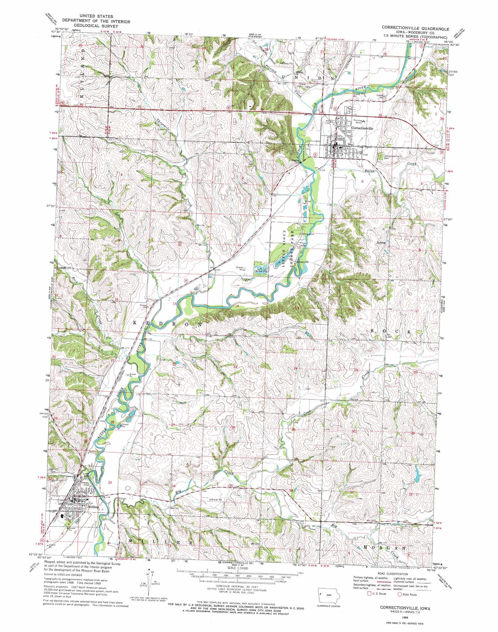
USGS Topo Quad 42095d7 - 1:24,000 scale
| Topo Map Name: | Correctionville |
| USGS Topo Quad ID: | 42095d7 |
| Print Size: | ca. 21 1/4" wide x 27" high |
| Southeast Coordinates: | 42.375° N latitude / 95.75° W longitude |
| Map Center Coordinates: | 42.4375° N latitude / 95.8125° W longitude |
| U.S. State: | IA |
| Filename: | o42095d7.jpg |
| Download Map JPG Image: | Correctionville topo map 1:24,000 scale |
| Map Type: | Topographic |
| Topo Series: | 7.5´ |
| Map Scale: | 1:24,000 |
| Source of Map Images: | United States Geological Survey (USGS) |
| Alternate Map Versions: |
Correctionville IA 1969, updated 1971 Download PDF Buy paper map Correctionville IA 2010 Download PDF Buy paper map Correctionville IA 2013 Download PDF Buy paper map Correctionville IA 2015 Download PDF Buy paper map |
1:24,000 Topo Quads surrounding Correctionville
Union Center |
Kingsley Nw |
Fielding |
Quimby |
Cherokee South |
Union Center Se |
Kingsley |
Pierson |
Washta |
Quimby Se |
Moville |
Correctionville Nw |
Correctionville |
Cushing |
Holstein |
Climbing Hill |
Oto |
Correctionville Se |
Holstein Sw |
Battle Creek |
Hornick |
Smithland |
Mapleton |
Danbury |
Ricketts |
> Back to 42095a1 at 1:100,000 scale
> Back to 42094a1 at 1:250,000 scale
> Back to U.S. Topo Maps home
Correctionville topo map: Gazetteer
Correctionville: Areas
Sioux Bend Public Hunting Area elevation 344m 1128′Correctionville: Parks
Copeland Park elevation 341m 1118′Historic Sioux City State Historical Marker elevation 341m 1118′
Little Sioux County Park elevation 341m 1118′
Shagbark Hills Area elevation 382m 1253′
Sioux Bend Wildlife Area elevation 341m 1118′
Stahls Park elevation 337m 1105′
Correctionville: Populated Places
Anthon elevation 341m 1118′Correctionville elevation 343m 1125′
Correctionville: Post Offices
Anthon Post Office elevation 341m 1118′Correctionville Post Office elevation 343m 1125′
Discord Post Office (historical) elevation 336m 1102′
Correctionville: Streams
Bacon Creek elevation 340m 1115′Big Creek elevation 335m 1099′
Coon Creek elevation 348m 1141′
Pierson Creek elevation 341m 1118′
Rock Creek elevation 335m 1099′
Threemile Creek elevation 335m 1099′
Correctionville digital topo map on disk
Buy this Correctionville topo map showing relief, roads, GPS coordinates and other geographical features, as a high-resolution digital map file on DVD: