Galva Topo Map Iowa
To zoom in, hover over the map of Galva
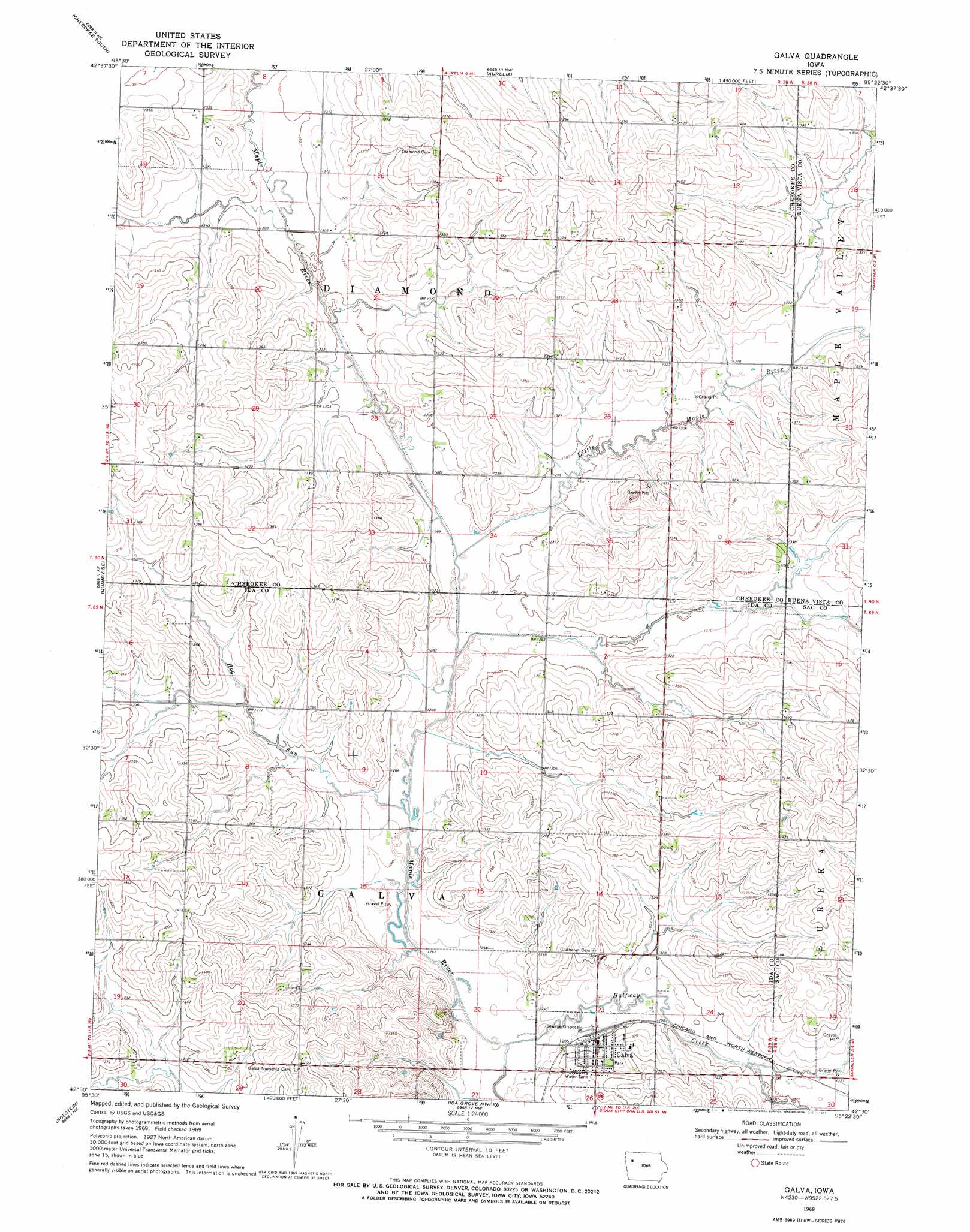
USGS Topo Quad 42095e4 - 1:24,000 scale
| Topo Map Name: | Galva |
| USGS Topo Quad ID: | 42095e4 |
| Print Size: | ca. 21 1/4" wide x 27" high |
| Southeast Coordinates: | 42.5° N latitude / 95.375° W longitude |
| Map Center Coordinates: | 42.5625° N latitude / 95.4375° W longitude |
| U.S. State: | IA |
| Filename: | o42095e4.jpg |
| Download Map JPG Image: | Galva topo map 1:24,000 scale |
| Map Type: | Topographic |
| Topo Series: | 7.5´ |
| Map Scale: | 1:24,000 |
| Source of Map Images: | United States Geological Survey (USGS) |
| Alternate Map Versions: |
Galva IA 1969, updated 1971 Download PDF Buy paper map Galva IA 2010 Download PDF Buy paper map Galva IA 2013 Download PDF Buy paper map Galva IA 2015 Download PDF Buy paper map |
1:24,000 Topo Quads surrounding Galva
Cleghorn |
Cherokee North |
Peterson Sw |
Peterson Se |
Rembrandt |
Quimby |
Cherokee South |
Aurelia |
Alta |
Storm Lake |
Washta |
Quimby Se |
Galva |
Schaller North |
Lakeside |
Cushing |
Holstein |
Ida Grove Nw |
Schaller South |
Early |
Holstein Sw |
Battle Creek |
Ida Grove |
Odebolt West |
Odebolt East |
> Back to 42095e1 at 1:100,000 scale
> Back to 42094a1 at 1:250,000 scale
> Back to U.S. Topo Maps home
Galva topo map: Gazetteer
Galva: Populated Places
Galva elevation 396m 1299′Galva: Post Offices
Coulson Post Office elevation 417m 1368′Diamond Post Office (historical) elevation 417m 1368′
Galva Post Office elevation 395m 1295′
Galva: Streams
Halfway Creek elevation 383m 1256′Hog Run elevation 387m 1269′
Little Maple River elevation 391m 1282′
Galva digital topo map on disk
Buy this Galva topo map showing relief, roads, GPS coordinates and other geographical features, as a high-resolution digital map file on DVD: