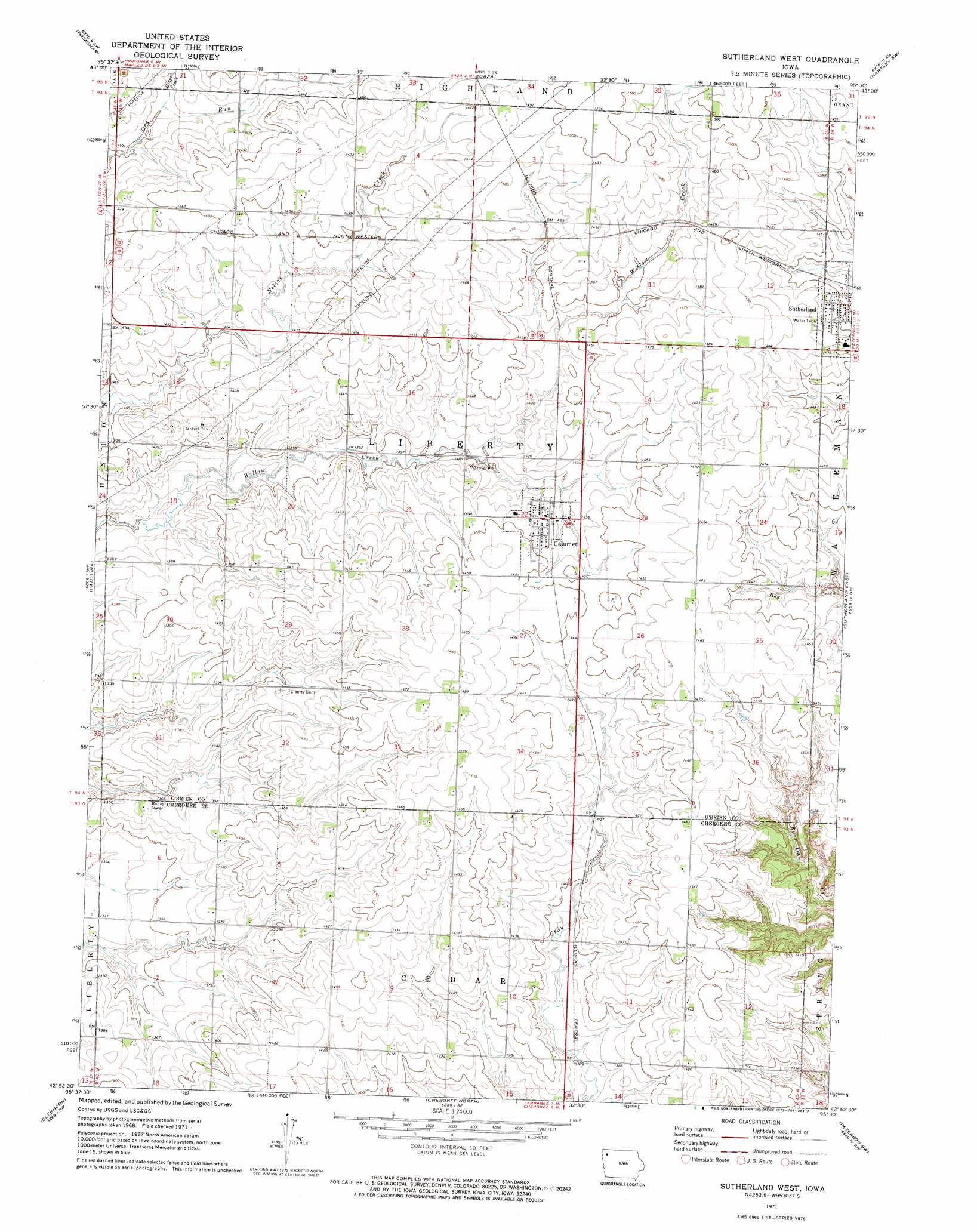
Sutherland West Topo Map Iowa
To zoom in, hover over the map of Sutherland West
USGS Topo Quad 42095h5 - 1:24,000 scale
| Topo Map Name: | Sutherland West |
| USGS Topo Quad ID: | 42095h5 |
| Print Size: | ca. 21 1/4" wide x 27" high |
| Southeast Coordinates: | 42.875° N latitude / 95.5° W longitude |
| Map Center Coordinates: | 42.9375° N latitude / 95.5625° W longitude |
| U.S. State: | IA |
| Filename: | o42095h5.jpg |
| Download Map JPG Image: | Sutherland West topo map 1:24,000 scale |
| Map Type: | Topographic |
| Topo Series: | 7.5´ |
| Map Scale: | 1:24,000 |
| Source of Map Images: | United States Geological Survey (USGS) |
| Alternate Map Versions: |
Sutherland West IA 1971, updated 1973 Download PDF Buy paper map Sutherland West IA 2010 Download PDF Buy paper map Sutherland West IA 2013 Download PDF Buy paper map Sutherland West IA 2015 Download PDF Buy paper map |
1:24,000 Topo Quads surrounding Sutherland West
Sheldon |
Sanborn |
Plessis |
Hartley |
Everly |
Sheldon Se |
Primghar |
Gaza |
Hartley Sw |
Royal |
Granville East |
Paullina |
Sutherland West |
Sutherland East |
Peterson |
Marcus |
Cleghorn |
Cherokee North |
Peterson Sw |
Peterson Se |
Fielding |
Quimby |
Cherokee South |
Aurelia |
Alta |
> Back to 42095e1 at 1:100,000 scale
> Back to 42094a1 at 1:250,000 scale
> Back to U.S. Topo Maps home
Sutherland West topo map: Gazetteer
Sutherland West: Parks
Flinders Area elevation 454m 1489′Steele Prairie State Preserve elevation 429m 1407′
Sutherland West: Populated Places
Calumet elevation 438m 1437′Sutherland West: Post Offices
Calumet Post Office elevation 438m 1437′Erie Post Office (historical) elevation 445m 1459′
Romano Post Office (historical) elevation 430m 1410′
Sutherland West: Streams
Ginger Creek elevation 428m 1404′Sutherland West digital topo map on disk
Buy this Sutherland West topo map showing relief, roads, GPS coordinates and other geographical features, as a high-resolution digital map file on DVD: