Macy Topo Map Nebraska
To zoom in, hover over the map of Macy
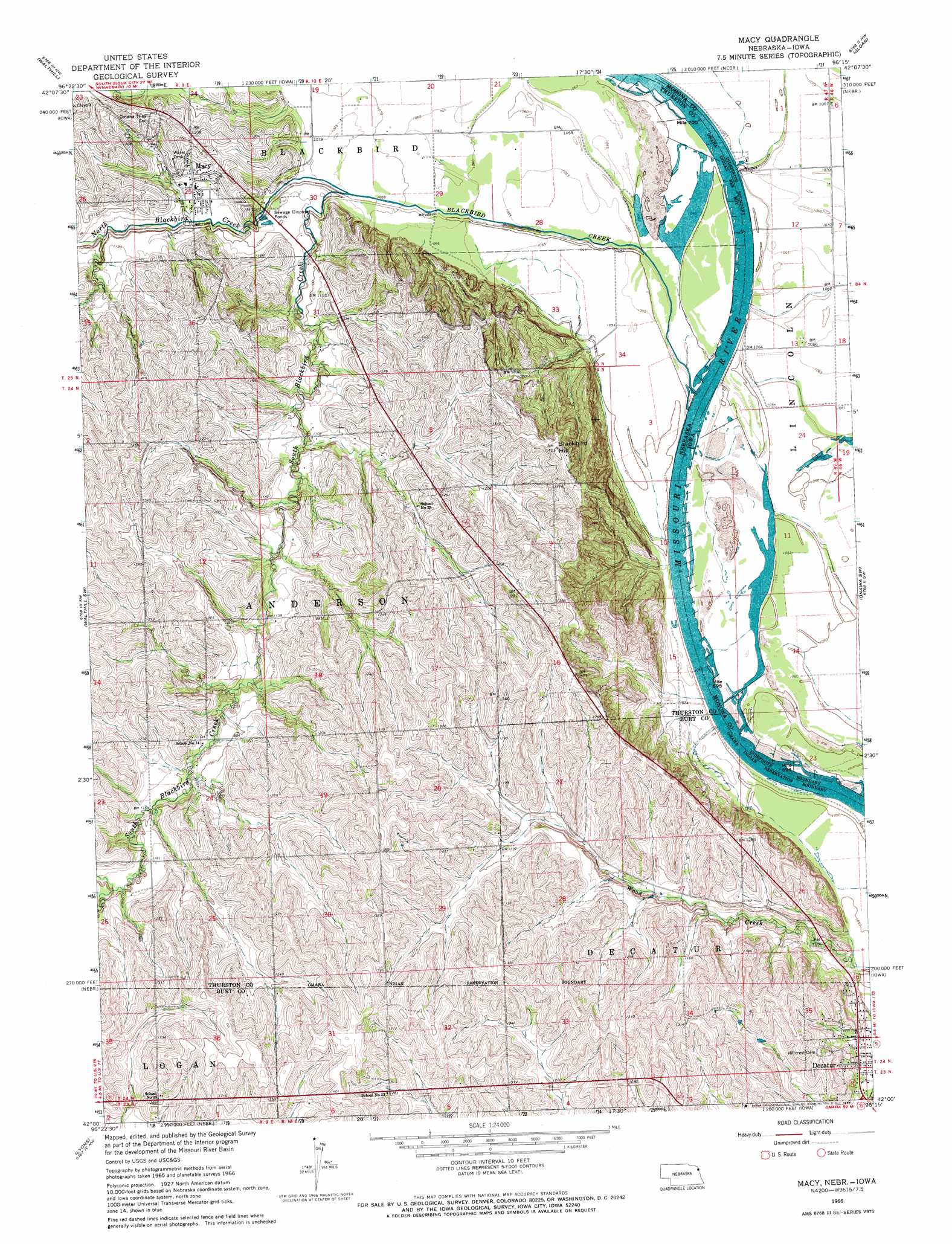
USGS Topo Quad 42096a3 - 1:24,000 scale
| Topo Map Name: | Macy |
| USGS Topo Quad ID: | 42096a3 |
| Print Size: | ca. 21 1/4" wide x 27" high |
| Southeast Coordinates: | 42° N latitude / 96.25° W longitude |
| Map Center Coordinates: | 42.0625° N latitude / 96.3125° W longitude |
| U.S. States: | NE, IA |
| Filename: | O42096A3.jpg |
| Download Map JPG Image: | Macy topo map 1:24,000 scale |
| Map Type: | Topographic |
| Topo Series: | 7.5´ |
| Map Scale: | 1:24,000 |
| Source of Map Images: | United States Geological Survey (USGS) |
| Alternate Map Versions: |
Macy NE 1966, updated 1968 Download PDF Buy paper map Macy NE 2011 Download PDF Buy paper map Macy NE 2014 Download PDF Buy paper map |
1:24,000 Topo Quads surrounding Macy
Emerson Se |
Homer |
Salix |
Luton |
Climbing Hill |
Pender Ne |
Walthill |
Albaton |
Sloan |
Hornick |
Bancroft |
Walthill Sw |
Macy |
Onawa Sw |
Onawa |
West Point Ne |
Lyons |
Bertha |
Tekamah Nw |
Blencoe |
West Point Se |
Oakland |
Craig |
Tekamah |
Little Sioux |
> Back to 42096a1 at 1:100,000 scale
> Back to 42096a1 at 1:250,000 scale
> Back to U.S. Topo Maps home
Macy topo map: Gazetteer
Macy: Bends
Black Bird Bend elevation 317m 1040′Black Bird Bend elevation 317m 1040′
Lower Monona Bend elevation 317m 1040′
Lower Monona Bend elevation 317m 1040′
Macy: Parks
Blackbird/Ivy Island Wildlife Area elevation 319m 1046′Omaha Tribe Historical Marker elevation 341m 1118′
Macy: Populated Places
Basford (historical) elevation 403m 1322′Macy elevation 341m 1118′
Macy: Post Offices
Basford Post Office (historical) elevation 403m 1322′Macy Post Office elevation 341m 1118′
Macy: Reservoirs
Badger Lake elevation 320m 1049′Macy: Streams
Blackbird Creek elevation 319m 1046′North Blackbird Creek elevation 324m 1062′
South Blackbird Creek elevation 327m 1072′
Macy: Summits
Blackbird Hill elevation 426m 1397′Macy digital topo map on disk
Buy this Macy topo map showing relief, roads, GPS coordinates and other geographical features, as a high-resolution digital map file on DVD: