Pender Ne Topo Map Nebraska
To zoom in, hover over the map of Pender Ne
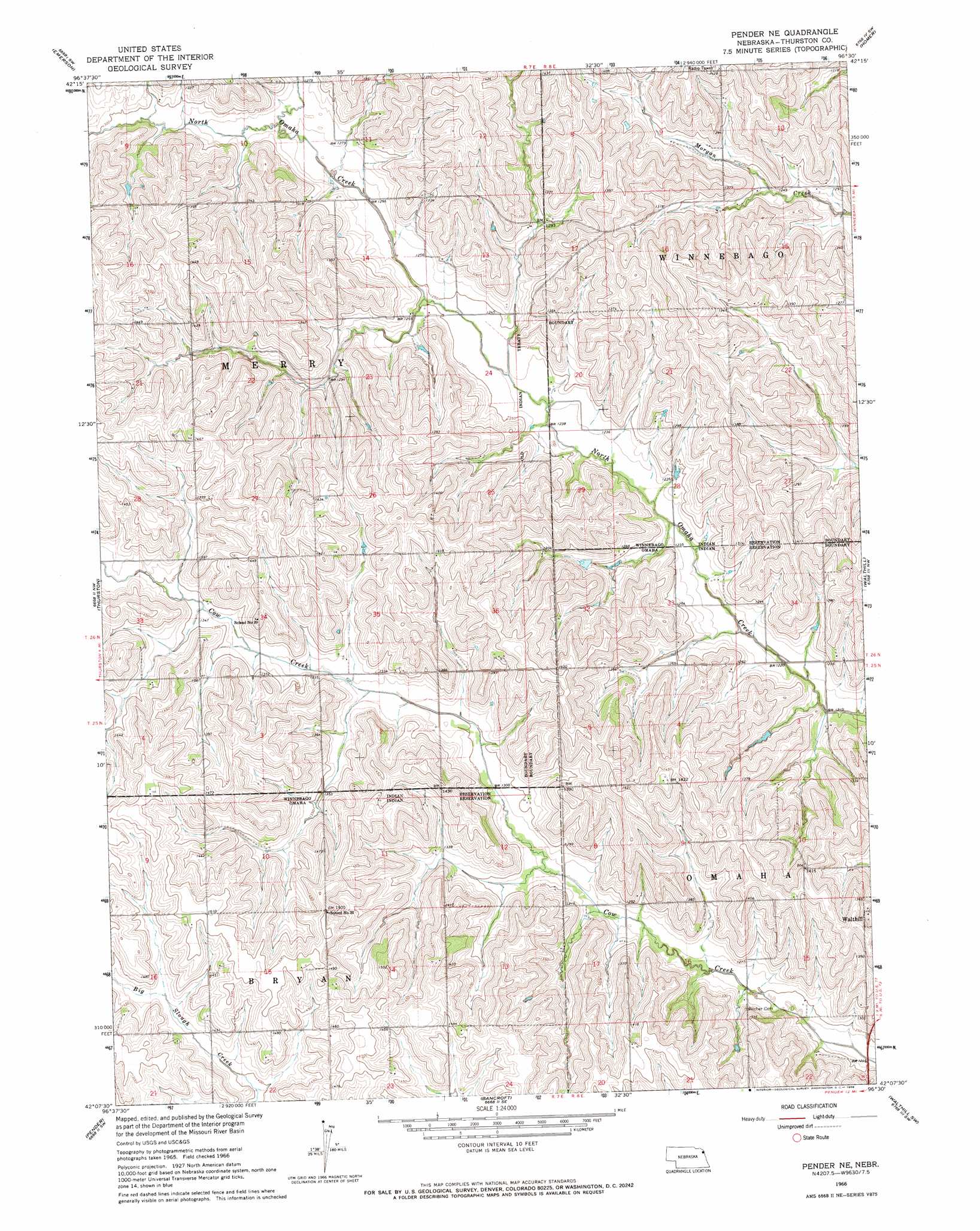
USGS Topo Quad 42096b5 - 1:24,000 scale
| Topo Map Name: | Pender Ne |
| USGS Topo Quad ID: | 42096b5 |
| Print Size: | ca. 21 1/4" wide x 27" high |
| Southeast Coordinates: | 42.125° N latitude / 96.5° W longitude |
| Map Center Coordinates: | 42.1875° N latitude / 96.5625° W longitude |
| U.S. State: | NE |
| Filename: | O42096B5.jpg |
| Download Map JPG Image: | Pender Ne topo map 1:24,000 scale |
| Map Type: | Topographic |
| Topo Series: | 7.5´ |
| Map Scale: | 1:24,000 |
| Source of Map Images: | United States Geological Survey (USGS) |
| Alternate Map Versions: |
Pender NE NE 1966, updated 1968 Download PDF Buy paper map Pender NE NE 2011 Download PDF Buy paper map Pender NE NE 2014 Download PDF Buy paper map |
1:24,000 Topo Quads surrounding Pender Ne
Allen |
Waterbury |
Jackson |
Sioux City South |
Sergeant Bluff |
Wakefield |
Emerson |
Emerson Se |
Homer |
Salix |
Altona Ne |
Thurston |
Pender Ne |
Walthill |
Albaton |
Altona Se |
Pender |
Bancroft |
Walthill Sw |
Macy |
Beemer |
West Point Nw |
West Point Ne |
Lyons |
Bertha |
> Back to 42096a1 at 1:100,000 scale
> Back to 42096a1 at 1:250,000 scale
> Back to U.S. Topo Maps home
No gazetteer data is available for the Pender Ne topo map sheet.
Pender Ne digital topo map on disk
Buy this Pender Ne topo map showing relief, roads, GPS coordinates and other geographical features, as a high-resolution digital map file on DVD: