James Topo Map Iowa
To zoom in, hover over the map of James
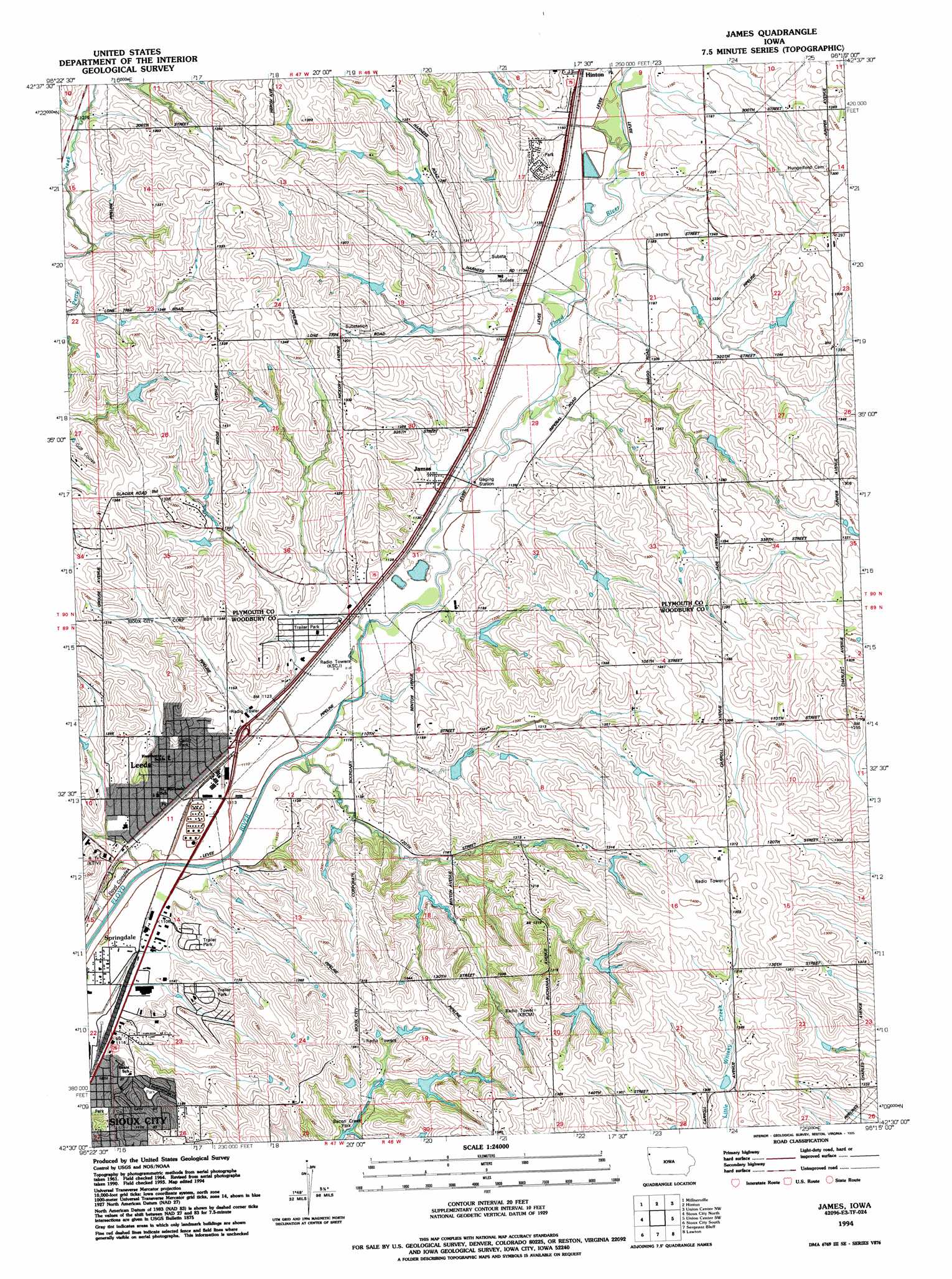
USGS Topo Quad 42096e3 - 1:24,000 scale
| Topo Map Name: | James |
| USGS Topo Quad ID: | 42096e3 |
| Print Size: | ca. 21 1/4" wide x 27" high |
| Southeast Coordinates: | 42.5° N latitude / 96.25° W longitude |
| Map Center Coordinates: | 42.5625° N latitude / 96.3125° W longitude |
| U.S. State: | IA |
| Filename: | o42096e3.jpg |
| Download Map JPG Image: | James topo map 1:24,000 scale |
| Map Type: | Topographic |
| Topo Series: | 7.5´ |
| Map Scale: | 1:24,000 |
| Source of Map Images: | United States Geological Survey (USGS) |
| Alternate Map Versions: |
James IA 1964, updated 1965 Download PDF Buy paper map James IA 1964, updated 1972 Download PDF Buy paper map James IA 1964, updated 1977 Download PDF Buy paper map James IA 1994, updated 1995 Download PDF Buy paper map James IA 2011 Download PDF Buy paper map James IA 2013 Download PDF Buy paper map James IA 2015 Download PDF Buy paper map |
1:24,000 Topo Quads surrounding James
Akron |
Ireton Sw |
Brunsville |
Le Mars |
Oyens |
Elk Point Ne |
Millnerville |
Hinton |
Union Center Nw |
Union Center |
Jefferson |
Sioux City North |
James |
Union Center Sw |
Union Center Se |
Jackson |
Sioux City South |
Sergeant Bluff |
Lawton |
Moville |
Emerson Se |
Homer |
Salix |
Luton |
Climbing Hill |
> Back to 42096e1 at 1:100,000 scale
> Back to 42096a1 at 1:250,000 scale
> Back to U.S. Topo Maps home
James topo map: Gazetteer
James: Parks
Carlin Park elevation 356m 1167′Hillcrest Park elevation 360m 1181′
Kelly Park elevation 358m 1174′
Leeds Park elevation 339m 1112′
James: Populated Places
Evergreen Village elevation 347m 1138′Holiday Village elevation 370m 1213′
James elevation 346m 1135′
Leeds elevation 338m 1108′
Springdale elevation 337m 1105′
Tallview Terrace Mobile Home Park elevation 364m 1194′
James: Post Offices
James Post Office (historical) elevation 346m 1135′Leeds Post Office (historical) elevation 338m 1108′
James: Trails
Floyd River Trail elevation 338m 1108′James digital topo map on disk
Buy this James topo map showing relief, roads, GPS coordinates and other geographical features, as a high-resolution digital map file on DVD: