Le Mars Topo Map Iowa
To zoom in, hover over the map of Le Mars
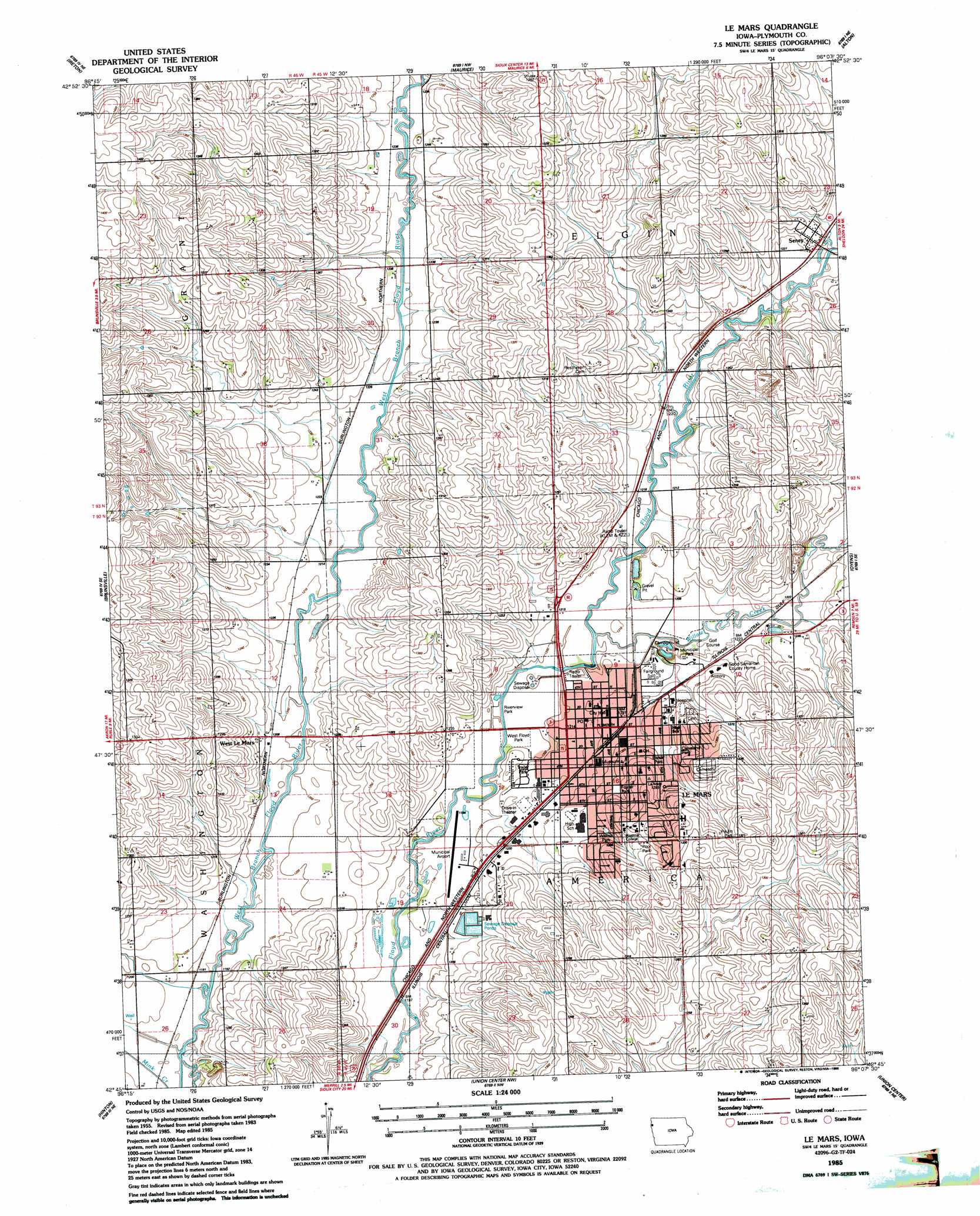
USGS Topo Quad 42096g2 - 1:24,000 scale
| Topo Map Name: | Le Mars |
| USGS Topo Quad ID: | 42096g2 |
| Print Size: | ca. 21 1/4" wide x 27" high |
| Southeast Coordinates: | 42.75° N latitude / 96.125° W longitude |
| Map Center Coordinates: | 42.8125° N latitude / 96.1875° W longitude |
| U.S. State: | IA |
| Filename: | o42096g2.jpg |
| Download Map JPG Image: | Le Mars topo map 1:24,000 scale |
| Map Type: | Topographic |
| Topo Series: | 7.5´ |
| Map Scale: | 1:24,000 |
| Source of Map Images: | United States Geological Survey (USGS) |
| Alternate Map Versions: |
Le Mars IA 1985, updated 1986 Download PDF Buy paper map Le Mars IA 2010 Download PDF Buy paper map Le Mars IA 2013 Download PDF Buy paper map Le Mars IA 2015 Download PDF Buy paper map |
1:24,000 Topo Quads surrounding Le Mars
Hawarden North |
Lebanon |
Sioux Center |
Orange City |
Hospers |
Hawarden South |
Ireton |
Maurice |
Alton |
Granville West |
Ireton Sw |
Brunsville |
Le Mars |
Oyens |
Remsen |
Millnerville |
Hinton |
Union Center Nw |
Union Center |
Kingsley Nw |
Sioux City North |
James |
Union Center Sw |
Union Center Se |
Kingsley |
> Back to 42096e1 at 1:100,000 scale
> Back to 42096a1 at 1:250,000 scale
> Back to U.S. Topo Maps home
Le Mars topo map: Gazetteer
Le Mars: Airports
Le Mars Municipal Airport elevation 364m 1194′Le Mars: Parks
Bolser Park elevation 381m 1250′Cleveland Park elevation 386m 1266′
Foster Park elevation 382m 1253′
Le Mars Municipal Park elevation 369m 1210′
Paulin Park elevation 398m 1305′
Pool Park elevation 392m 1286′
Riverview Park elevation 363m 1190′
Walnut Park elevation 381m 1250′
West Floyd Park elevation 364m 1194′
Le Mars: Populated Places
Armel Acres Mobile Home Estates elevation 369m 1210′Erdmann Trailer Court elevation 376m 1233′
Le Mars elevation 376m 1233′
Parkview Terrace elevation 366m 1200′
Seney elevation 378m 1240′
West Le Mars elevation 372m 1220′
Le Mars: Post Offices
Dalton Post Office (historical) elevation 369m 1210′Le Mars Post Office elevation 372m 1220′
Seney Post Office (historical) elevation 378m 1240′
Le Mars: Streams
Willow Creek elevation 366m 1200′Le Mars digital topo map on disk
Buy this Le Mars topo map showing relief, roads, GPS coordinates and other geographical features, as a high-resolution digital map file on DVD: