Richland Topo Map South Dakota
To zoom in, hover over the map of Richland
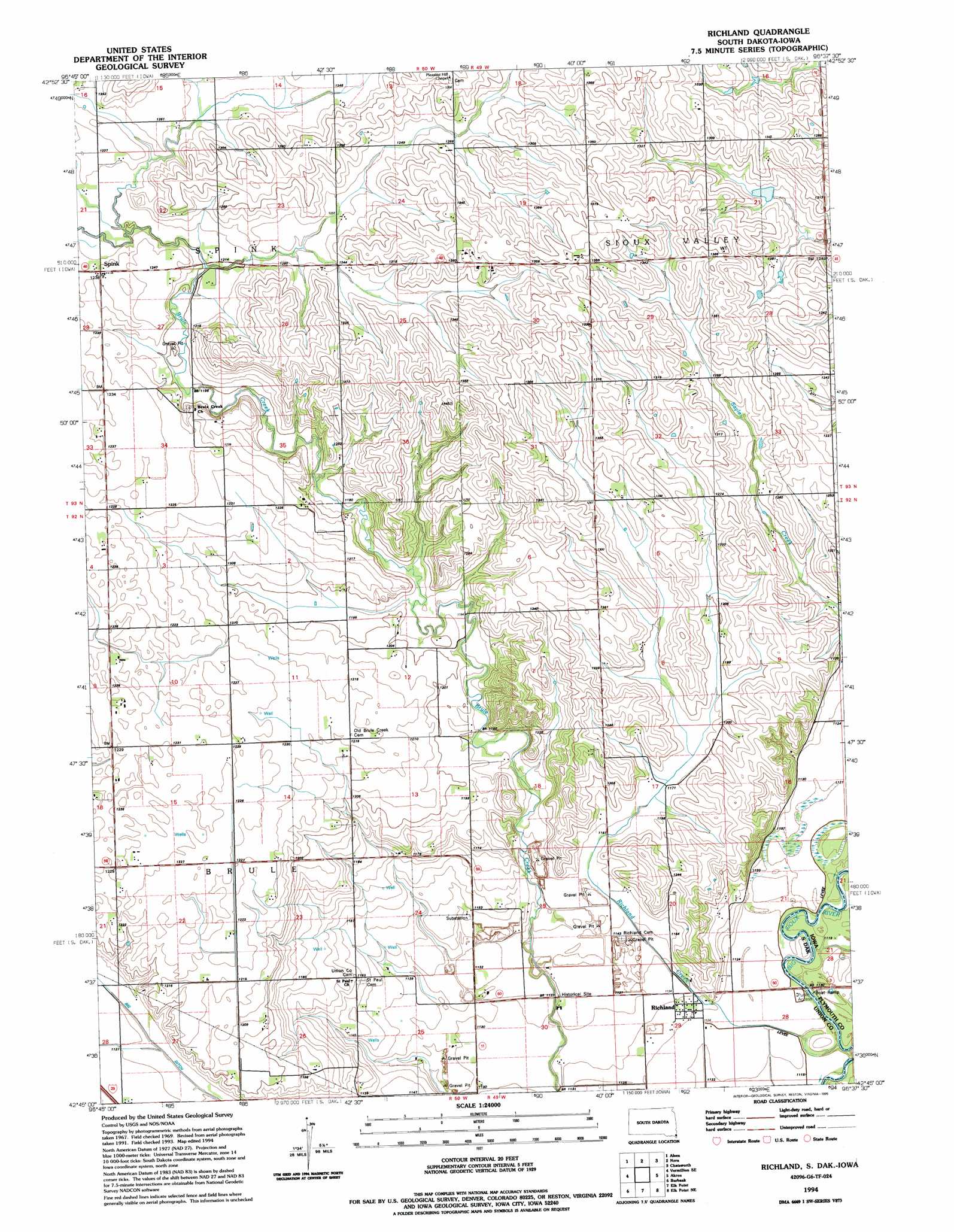
USGS Topo Quad 42096g6 - 1:24,000 scale
| Topo Map Name: | Richland |
| USGS Topo Quad ID: | 42096g6 |
| Print Size: | ca. 21 1/4" wide x 27" high |
| Southeast Coordinates: | 42.75° N latitude / 96.625° W longitude |
| Map Center Coordinates: | 42.8125° N latitude / 96.6875° W longitude |
| U.S. States: | SD, IA |
| Filename: | o42096g6.jpg |
| Download Map JPG Image: | Richland topo map 1:24,000 scale |
| Map Type: | Topographic |
| Topo Series: | 7.5´ |
| Map Scale: | 1:24,000 |
| Source of Map Images: | United States Geological Survey (USGS) |
| Alternate Map Versions: |
Richland SD 1969, updated 1971 Download PDF Buy paper map Richland SD 1994, updated 1995 Download PDF Buy paper map Richland SD 2011 Download PDF Buy paper map Richland SD 2012 Download PDF Buy paper map Richland SD 2015 Download PDF Buy paper map |
1:24,000 Topo Quads surrounding Richland
Centerville |
Beresford |
Alcester |
Alcester Se |
Hawarden North |
Hub City |
Alsen |
Nora |
Chatsworth |
Hawarden South |
Vermillon |
Vermillon Se |
Richland |
Akron |
Ireton Sw |
Maskell |
Burbank |
Elk Point |
Elk Point Ne |
Millnerville |
Martinsburg Sw |
Martinsburg |
Ponca |
Jefferson |
Sioux City North |
> Back to 42096e1 at 1:100,000 scale
> Back to 42096a1 at 1:250,000 scale
> Back to U.S. Topo Maps home
Richland topo map: Gazetteer
Richland: Canals
Big Ditch elevation 344m 1128′Richland: Populated Places
Richland elevation 344m 1128′Spink elevation 376m 1233′
Richland: Streams
Richland Creek elevation 340m 1115′Richland digital topo map on disk
Buy this Richland topo map showing relief, roads, GPS coordinates and other geographical features, as a high-resolution digital map file on DVD: