Vermillon Se Topo Map South Dakota
To zoom in, hover over the map of Vermillon Se
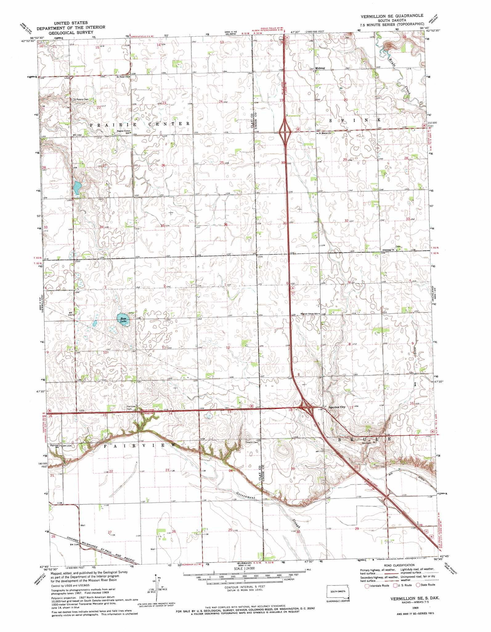
USGS Topo Quad 42096g7 - 1:24,000 scale
| Topo Map Name: | Vermillon Se |
| USGS Topo Quad ID: | 42096g7 |
| Print Size: | ca. 21 1/4" wide x 27" high |
| Southeast Coordinates: | 42.75° N latitude / 96.75° W longitude |
| Map Center Coordinates: | 42.8125° N latitude / 96.8125° W longitude |
| U.S. State: | SD |
| Filename: | o42096g7.jpg |
| Download Map JPG Image: | Vermillon Se topo map 1:24,000 scale |
| Map Type: | Topographic |
| Topo Series: | 7.5´ |
| Map Scale: | 1:24,000 |
| Source of Map Images: | United States Geological Survey (USGS) |
| Alternate Map Versions: |
Vermillion SE SD 1969, updated 1971 Download PDF Buy paper map Vermillion SE SD 2012 Download PDF Buy paper map Vermillion SE SD 2015 Download PDF Buy paper map |
1:24,000 Topo Quads surrounding Vermillon Se
Wakonda |
Centerville |
Beresford |
Alcester |
Alcester Se |
Gayville Ne |
Hub City |
Alsen |
Nora |
Chatsworth |
Meckling |
Vermillon |
Vermillon Se |
Richland |
Akron |
Obert |
Maskell |
Burbank |
Elk Point |
Elk Point Ne |
Coleridge Se |
Martinsburg Sw |
Martinsburg |
Ponca |
Jefferson |
> Back to 42096e1 at 1:100,000 scale
> Back to 42096a1 at 1:250,000 scale
> Back to U.S. Topo Maps home
Vermillon Se topo map: Gazetteer
Vermillon Se: Lakes
Rose Lake elevation 373m 1223′Vermillon Se: Populated Places
Junction City elevation 365m 1197′Midway elevation 383m 1256′
Vermillon Se digital topo map on disk
Buy this Vermillon Se topo map showing relief, roads, GPS coordinates and other geographical features, as a high-resolution digital map file on DVD: