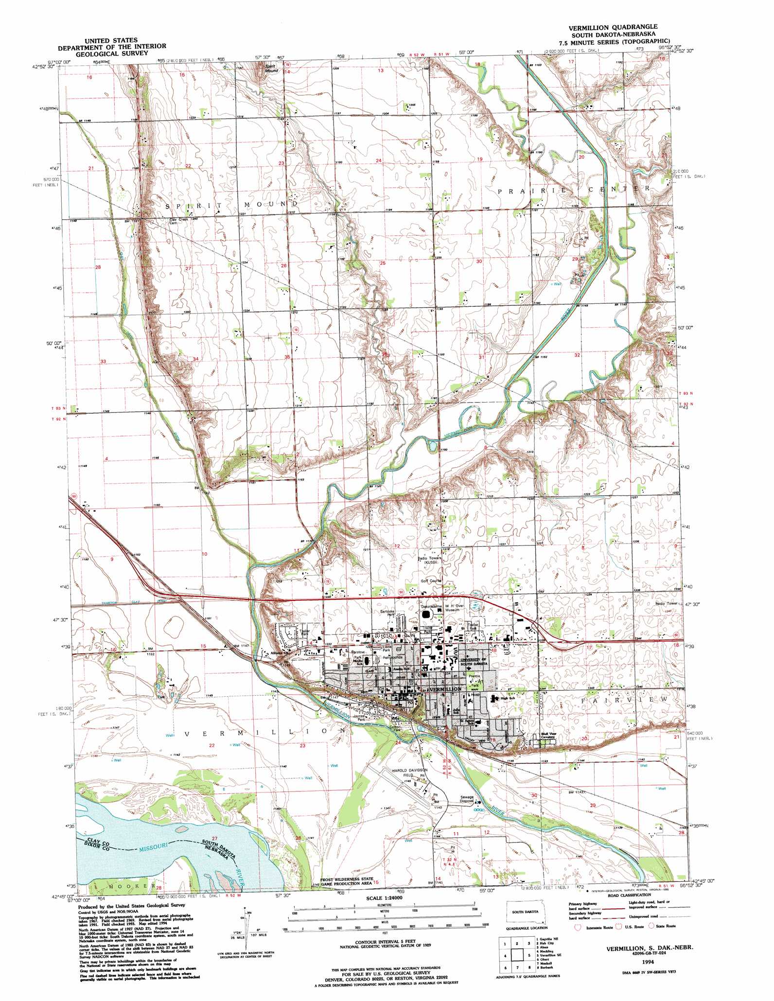
Vermillon Topo Map South Dakota
To zoom in, hover over the map of Vermillon
USGS Topo Quad 42096g8 - 1:24,000 scale
| Topo Map Name: | Vermillon |
| USGS Topo Quad ID: | 42096g8 |
| Print Size: | ca. 21 1/4" wide x 27" high |
| Southeast Coordinates: | 42.75° N latitude / 96.875° W longitude |
| Map Center Coordinates: | 42.8125° N latitude / 96.9375° W longitude |
| U.S. States: | SD, NE |
| Filename: | o42096g8.jpg |
| Download Map JPG Image: | Vermillon topo map 1:24,000 scale |
| Map Type: | Topographic |
| Topo Series: | 7.5´ |
| Map Scale: | 1:24,000 |
| Source of Map Images: | United States Geological Survey (USGS) |
| Alternate Map Versions: |
Vermillion SD 1969, updated 1971 Download PDF Buy paper map Vermillion SD 1969, updated 1980 Download PDF Buy paper map Vermillion SD 1994, updated 1995 Download PDF Buy paper map Vermillion SD 2012 Download PDF Buy paper map Vermillion SD 2015 Download PDF Buy paper map |
1:24,000 Topo Quads surrounding Vermillon
Irene |
Wakonda |
Centerville |
Beresford |
Alcester |
Gayville |
Gayville Ne |
Hub City |
Alsen |
Nora |
Saint Helena |
Meckling |
Vermillon |
Vermillon Se |
Richland |
Wynot |
Obert |
Maskell |
Burbank |
Elk Point |
Coleridge |
Coleridge Se |
Martinsburg Sw |
Martinsburg |
Ponca |
> Back to 42096e1 at 1:100,000 scale
> Back to 42096a1 at 1:250,000 scale
> Back to U.S. Topo Maps home
Vermillon topo map: Gazetteer
Vermillon: Airports
Harold Davidson Field elevation 348m 1141′Vermillon: Bends
North Alabama Bend (historical) elevation 344m 1128′Vermillon: Parks
Prentis Park elevation 377m 1236′Vermillon: Populated Places
Vermillion elevation 374m 1227′Vermillon: Streams
Spirit Mound Creek elevation 346m 1135′Vermillon: Summits
Spirit Mound elevation 390m 1279′Vermillon digital topo map on disk
Buy this Vermillon topo map showing relief, roads, GPS coordinates and other geographical features, as a high-resolution digital map file on DVD: