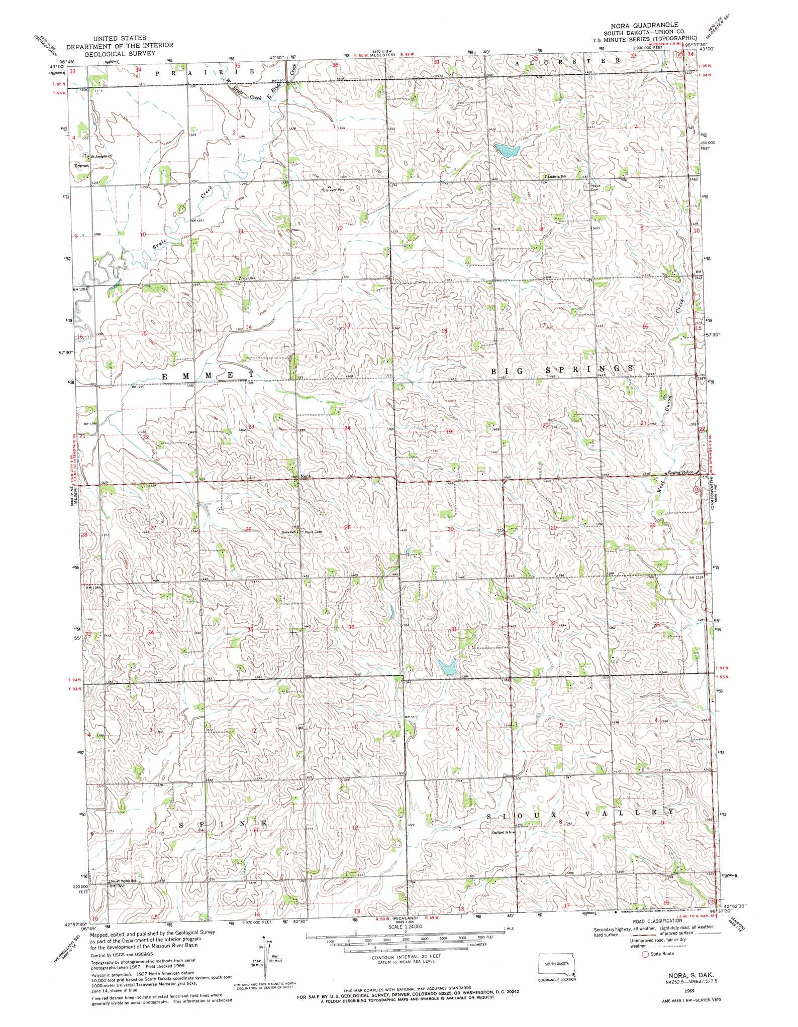
Nora Topo Map South Dakota
To zoom in, hover over the map of Nora
USGS Topo Quad 42096h6 - 1:24,000 scale
| Topo Map Name: | Nora |
| USGS Topo Quad ID: | 42096h6 |
| Print Size: | ca. 21 1/4" wide x 27" high |
| Southeast Coordinates: | 42.875° N latitude / 96.625° W longitude |
| Map Center Coordinates: | 42.9375° N latitude / 96.6875° W longitude |
| U.S. State: | SD |
| Filename: | o42096h6.jpg |
| Download Map JPG Image: | Nora topo map 1:24,000 scale |
| Map Type: | Topographic |
| Topo Series: | 7.5´ |
| Map Scale: | 1:24,000 |
| Source of Map Images: | United States Geological Survey (USGS) |
| Alternate Map Versions: |
Nora SD 1969, updated 1971 Download PDF Buy paper map Nora SD 2012 Download PDF Buy paper map Nora SD 2015 Download PDF Buy paper map |
1:24,000 Topo Quads surrounding Nora
Beresford Nw |
Beresford Ne |
Alcester Nw |
Alcester Ne |
Fairview |
Centerville |
Beresford |
Alcester |
Alcester Se |
Hawarden North |
Hub City |
Alsen |
Nora |
Chatsworth |
Hawarden South |
Vermillon |
Vermillon Se |
Richland |
Akron |
Ireton Sw |
Maskell |
Burbank |
Elk Point |
Elk Point Ne |
Millnerville |
> Back to 42096e1 at 1:100,000 scale
> Back to 42096a1 at 1:250,000 scale
> Back to U.S. Topo Maps home
Nora topo map: Gazetteer
Nora: Populated Places
Emmet elevation 395m 1295′Nora elevation 425m 1394′
Nora: Post Offices
Nora Post Office (historical) elevation 410m 1345′Nora: Streams
East Brule Creek elevation 396m 1299′West Brule Creek elevation 396m 1299′
Nora digital topo map on disk
Buy this Nora topo map showing relief, roads, GPS coordinates and other geographical features, as a high-resolution digital map file on DVD: