Alsen Topo Map South Dakota
To zoom in, hover over the map of Alsen
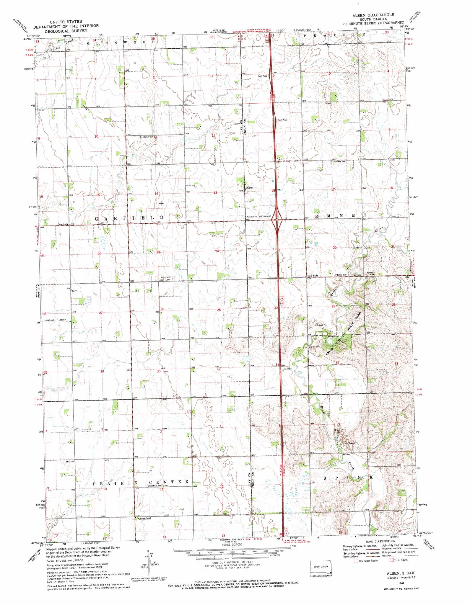
USGS Topo Quad 42096h7 - 1:24,000 scale
| Topo Map Name: | Alsen |
| USGS Topo Quad ID: | 42096h7 |
| Print Size: | ca. 21 1/4" wide x 27" high |
| Southeast Coordinates: | 42.875° N latitude / 96.75° W longitude |
| Map Center Coordinates: | 42.9375° N latitude / 96.8125° W longitude |
| U.S. State: | SD |
| Filename: | o42096h7.jpg |
| Download Map JPG Image: | Alsen topo map 1:24,000 scale |
| Map Type: | Topographic |
| Topo Series: | 7.5´ |
| Map Scale: | 1:24,000 |
| Source of Map Images: | United States Geological Survey (USGS) |
| Alternate Map Versions: |
Alsen SD 1969, updated 1971 Download PDF Buy paper map Alsen SD 1969, updated 1971 Download PDF Buy paper map Alsen SD 2012 Download PDF Buy paper map Alsen SD 2015 Download PDF Buy paper map |
1:24,000 Topo Quads surrounding Alsen
Viborg |
Beresford Nw |
Beresford Ne |
Alcester Nw |
Alcester Ne |
Wakonda |
Centerville |
Beresford |
Alcester |
Alcester Se |
Gayville Ne |
Hub City |
Alsen |
Nora |
Chatsworth |
Meckling |
Vermillon |
Vermillon Se |
Richland |
Akron |
Obert |
Maskell |
Burbank |
Elk Point |
Elk Point Ne |
> Back to 42096e1 at 1:100,000 scale
> Back to 42096a1 at 1:250,000 scale
> Back to U.S. Topo Maps home
Alsen topo map: Gazetteer
Alsen: Crossings
Alsen Interchange elevation 406m 1332′Alsen: Parks
Union County State Park elevation 397m 1302′Alsen: Populated Places
Alsen elevation 408m 1338′Greenfield elevation 375m 1230′
Hill Side elevation 409m 1341′
Alsen digital topo map on disk
Buy this Alsen topo map showing relief, roads, GPS coordinates and other geographical features, as a high-resolution digital map file on DVD: