Hoskins Topo Map Nebraska
To zoom in, hover over the map of Hoskins
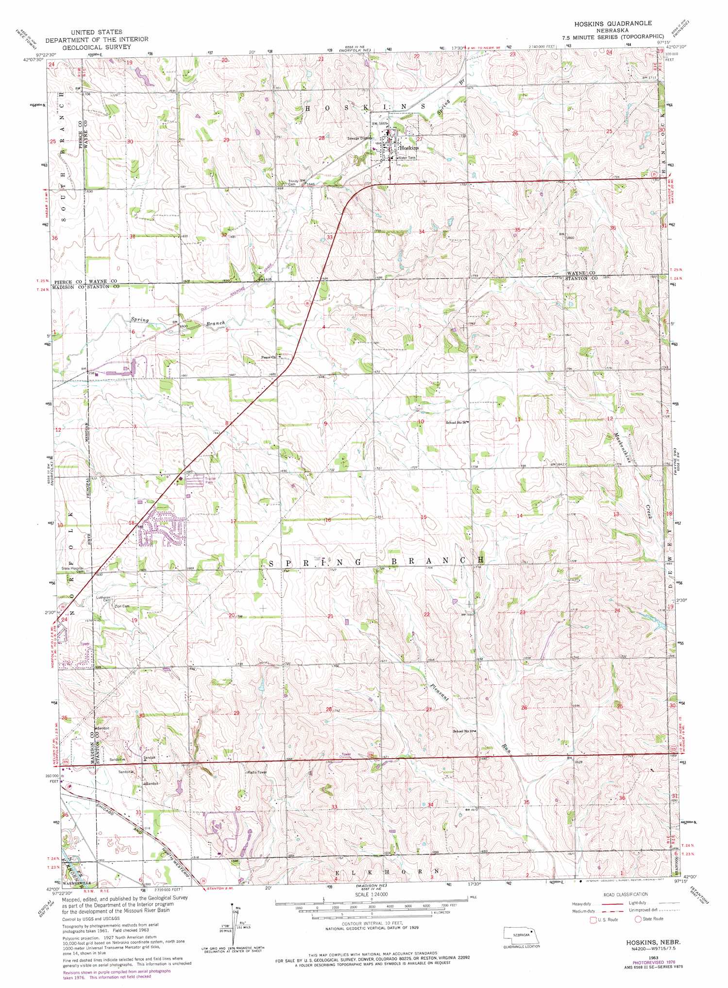
USGS Topo Quad 42097a3 - 1:24,000 scale
| Topo Map Name: | Hoskins |
| USGS Topo Quad ID: | 42097a3 |
| Print Size: | ca. 21 1/4" wide x 27" high |
| Southeast Coordinates: | 42° N latitude / 97.25° W longitude |
| Map Center Coordinates: | 42.0625° N latitude / 97.3125° W longitude |
| U.S. State: | NE |
| Filename: | O42097A3.jpg |
| Download Map JPG Image: | Hoskins topo map 1:24,000 scale |
| Map Type: | Topographic |
| Topo Series: | 7.5´ |
| Map Scale: | 1:24,000 |
| Source of Map Images: | United States Geological Survey (USGS) |
| Alternate Map Versions: |
Hoskins NE 1963, updated 1964 Download PDF Buy paper map Hoskins NE 1963, updated 1977 Download PDF Buy paper map Hoskins NE 2011 Download PDF Buy paper map Hoskins NE 2014 Download PDF Buy paper map |
1:24,000 Topo Quads surrounding Hoskins
Osmond |
Randolph Sw |
Randolph South |
Carroll |
Laurel Se |
Pierce |
Wee Town |
Norfolk Ne |
Winside |
Wayne |
Pierce Se |
Norfolk |
Hoskins |
Wayne Sw |
Pilger |
Battle Creek |
Enola |
Madison Ne |
Stanton |
Stanton Ne |
Battle Creek Se |
Madison |
Madison Se |
Stanton Sw |
Stanton Se |
> Back to 42097a1 at 1:100,000 scale
> Back to 42096a1 at 1:250,000 scale
> Back to U.S. Topo Maps home
Hoskins topo map: Gazetteer
Hoskins: Populated Places
Hoskins elevation 510m 1673′Hoskins: Post Offices
Hoskins Post Office elevation 510m 1673′Hoskins digital topo map on disk
Buy this Hoskins topo map showing relief, roads, GPS coordinates and other geographical features, as a high-resolution digital map file on DVD: