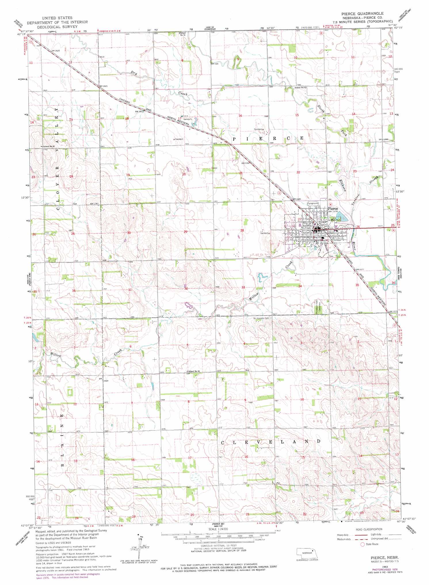
Pierce Topo Map Nebraska
To zoom in, hover over the map of Pierce
USGS Topo Quad 42097b5 - 1:24,000 scale
| Topo Map Name: | Pierce |
| USGS Topo Quad ID: | 42097b5 |
| Print Size: | ca. 21 1/4" wide x 27" high |
| Southeast Coordinates: | 42.125° N latitude / 97.5° W longitude |
| Map Center Coordinates: | 42.1875° N latitude / 97.5625° W longitude |
| U.S. State: | NE |
| Filename: | O42097B5.jpg |
| Download Map JPG Image: | Pierce topo map 1:24,000 scale |
| Map Type: | Topographic |
| Topo Series: | 7.5´ |
| Map Scale: | 1:24,000 |
| Source of Map Images: | United States Geological Survey (USGS) |
| Alternate Map Versions: |
Pierce NE 1963, updated 1964 Download PDF Buy paper map Pierce NE 1963, updated 1977 Download PDF Buy paper map Pierce NE 2011 Download PDF Buy paper map Pierce NE 2014 Download PDF Buy paper map |
1:24,000 Topo Quads surrounding Pierce
Plainview Ne |
Midland |
Wausa |
Magnet |
Randolph North |
Plainview |
Foster |
Osmond |
Randolph Sw |
Randolph South |
Tilden Ne |
Pierce Nw |
Pierce |
Wee Town |
Norfolk Ne |
Tilden |
Meadow Grove |
Pierce Se |
Norfolk |
Hoskins |
Closter Ne |
Emerick |
Battle Creek |
Enola |
Madison Ne |
> Back to 42097a1 at 1:100,000 scale
> Back to 42096a1 at 1:250,000 scale
> Back to U.S. Topo Maps home
Pierce topo map: Gazetteer
Pierce: Dams
Pierce Dam elevation 479m 1571′Pierce: Parks
Gilman Park elevation 479m 1571′Gilman Park Arboretum elevation 479m 1571′
Gilman Park Historical Marker elevation 479m 1571′
Old Willow Creek Bridge Historical Marker elevation 479m 1571′
Willow Creek State Recreation Area elevation 489m 1604′
Pierce: Populated Places
Pierce elevation 482m 1581′Pierce: Post Offices
Pierce Post Office elevation 482m 1581′Pierce: Reservoirs
Pierce Lake elevation 479m 1571′Willow Creek Lake elevation 488m 1601′
Pierce: Streams
Dry Creek elevation 482m 1581′Willow Creek elevation 479m 1571′
Yankton Slough elevation 479m 1571′
Pierce: Trails
Willow Creek Trail elevation 494m 1620′Pierce digital topo map on disk
Buy this Pierce topo map showing relief, roads, GPS coordinates and other geographical features, as a high-resolution digital map file on DVD: