Center West Topo Map Nebraska
To zoom in, hover over the map of Center West
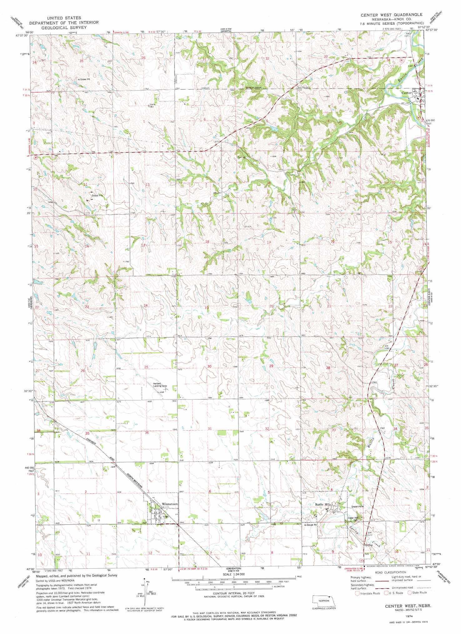
USGS Topo Quad 42097e8 - 1:24,000 scale
| Topo Map Name: | Center West |
| USGS Topo Quad ID: | 42097e8 |
| Print Size: | ca. 21 1/4" wide x 27" high |
| Southeast Coordinates: | 42.5° N latitude / 97.875° W longitude |
| Map Center Coordinates: | 42.5625° N latitude / 97.9375° W longitude |
| U.S. State: | NE |
| Filename: | O42097E8.jpg |
| Download Map JPG Image: | Center West topo map 1:24,000 scale |
| Map Type: | Topographic |
| Topo Series: | 7.5´ |
| Map Scale: | 1:24,000 |
| Source of Map Images: | United States Geological Survey (USGS) |
| Alternate Map Versions: |
Center West NE 1974, updated 1978 Download PDF Buy paper map Center West NE 2011 Download PDF Buy paper map Center West NE 2014 Download PDF Buy paper map |
1:24,000 Topo Quads surrounding Center West
Verdel |
Niobrara |
Springfield |
Santee |
Bon Homme Colony |
Pishelville |
Verdigre Ne |
Sparta |
Howe Creek |
Lindy |
Walnut |
Verdigre |
Center West |
Center East |
Bloomfield |
Orchard Nw |
Orchard Ne |
Creighton |
Plainview Ne |
Midland |
Orchard |
Royal |
Brunswick |
Plainview |
Foster |
> Back to 42097e1 at 1:100,000 scale
> Back to 42096a1 at 1:250,000 scale
> Back to U.S. Topo Maps home
Center West topo map: Gazetteer
Center West: Airports
Herberts Farm Airport elevation 504m 1653′Center West: Parks
Winnetoon Park elevation 505m 1656′Center West: Populated Places
Bazile Mills elevation 480m 1574′Center elevation 425m 1394′
Winnetoon elevation 506m 1660′
Center West: Post Offices
Bazile Mills Post Office (historical) elevation 480m 1574′Center Post Office elevation 425m 1394′
Winnetoon Post Office elevation 506m 1660′
Center West: Streams
Spring Creek elevation 472m 1548′Center West digital topo map on disk
Buy this Center West topo map showing relief, roads, GPS coordinates and other geographical features, as a high-resolution digital map file on DVD: