Crofton Topo Map Nebraska
To zoom in, hover over the map of Crofton
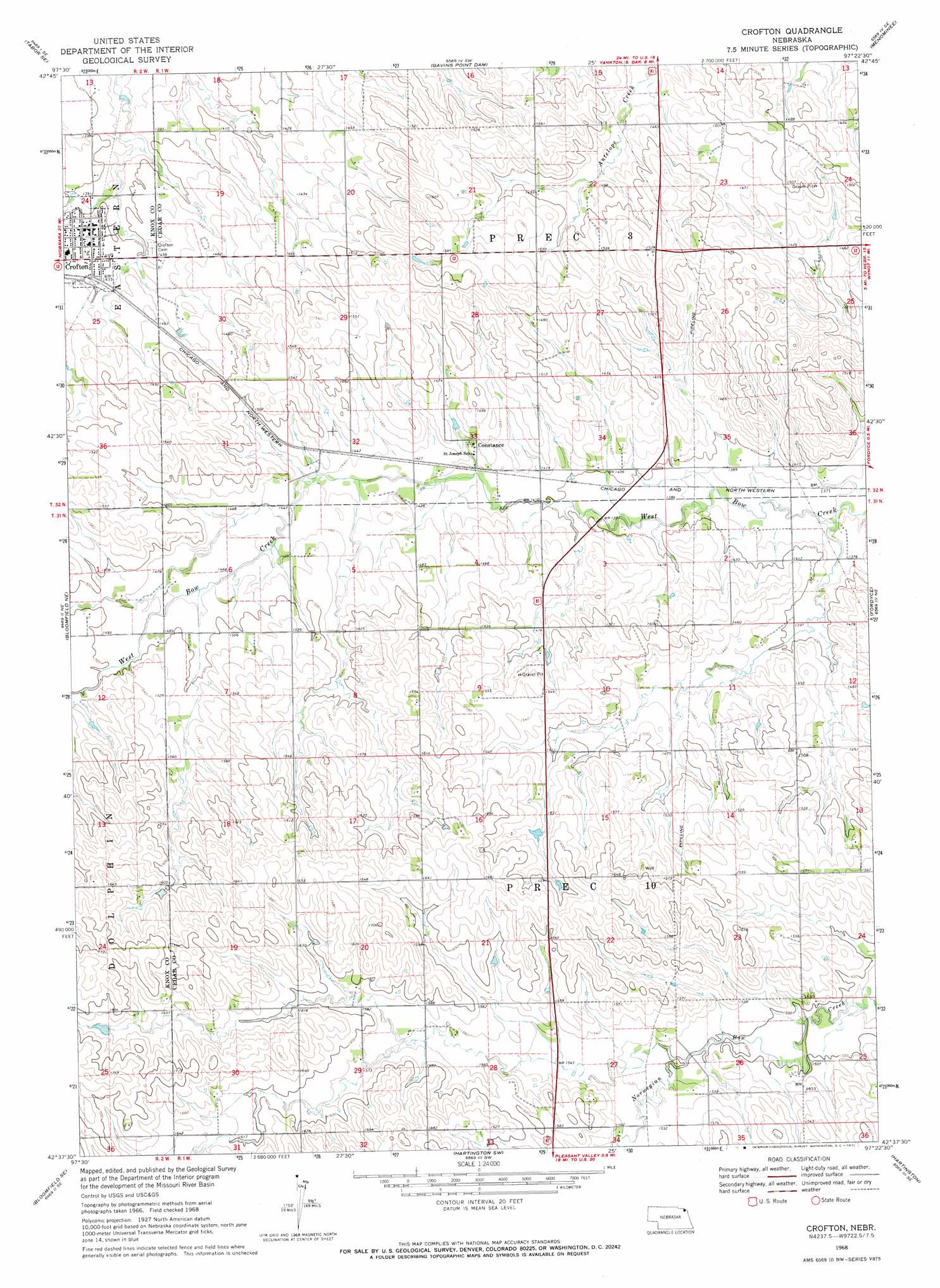
USGS Topo Quad 42097f4 - 1:24,000 scale
| Topo Map Name: | Crofton |
| USGS Topo Quad ID: | 42097f4 |
| Print Size: | ca. 21 1/4" wide x 27" high |
| Southeast Coordinates: | 42.625° N latitude / 97.375° W longitude |
| Map Center Coordinates: | 42.6875° N latitude / 97.4375° W longitude |
| U.S. State: | NE |
| Filename: | O42097F4.jpg |
| Download Map JPG Image: | Crofton topo map 1:24,000 scale |
| Map Type: | Topographic |
| Topo Series: | 7.5´ |
| Map Scale: | 1:24,000 |
| Source of Map Images: | United States Geological Survey (USGS) |
| Alternate Map Versions: |
Crofton NE 1968, updated 1971 Download PDF Buy paper map Crofton NE 2011 Download PDF Buy paper map Crofton NE 2014 Download PDF Buy paper map |
1:24,000 Topo Quads surrounding Crofton
Tabor |
Tabor Ne |
Yankton |
Mission Hill |
Gayville |
Bon Homme Colony |
Tabor Se |
Gavins Point Dam |
Menominee |
Saint Helena |
Lindy |
Bloomfield Ne |
Crofton |
Fordyce |
Wynot |
Bloomfield |
Bloomfield Se |
Hartington Sw |
Hartington |
Coleridge |
Midland |
Wausa |
Magnet |
Randolph North |
Belden |
> Back to 42097e1 at 1:100,000 scale
> Back to 42096a1 at 1:250,000 scale
> Back to U.S. Topo Maps home
Crofton topo map: Gazetteer
Crofton: Parks
Northside Park elevation 426m 1397′Southside Park elevation 432m 1417′
Crofton: Populated Places
Constance elevation 444m 1456′Crofton elevation 433m 1420′
Crofton: Post Offices
Constance Post Office (historical) elevation 444m 1456′Crofton Post Office elevation 436m 1430′
Crofton digital topo map on disk
Buy this Crofton topo map showing relief, roads, GPS coordinates and other geographical features, as a high-resolution digital map file on DVD: