Bloomfield Ne Topo Map Nebraska
To zoom in, hover over the map of Bloomfield Ne
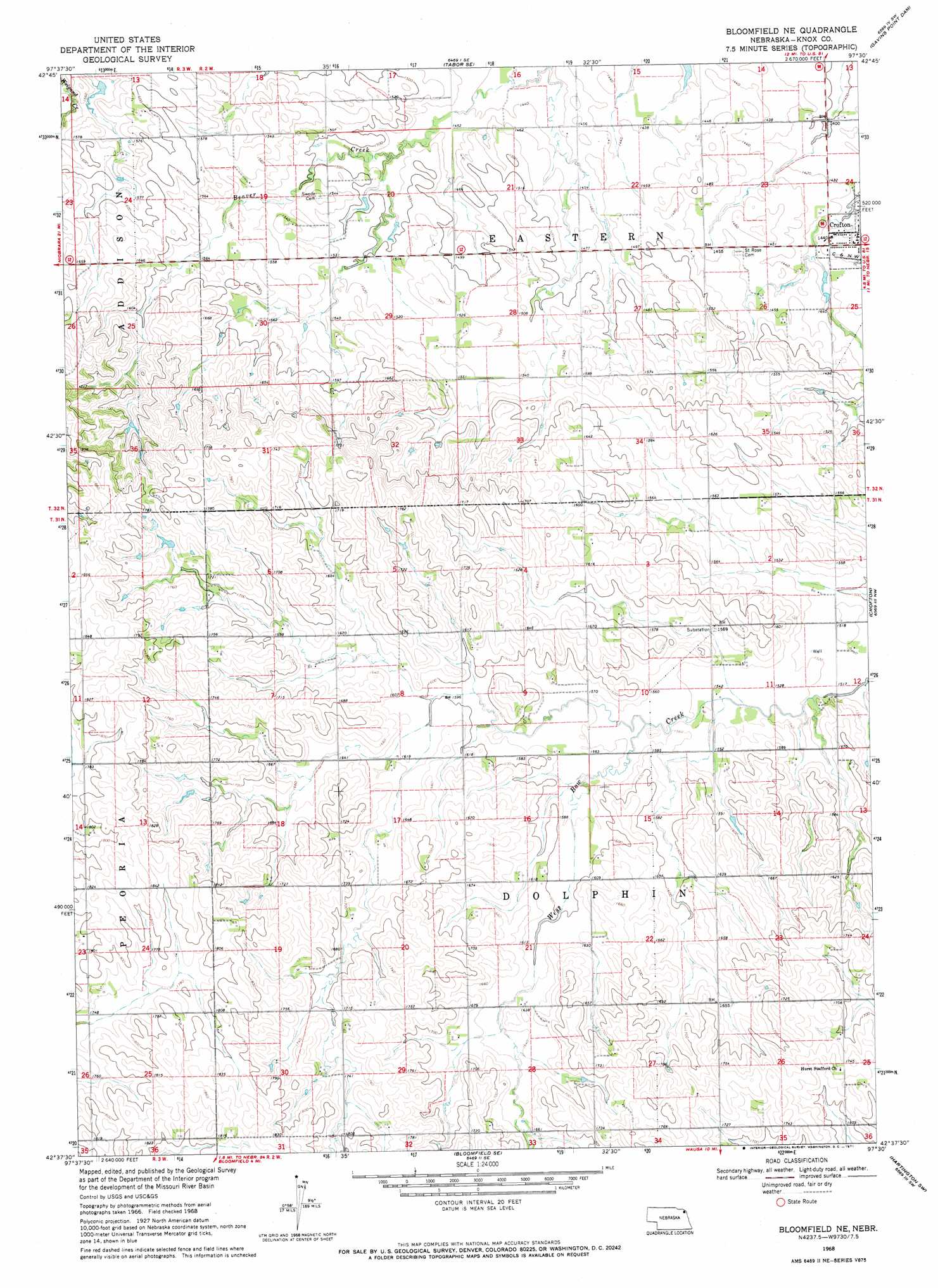
USGS Topo Quad 42097f5 - 1:24,000 scale
| Topo Map Name: | Bloomfield Ne |
| USGS Topo Quad ID: | 42097f5 |
| Print Size: | ca. 21 1/4" wide x 27" high |
| Southeast Coordinates: | 42.625° N latitude / 97.5° W longitude |
| Map Center Coordinates: | 42.6875° N latitude / 97.5625° W longitude |
| U.S. State: | NE |
| Filename: | O42097F5.jpg |
| Download Map JPG Image: | Bloomfield Ne topo map 1:24,000 scale |
| Map Type: | Topographic |
| Topo Series: | 7.5´ |
| Map Scale: | 1:24,000 |
| Source of Map Images: | United States Geological Survey (USGS) |
| Alternate Map Versions: |
Bloomfield NE NE 1968, updated 1971 Download PDF Buy paper map Bloomfield NE NE 2011 Download PDF Buy paper map Bloomfield NE NE 2014 Download PDF Buy paper map |
1:24,000 Topo Quads surrounding Bloomfield Ne
Tyndall |
Tabor |
Tabor Ne |
Yankton |
Mission Hill |
Santee |
Bon Homme Colony |
Tabor Se |
Gavins Point Dam |
Menominee |
Howe Creek |
Lindy |
Bloomfield Ne |
Crofton |
Fordyce |
Center East |
Bloomfield |
Bloomfield Se |
Hartington Sw |
Hartington |
Plainview Ne |
Midland |
Wausa |
Magnet |
Randolph North |
> Back to 42097e1 at 1:100,000 scale
> Back to 42096a1 at 1:250,000 scale
> Back to U.S. Topo Maps home
No gazetteer data is available for the Bloomfield Ne topo map sheet.
Bloomfield Ne digital topo map on disk
Buy this Bloomfield Ne topo map showing relief, roads, GPS coordinates and other geographical features, as a high-resolution digital map file on DVD: