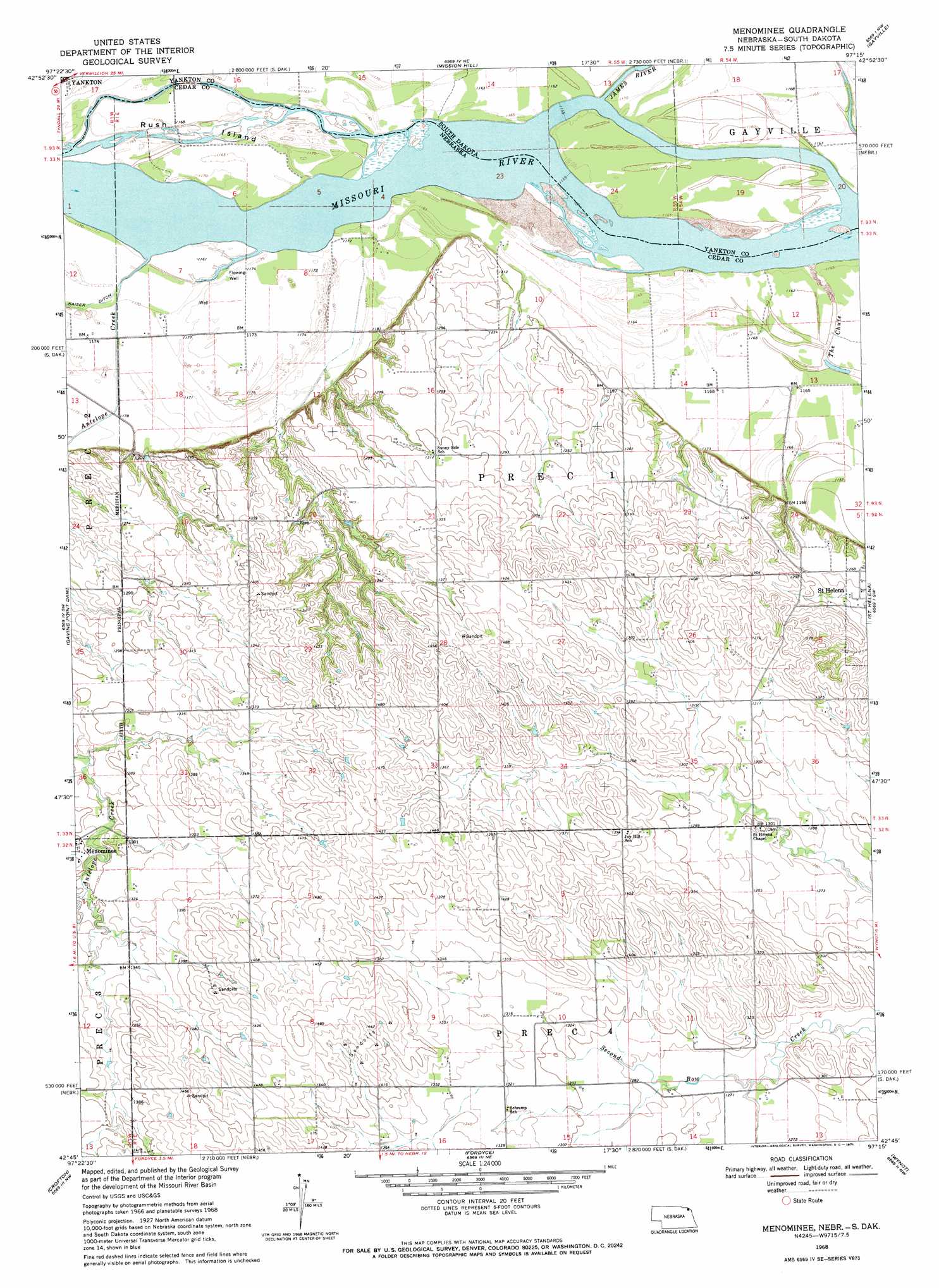
Menominee Topo Map Nebraska
To zoom in, hover over the map of Menominee
USGS Topo Quad 42097g3 - 1:24,000 scale
| Topo Map Name: | Menominee |
| USGS Topo Quad ID: | 42097g3 |
| Print Size: | ca. 21 1/4" wide x 27" high |
| Southeast Coordinates: | 42.75° N latitude / 97.25° W longitude |
| Map Center Coordinates: | 42.8125° N latitude / 97.3125° W longitude |
| U.S. States: | NE, SD |
| Filename: | O42097G3.jpg |
| Download Map JPG Image: | Menominee topo map 1:24,000 scale |
| Map Type: | Topographic |
| Topo Series: | 7.5´ |
| Map Scale: | 1:24,000 |
| Source of Map Images: | United States Geological Survey (USGS) |
| Alternate Map Versions: |
Menominee NE 1968, updated 1971 Download PDF Buy paper map Menominee NE 1968, updated 1971 Download PDF Buy paper map Menominee NE 2011 Download PDF Buy paper map Menominee NE 2014 Download PDF Buy paper map |
1:24,000 Topo Quads surrounding Menominee
Lesterville |
Jamesville |
Mayfield |
Irene |
Wakonda |
Tabor Ne |
Yankton |
Mission Hill |
Gayville |
Gayville Ne |
Tabor Se |
Gavins Point Dam |
Menominee |
Saint Helena |
Meckling |
Bloomfield Ne |
Crofton |
Fordyce |
Wynot |
Obert |
Bloomfield Se |
Hartington Sw |
Hartington |
Coleridge |
Coleridge Se |
> Back to 42097e1 at 1:100,000 scale
> Back to 42096a1 at 1:250,000 scale
> Back to U.S. Topo Maps home
Menominee topo map: Gazetteer
Menominee: Islands
Rush Island elevation 355m 1164′Menominee: Populated Places
Menominee elevation 396m 1299′Menominee: Post Offices
Menominee Post Office (historical) elevation 396m 1299′Saint Helena Post Office elevation 381m 1250′
Menominee: Streams
Antelope Creek elevation 353m 1158′James River elevation 351m 1151′
Menominee digital topo map on disk
Buy this Menominee topo map showing relief, roads, GPS coordinates and other geographical features, as a high-resolution digital map file on DVD: