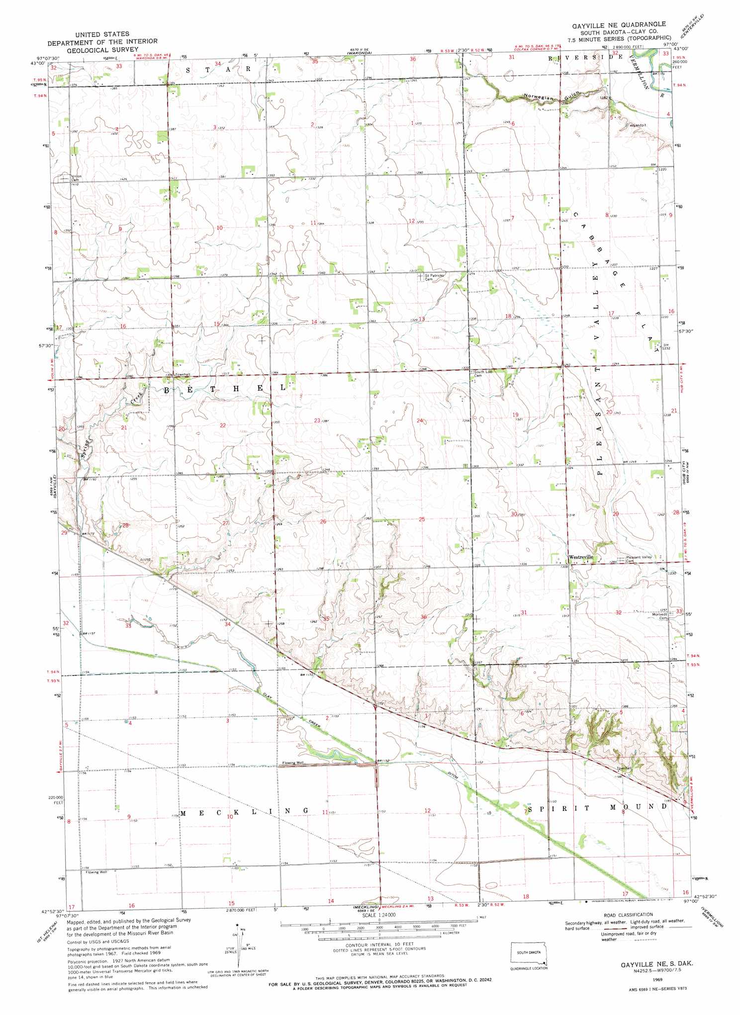
Gayville Ne Topo Map South Dakota
To zoom in, hover over the map of Gayville Ne
USGS Topo Quad 42097h1 - 1:24,000 scale
| Topo Map Name: | Gayville Ne |
| USGS Topo Quad ID: | 42097h1 |
| Print Size: | ca. 21 1/4" wide x 27" high |
| Southeast Coordinates: | 42.875° N latitude / 97° W longitude |
| Map Center Coordinates: | 42.9375° N latitude / 97.0625° W longitude |
| U.S. State: | SD |
| Filename: | o42097h1.jpg |
| Download Map JPG Image: | Gayville Ne topo map 1:24,000 scale |
| Map Type: | Topographic |
| Topo Series: | 7.5´ |
| Map Scale: | 1:24,000 |
| Source of Map Images: | United States Geological Survey (USGS) |
| Alternate Map Versions: |
Gayville NE SD 1969, updated 1971 Download PDF Buy paper map Gayville NE SD 2012 Download PDF Buy paper map Gayville NE SD 2015 Download PDF Buy paper map |
1:24,000 Topo Quads surrounding Gayville Ne
Turkey Ridge |
Center Point |
Viborg |
Beresford Nw |
Beresford Ne |
Mayfield |
Irene |
Wakonda |
Centerville |
Beresford |
Mission Hill |
Gayville |
Gayville Ne |
Hub City |
Alsen |
Menominee |
Saint Helena |
Meckling |
Vermillon |
Vermillon Se |
Fordyce |
Wynot |
Obert |
Maskell |
Burbank |
> Back to 42097e1 at 1:100,000 scale
> Back to 42096a1 at 1:250,000 scale
> Back to U.S. Topo Maps home
Gayville Ne topo map: Gazetteer
Gayville Ne: Canals
Clay Creek Ditch elevation 349m 1145′Gayville Ne: Populated Places
Bluff Center (historical) elevation 379m 1243′Westreville elevation 399m 1309′
Gayville Ne: Post Offices
Bolton Post Office (historical) elevation 390m 1279′Gayville Ne: Springs
Dillon Spring elevation 383m 1256′Ellingson Spring (historical) elevation 412m 1351′
Gayville Ne: Streams
Spring Creek elevation 352m 1154′Gayville Ne: Valleys
Norwegian Gulch elevation 356m 1167′Gayville Ne digital topo map on disk
Buy this Gayville Ne topo map showing relief, roads, GPS coordinates and other geographical features, as a high-resolution digital map file on DVD: