Yankton Topo Map South Dakota
To zoom in, hover over the map of Yankton
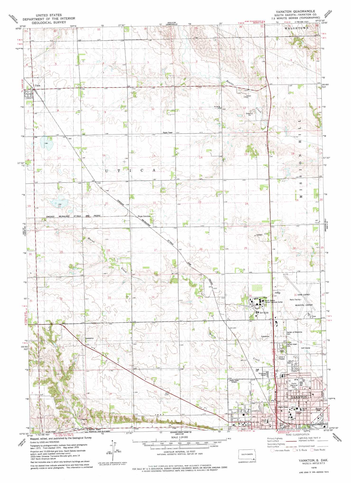
USGS Topo Quad 42097h4 - 1:24,000 scale
| Topo Map Name: | Yankton |
| USGS Topo Quad ID: | 42097h4 |
| Print Size: | ca. 21 1/4" wide x 27" high |
| Southeast Coordinates: | 42.875° N latitude / 97.375° W longitude |
| Map Center Coordinates: | 42.9375° N latitude / 97.4375° W longitude |
| U.S. State: | SD |
| Filename: | o42097h4.jpg |
| Download Map JPG Image: | Yankton topo map 1:24,000 scale |
| Map Type: | Topographic |
| Topo Series: | 7.5´ |
| Map Scale: | 1:24,000 |
| Source of Map Images: | United States Geological Survey (USGS) |
| Alternate Map Versions: |
Yankton SD 1978, updated 1979 Download PDF Buy paper map Yankton SD 2012 Download PDF Buy paper map Yankton SD 2015 Download PDF Buy paper map |
1:24,000 Topo Quads surrounding Yankton
Scotland |
Menno |
Midway |
Turkey Ridge |
Center Point |
Kloucek Lake |
Lesterville |
Jamesville |
Mayfield |
Irene |
Tabor |
Tabor Ne |
Yankton |
Mission Hill |
Gayville |
Bon Homme Colony |
Tabor Se |
Gavins Point Dam |
Menominee |
Saint Helena |
Lindy |
Bloomfield Ne |
Crofton |
Fordyce |
Wynot |
> Back to 42097e1 at 1:100,000 scale
> Back to 42096a1 at 1:250,000 scale
> Back to U.S. Topo Maps home
Yankton topo map: Gazetteer
Yankton: Airports
Chan Gurney Municipal Airport elevation 390m 1279′Yankton: Parks
Crockett Park elevation 361m 1184′Fantle Memorial Park elevation 382m 1253′
Tripp Park elevation 366m 1200′
Yankton: Populated Places
Napa Junction elevation 415m 1361′Utica elevation 417m 1368′
Yankton digital topo map on disk
Buy this Yankton topo map showing relief, roads, GPS coordinates and other geographical features, as a high-resolution digital map file on DVD: