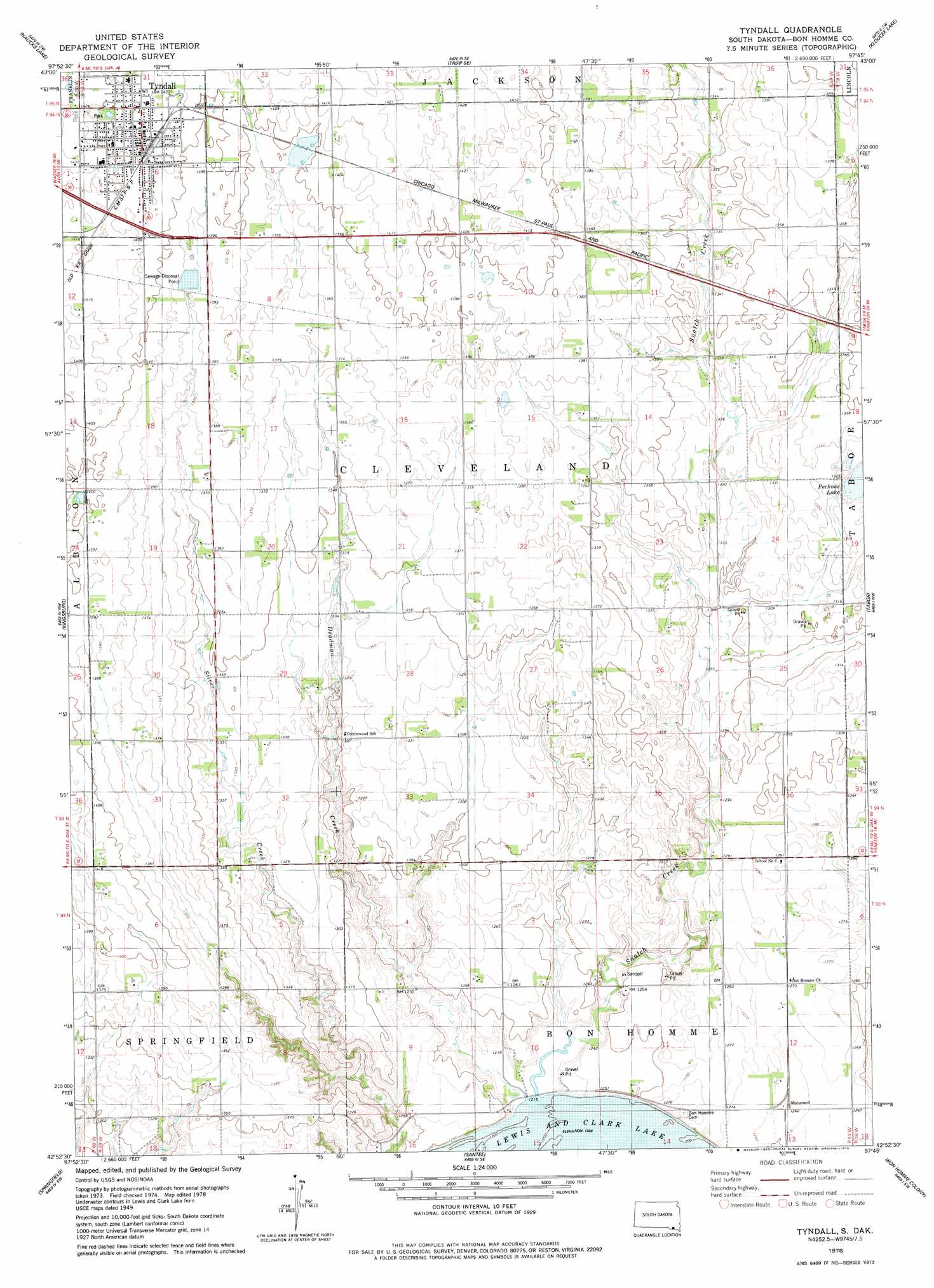
Tyndall Topo Map South Dakota
To zoom in, hover over the map of Tyndall
USGS Topo Quad 42097h7 - 1:24,000 scale
| Topo Map Name: | Tyndall |
| USGS Topo Quad ID: | 42097h7 |
| Print Size: | ca. 21 1/4" wide x 27" high |
| Southeast Coordinates: | 42.875° N latitude / 97.75° W longitude |
| Map Center Coordinates: | 42.9375° N latitude / 97.8125° W longitude |
| U.S. State: | SD |
| Filename: | o42097h7.jpg |
| Download Map JPG Image: | Tyndall topo map 1:24,000 scale |
| Map Type: | Topographic |
| Topo Series: | 7.5´ |
| Map Scale: | 1:24,000 |
| Source of Map Images: | United States Geological Survey (USGS) |
| Alternate Map Versions: |
Tyndall SD 1978, updated 1979 Download PDF Buy paper map Tyndall SD 2012 Download PDF Buy paper map Tyndall SD 2015 Download PDF Buy paper map |
1:24,000 Topo Quads surrounding Tyndall
Oak Hollow |
Tripp |
Kaylor |
Scotland |
Menno |
Avon |
Haucks Lake |
Tripp Se |
Kloucek Lake |
Lesterville |
Niobrara Ne |
Kingsburg |
Tyndall |
Tabor |
Tabor Ne |
Niobrara |
Springfield |
Santee |
Bon Homme Colony |
Tabor Se |
Verdigre Ne |
Sparta |
Howe Creek |
Lindy |
Bloomfield Ne |
> Back to 42097e1 at 1:100,000 scale
> Back to 42096a1 at 1:250,000 scale
> Back to U.S. Topo Maps home
Tyndall topo map: Gazetteer
Tyndall: Parks
Snatch Creek Recreation Area elevation 372m 1220′Tyndall: Populated Places
Tyndall elevation 433m 1420′Tyndall: Streams
Deadman Creek elevation 368m 1207′Snatch Creek elevation 368m 1207′
Tyndall digital topo map on disk
Buy this Tyndall topo map showing relief, roads, GPS coordinates and other geographical features, as a high-resolution digital map file on DVD: