Star Topo Map Nebraska
To zoom in, hover over the map of Star
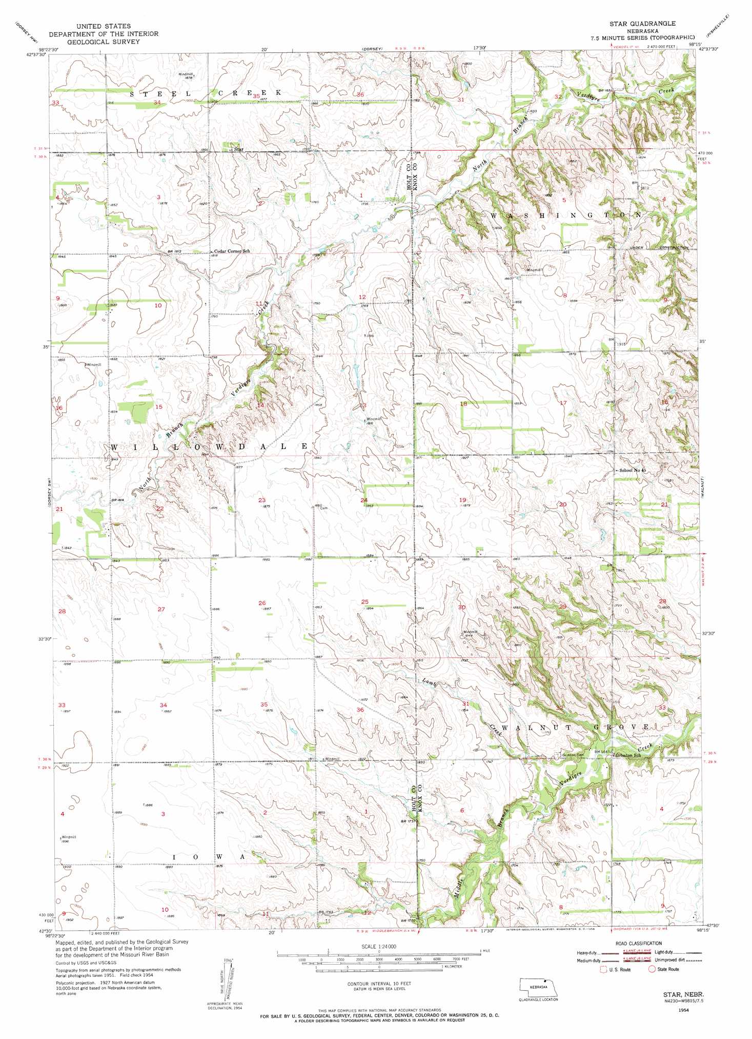
USGS Topo Quad 42098e3 - 1:24,000 scale
| Topo Map Name: | Star |
| USGS Topo Quad ID: | 42098e3 |
| Print Size: | ca. 21 1/4" wide x 27" high |
| Southeast Coordinates: | 42.5° N latitude / 98.25° W longitude |
| Map Center Coordinates: | 42.5625° N latitude / 98.3125° W longitude |
| U.S. State: | NE |
| Filename: | O42098E3.jpg |
| Download Map JPG Image: | Star topo map 1:24,000 scale |
| Map Type: | Topographic |
| Topo Series: | 7.5´ |
| Map Scale: | 1:24,000 |
| Source of Map Images: | United States Geological Survey (USGS) |
| Alternate Map Versions: |
Star NE 1954, updated 1956 Download PDF Buy paper map Star NE 1954, updated 1956 Download PDF Buy paper map Star NE 2011 Download PDF Buy paper map Star NE 2014 Download PDF Buy paper map |
1:24,000 Topo Quads surrounding Star
Bristow |
Lynch |
Monowi |
Verdel |
Niobrara |
Meek Ne |
Dorsey Nw |
Dorsey |
Pishelville |
Verdigre Ne |
Opportunity |
Dorsey Sw |
Star |
Walnut |
Verdigre |
Inman |
Page |
Venus |
Orchard Nw |
Orchard Ne |
O'Neill Se |
Ewing Sw |
Ewing |
Orchard |
Royal |
> Back to 42098e1 at 1:100,000 scale
> Back to 42098a1 at 1:250,000 scale
> Back to U.S. Topo Maps home
Star topo map: Gazetteer
Star: Populated Places
Star elevation 565m 1853′Star: Post Offices
Star Post Office (historical) elevation 565m 1853′Star: Streams
Lamb Creek elevation 500m 1640′Star digital topo map on disk
Buy this Star topo map showing relief, roads, GPS coordinates and other geographical features, as a high-resolution digital map file on DVD: