Verdigre Ne Topo Map Nebraska
To zoom in, hover over the map of Verdigre Ne
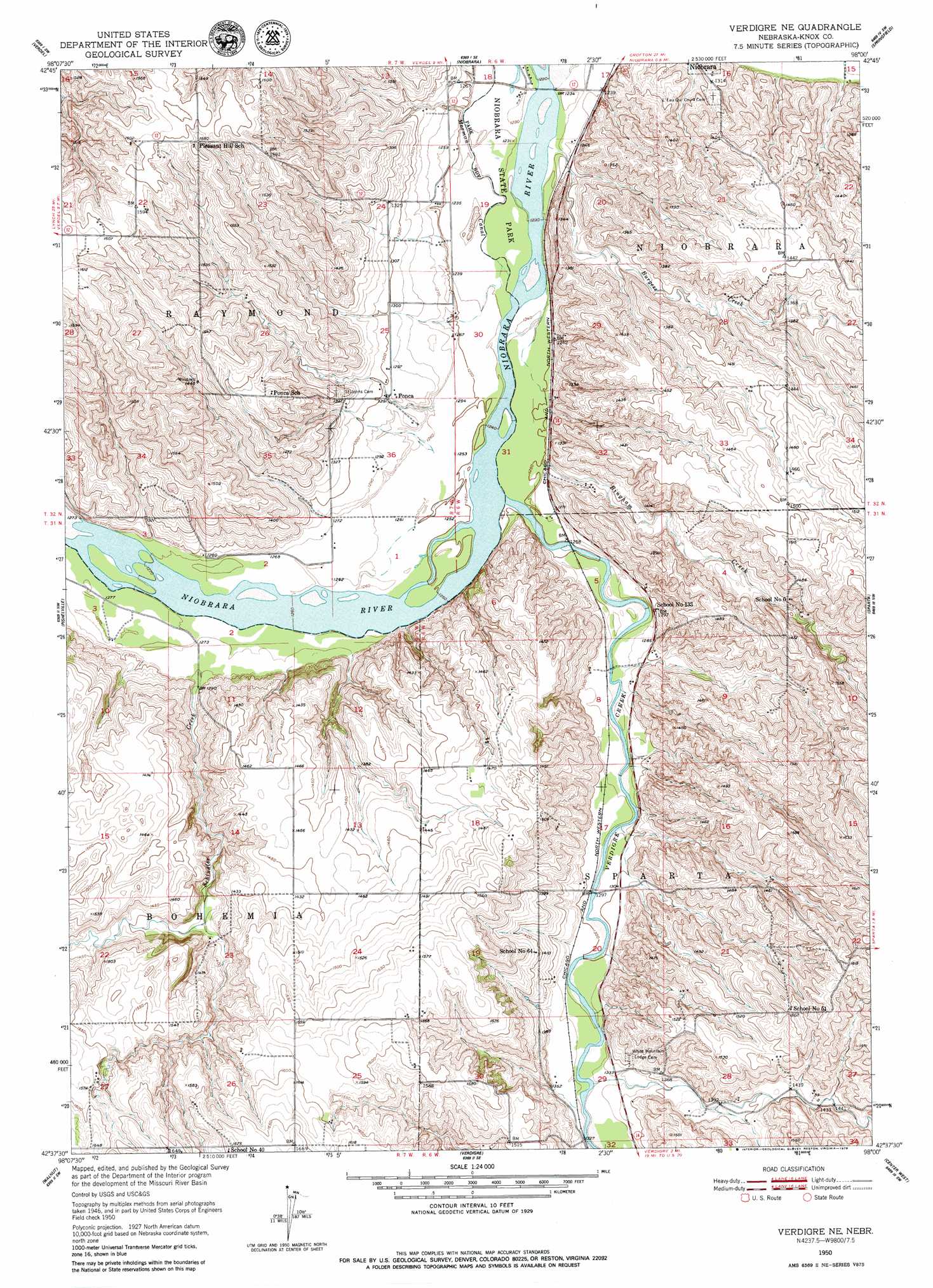
USGS Topo Quad 42098f1 - 1:24,000 scale
| Topo Map Name: | Verdigre Ne |
| USGS Topo Quad ID: | 42098f1 |
| Print Size: | ca. 21 1/4" wide x 27" high |
| Southeast Coordinates: | 42.625° N latitude / 98° W longitude |
| Map Center Coordinates: | 42.6875° N latitude / 98.0625° W longitude |
| U.S. State: | NE |
| Filename: | O42098F1.jpg |
| Download Map JPG Image: | Verdigre Ne topo map 1:24,000 scale |
| Map Type: | Topographic |
| Topo Series: | 7.5´ |
| Map Scale: | 1:24,000 |
| Source of Map Images: | United States Geological Survey (USGS) |
| Alternate Map Versions: |
Verdigre NE NE 1950, updated 1952 Download PDF Buy paper map Verdigre NE NE 1950, updated 1979 Download PDF Buy paper map Verdigre NE NE 2011 Download PDF Buy paper map Verdigre NE NE 2014 Download PDF Buy paper map |
1:24,000 Topo Quads surrounding Verdigre Ne
Lynch Ne |
Niobrara Nw |
Niobrara Ne |
Kingsburg |
Tyndall |
Monowi |
Verdel |
Niobrara |
Springfield |
Santee |
Dorsey |
Pishelville |
Verdigre Ne |
Sparta |
Howe Creek |
Star |
Walnut |
Verdigre |
Center West |
Center East |
Venus |
Orchard Nw |
Orchard Ne |
Creighton |
Plainview Ne |
> Back to 42098e1 at 1:100,000 scale
> Back to 42098a1 at 1:250,000 scale
> Back to U.S. Topo Maps home
Verdigre Ne topo map: Gazetteer
Verdigre Ne: Canals
Mormon Canal elevation 375m 1230′Verdigre Ne: Dams
Paesl Dam elevation 400m 1312′Verdigre Ne: Parks
Niobrara State Park elevation 375m 1230′Ponca Tribe Historical Marker elevation 372m 1220′
Sage Brothers Historical Marker elevation 372m 1220′
Verdigre Ne: Populated Places
Ponca elevation 393m 1289′Verdigre Ne: Reservoirs
Paesl Reservoir elevation 400m 1312′Verdigre Ne: Streams
Bingham Creek elevation 384m 1259′Burgess Creek elevation 373m 1223′
Schindler Creek elevation 390m 1279′
Verdigre Creek elevation 379m 1243′
Verdigre Ne: Trails
Niobrara Trails elevation 373m 1223′Verdigre Ne digital topo map on disk
Buy this Verdigre Ne topo map showing relief, roads, GPS coordinates and other geographical features, as a high-resolution digital map file on DVD: