Niobrara Ne Topo Map South Dakota
To zoom in, hover over the map of Niobrara Ne
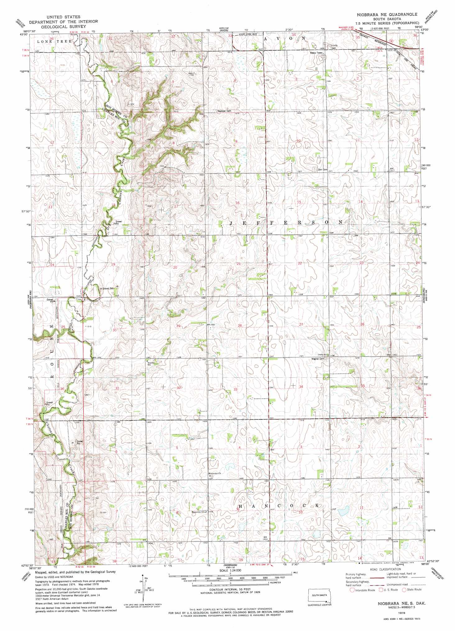
USGS Topo Quad 42098h1 - 1:24,000 scale
| Topo Map Name: | Niobrara Ne |
| USGS Topo Quad ID: | 42098h1 |
| Print Size: | ca. 21 1/4" wide x 27" high |
| Southeast Coordinates: | 42.875° N latitude / 98° W longitude |
| Map Center Coordinates: | 42.9375° N latitude / 98.0625° W longitude |
| U.S. State: | SD |
| Filename: | o42098h1.jpg |
| Download Map JPG Image: | Niobrara Ne topo map 1:24,000 scale |
| Map Type: | Topographic |
| Topo Series: | 7.5´ |
| Map Scale: | 1:24,000 |
| Source of Map Images: | United States Geological Survey (USGS) |
| Alternate Map Versions: |
Niobrara NE SD 1978, updated 1979 Download PDF Buy paper map Niobrara NE SD 2012 Download PDF Buy paper map Niobrara NE SD 2015 Download PDF Buy paper map |
1:24,000 Topo Quads surrounding Niobrara Ne
Wagner Ne |
Greenwood Colony |
Oak Hollow |
Tripp |
Kaylor |
Wagner |
Dante |
Avon |
Haucks Lake |
Tripp Se |
Lynch Ne |
Niobrara Nw |
Niobrara Ne |
Kingsburg |
Tyndall |
Monowi |
Verdel |
Niobrara |
Springfield |
Santee |
Dorsey |
Pishelville |
Verdigre Ne |
Sparta |
Howe Creek |
> Back to 42098e1 at 1:100,000 scale
> Back to 42098a1 at 1:250,000 scale
> Back to U.S. Topo Maps home
Niobrara Ne topo map: Gazetteer
Niobrara Ne: Post Offices
Andrus Post Office (historical) elevation 397m 1302′Lorettta Post Office (historical) elevation 440m 1443′
Niobrara Ne: Streams
Dry Choteau Creek elevation 396m 1299′Niobrara Ne digital topo map on disk
Buy this Niobrara Ne topo map showing relief, roads, GPS coordinates and other geographical features, as a high-resolution digital map file on DVD: