Lynch Ne Topo Map South Dakota
To zoom in, hover over the map of Lynch Ne
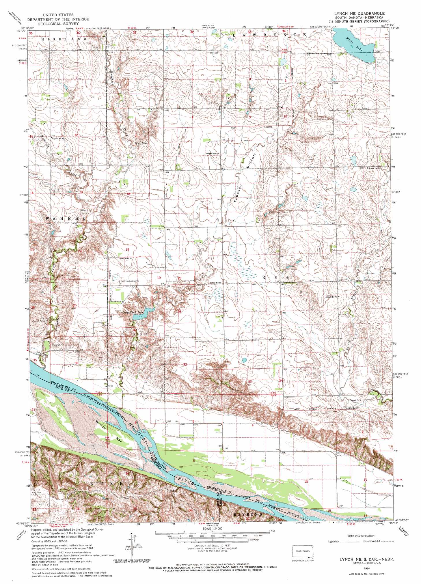
USGS Topo Quad 42098h3 - 1:24,000 scale
| Topo Map Name: | Lynch Ne |
| USGS Topo Quad ID: | 42098h3 |
| Print Size: | ca. 21 1/4" wide x 27" high |
| Southeast Coordinates: | 42.875° N latitude / 98.25° W longitude |
| Map Center Coordinates: | 42.9375° N latitude / 98.3125° W longitude |
| U.S. States: | SD, NE |
| Filename: | o42098h3.jpg |
| Download Map JPG Image: | Lynch Ne topo map 1:24,000 scale |
| Map Type: | Topographic |
| Topo Series: | 7.5´ |
| Map Scale: | 1:24,000 |
| Source of Map Images: | United States Geological Survey (USGS) |
| Alternate Map Versions: |
Lynch NE SD 1964, updated 1966 Download PDF Buy paper map Lynch NE SD 1964, updated 1966 Download PDF Buy paper map Lynch NE SD 2012 Download PDF Buy paper map Lynch NE SD 2015 Download PDF Buy paper map |
1:24,000 Topo Quads surrounding Lynch Ne
Lake Andes |
Ravinia |
Wagner Ne |
Greenwood Colony |
Oak Hollow |
Fort Randall Dam |
Wagner Sw |
Wagner |
Dante |
Avon |
Gross |
Marty |
Lynch Ne |
Niobrara Nw |
Niobrara Ne |
Bristow |
Lynch |
Monowi |
Verdel |
Niobrara |
Meek Ne |
Dorsey Nw |
Dorsey |
Pishelville |
Verdigre Ne |
> Back to 42098e1 at 1:100,000 scale
> Back to 42098a1 at 1:250,000 scale
> Back to U.S. Topo Maps home
Lynch Ne topo map: Gazetteer
Lynch Ne: Bars
Willow Bar elevation 380m 1246′Lynch Ne: Flats
Tobacco Bottom elevation 436m 1430′Lynch Ne: Lakes
Song Hawk Lake elevation 401m 1315′White Lake elevation 474m 1555′
Lynch Ne: Streams
Mosquito Creek elevation 405m 1328′Slaughter Creek elevation 374m 1227′
Lynch Ne digital topo map on disk
Buy this Lynch Ne topo map showing relief, roads, GPS coordinates and other geographical features, as a high-resolution digital map file on DVD: