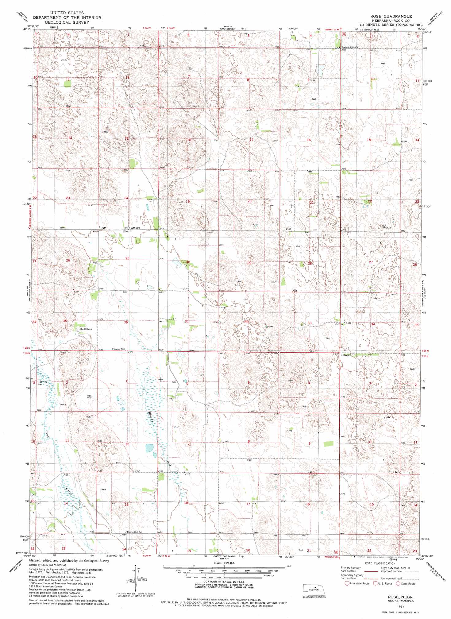
Rose Topo Map Nebraska
To zoom in, hover over the map of Rose
USGS Topo Quad 42099b5 - 1:24,000 scale
| Topo Map Name: | Rose |
| USGS Topo Quad ID: | 42099b5 |
| Print Size: | ca. 21 1/4" wide x 27" high |
| Southeast Coordinates: | 42.125° N latitude / 99.5° W longitude |
| Map Center Coordinates: | 42.1875° N latitude / 99.5625° W longitude |
| U.S. State: | NE |
| Filename: | O42099B5.jpg |
| Download Map JPG Image: | Rose topo map 1:24,000 scale |
| Map Type: | Topographic |
| Topo Series: | 7.5´ |
| Map Scale: | 1:24,000 |
| Source of Map Images: | United States Geological Survey (USGS) |
| Alternate Map Versions: |
Rose NE 1981, updated 1982 Download PDF Buy paper map Rose NE 2011 Download PDF Buy paper map Rose NE 2014 Download PDF Buy paper map |
1:24,000 Topo Quads surrounding Rose
Hofeld Lake |
Hagan Lake Nw |
Hagan Lake Ne |
Linke Lake |
Pony Lake |
Raven |
Hagan Lake |
Lake George |
Stockdale Lake |
Sybrant |
Goldman Lake Ne |
Paramount Valley |
Rose |
Stonehouse Ranch Nw |
Stonehouse Ranch Ne |
Goldman Lake Se |
Boiling Spring |
Shovel Dot Ranch |
Stonehouse Ranch Sw |
Stonehouse Ranch |
Brewster |
Almeria Nw |
Almeria Ne |
Taylor Nw |
Taylor Ne |
> Back to 42099a1 at 1:100,000 scale
> Back to 42098a1 at 1:250,000 scale
> Back to U.S. Topo Maps home
Rose topo map: Gazetteer
Rose: Populated Places
Duff elevation 763m 2503′Rose elevation 770m 2526′
Rose: Post Offices
Duff Post Office (historical) elevation 763m 2503′Rose Post Office elevation 770m 2526′
Rose digital topo map on disk
Buy this Rose topo map showing relief, roads, GPS coordinates and other geographical features, as a high-resolution digital map file on DVD: