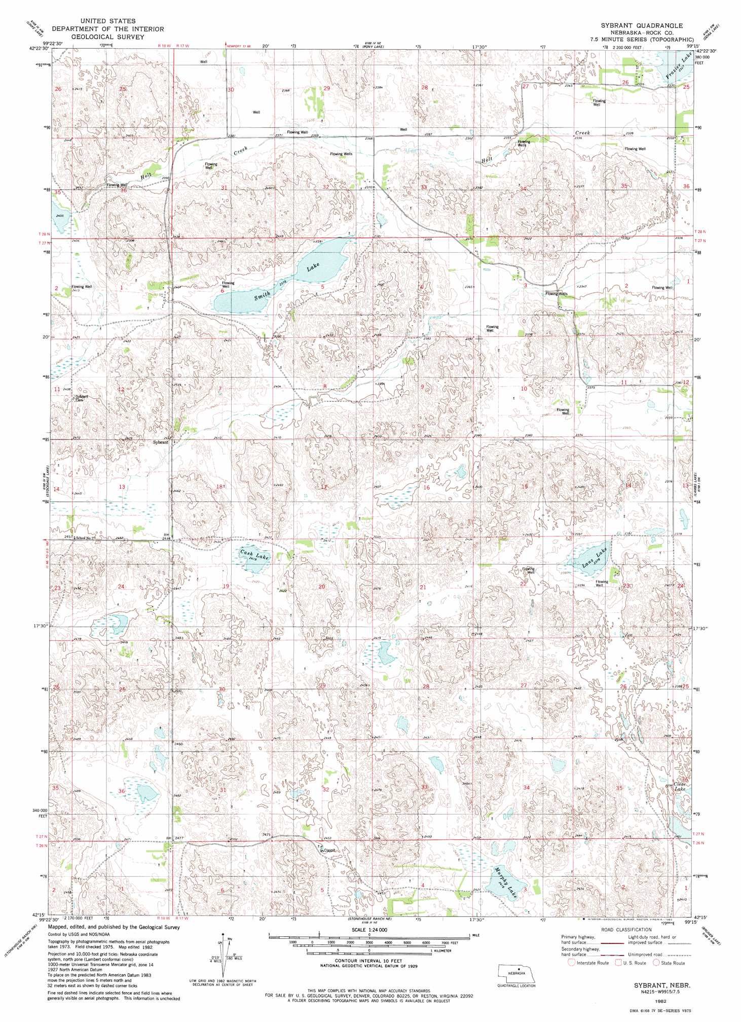
Sybrant Topo Map Nebraska
To zoom in, hover over the map of Sybrant
USGS Topo Quad 42099c3 - 1:24,000 scale
| Topo Map Name: | Sybrant |
| USGS Topo Quad ID: | 42099c3 |
| Print Size: | ca. 21 1/4" wide x 27" high |
| Southeast Coordinates: | 42.25° N latitude / 99.25° W longitude |
| Map Center Coordinates: | 42.3125° N latitude / 99.3125° W longitude |
| U.S. State: | NE |
| Filename: | O42099C3.jpg |
| Download Map JPG Image: | Sybrant topo map 1:24,000 scale |
| Map Type: | Topographic |
| Topo Series: | 7.5´ |
| Map Scale: | 1:24,000 |
| Source of Map Images: | United States Geological Survey (USGS) |
| Alternate Map Versions: |
Sybrant NE 1982, updated 1982 Download PDF Buy paper map Sybrant NE 2011 Download PDF Buy paper map Sybrant NE 2014 Download PDF Buy paper map |
1:24,000 Topo Quads surrounding Sybrant
Bassett |
Newport Sw |
Newport |
Stuart |
Stuart Se |
Hagan Lake Ne |
Linke Lake |
Pony Lake |
Dora Lake |
Lambs Lake Ne |
Lake George |
Stockdale Lake |
Sybrant |
Lambs Lake |
Cottonwood Lake |
Rose |
Stonehouse Ranch Nw |
Stonehouse Ranch Ne |
Bruner Lake |
Swan Lake |
Shovel Dot Ranch |
Stonehouse Ranch Sw |
Stonehouse Ranch |
Carson Lake |
Abbott Ranch |
> Back to 42099a1 at 1:100,000 scale
> Back to 42098a1 at 1:250,000 scale
> Back to U.S. Topo Maps home
Sybrant topo map: Gazetteer
Sybrant: Lakes
Cash Lake elevation 735m 2411′Frazier Lake elevation 708m 2322′
Lanz Lake elevation 723m 2372′
Murphy Lake elevation 735m 2411′
Smith Lake elevation 723m 2372′
Sybrant: Populated Places
Sybrant elevation 743m 2437′Sybrant: Post Offices
Sybrant Post Office (historical) elevation 743m 2437′Sybrant digital topo map on disk
Buy this Sybrant topo map showing relief, roads, GPS coordinates and other geographical features, as a high-resolution digital map file on DVD: