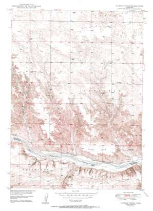
Huddle Table Topo Map Nebraska
To zoom in, hover over the map of Huddle Table
USGS Topo Quad 42099g8 - 1:24,000 scale
| Topo Map Name: | Huddle Table |
| USGS Topo Quad ID: | 42099g8 |
| Print Size: | ca. 21 1/4" wide x 27" high |
| Southeast Coordinates: | 42.75° N latitude / 99.875° W longitude |
| Map Center Coordinates: | 42.8125° N latitude / 99.9375° W longitude |
| U.S. State: | NE |
| Filename: | O42099G8.jpg |
| Download Map JPG Image: | Huddle Table topo map 1:24,000 scale |
| Map Type: | Topographic |
| Topo Series: | 7.5´ |
| Map Scale: | 1:24,000 |
| Source of Map Images: | United States Geological Survey (USGS) |
| Alternate Map Versions: |
Huddle Table NE 1950 Download PDF Buy paper map Huddle Table NE 2011 Download PDF Buy paper map Huddle Table NE 2014 Download PDF Buy paper map |
1:24,000 Topo Quads surrounding Huddle Table
> Back to 42099e1 at 1:100,000 scale
> Back to 42098a1 at 1:250,000 scale
> Back to U.S. Topo Maps home
Huddle Table topo map: Gazetteer
Huddle Table: Dams
Batchelder Dam elevation 723m 2372′Cub Creek Dam elevation 714m 2342′
Huddle Table: Islands
Cedar Island elevation 643m 2109′Hartman Island elevation 629m 2063′
Huddle Table: Reservoirs
Batchelder Reservoir elevation 723m 2372′Cub Creek Reservoir elevation 714m 2342′
Huddle Table: Streams
Barney Creek elevation 636m 2086′Bronson Creek elevation 639m 2096′
Chimney Creek elevation 630m 2066′
Cub Creek elevation 625m 2050′
Garden Creek elevation 633m 2076′
Hazel Creek elevation 629m 2063′
Jeff Creek elevation 630m 2066′
Smith Creek elevation 629m 2063′
Turkey Creek elevation 637m 2089′
Huddle Table: Summits
Huddle Table elevation 697m 2286′Huddle Table: Valleys
Buzzard Canyon elevation 626m 2053′Huddle Table digital topo map on disk
Buy this Huddle Table topo map showing relief, roads, GPS coordinates and other geographical features, as a high-resolution digital map file on DVD:


