Springview Nw Topo Map Nebraska
To zoom in, hover over the map of Springview Nw
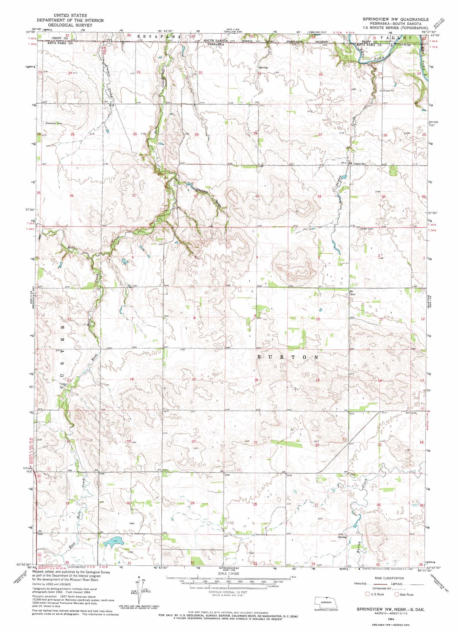
USGS Topo Quad 42099h6 - 1:24,000 scale
| Topo Map Name: | Springview Nw |
| USGS Topo Quad ID: | 42099h6 |
| Print Size: | ca. 21 1/4" wide x 27" high |
| Southeast Coordinates: | 42.875° N latitude / 99.625° W longitude |
| Map Center Coordinates: | 42.9375° N latitude / 99.6875° W longitude |
| U.S. States: | NE, SD |
| Filename: | O42099H6.jpg |
| Download Map JPG Image: | Springview Nw topo map 1:24,000 scale |
| Map Type: | Topographic |
| Topo Series: | 7.5´ |
| Map Scale: | 1:24,000 |
| Source of Map Images: | United States Geological Survey (USGS) |
| Alternate Map Versions: |
Springview NW NE 1964, updated 1965 Download PDF Buy paper map Springview NW NE 2011 Download PDF Buy paper map Springview NW NE 2014 Download PDF Buy paper map |
1:24,000 Topo Quads surrounding Springview Nw
Dog Ear Lake |
Wewela Ne |
Dallas Nw |
Dallas |
Gregory |
Millboro |
Wewela |
Dallas Sw |
Paxton |
Carlock |
Meadville Nw |
Meadville Ne |
Springview Nw |
Burton |
Mills |
Huddle Table |
Meadville |
Springview |
Springview Se |
Jamison Sw |
Ainsworth Nw |
Dutch Creek |
Bassett Nw |
Riverview |
Carns |
> Back to 42099e1 at 1:100,000 scale
> Back to 42098a1 at 1:250,000 scale
> Back to U.S. Topo Maps home
Springview Nw topo map: Gazetteer
Springview Nw: Bridges
Dubel Bridge elevation 604m 1981′Dubel Bridge elevation 603m 1978′
Springview Nw: Dams
Bloomstrom Dam elevation 626m 2053′Kappelman Dam elevation 657m 2155′
Sloan Dam elevation 679m 2227′
Springview Nw: Reservoirs
Bloomstrom Reservoir elevation 626m 2053′Kappleman Reservoir elevation 657m 2155′
Sloan Reservoir elevation 679m 2227′
Springview Nw: Streams
East Holt Creek elevation 654m 2145′Holt Creek elevation 636m 2086′
Jordan Creek elevation 601m 1971′
Springview Nw: Valleys
Deckers Gulch elevation 649m 2129′Springview Nw digital topo map on disk
Buy this Springview Nw topo map showing relief, roads, GPS coordinates and other geographical features, as a high-resolution digital map file on DVD: