Lowes Lake Topo Map Nebraska
To zoom in, hover over the map of Lowes Lake
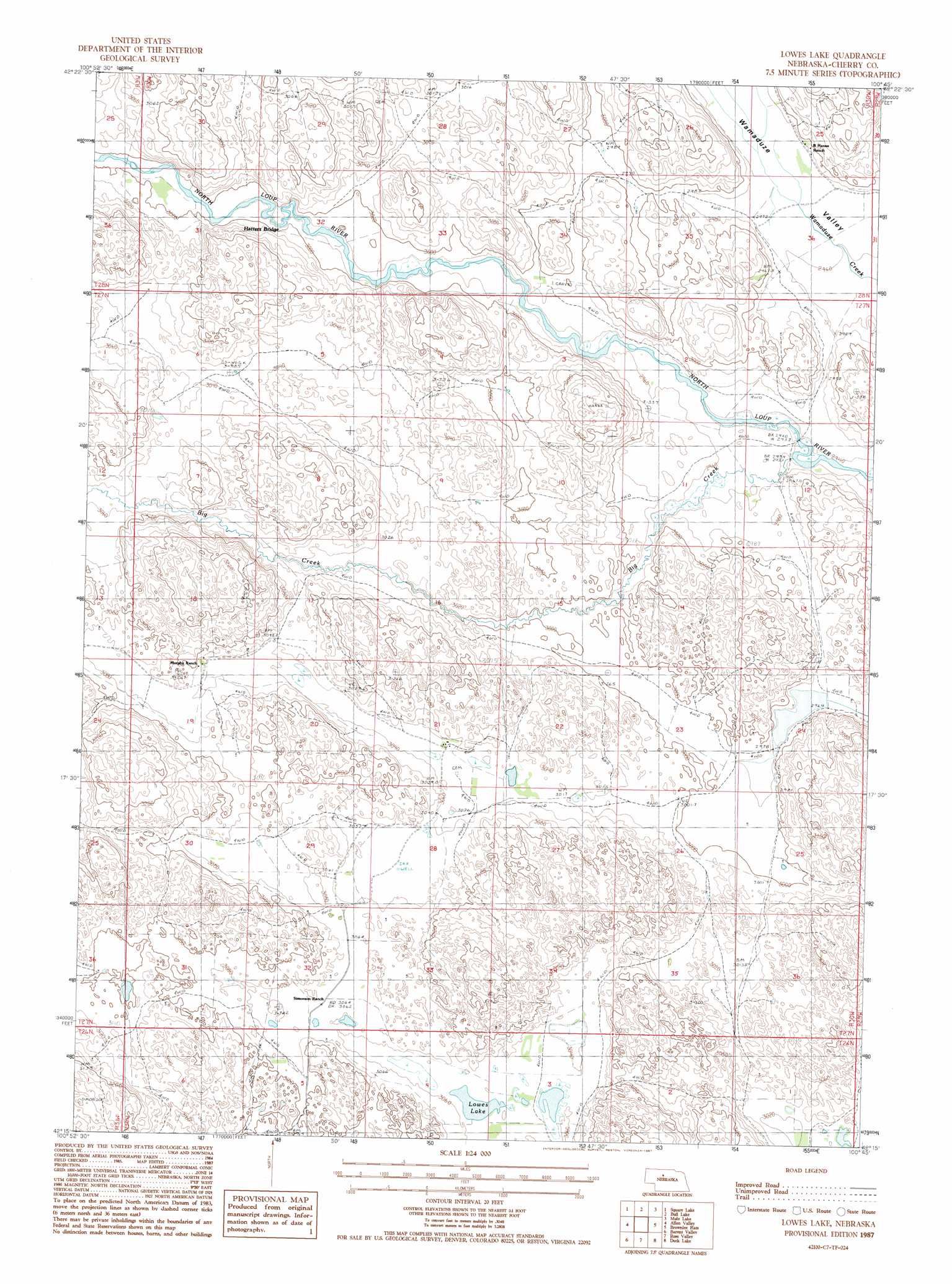
USGS Topo Quad 42100c7 - 1:24,000 scale
| Topo Map Name: | Lowes Lake |
| USGS Topo Quad ID: | 42100c7 |
| Print Size: | ca. 21 1/4" wide x 27" high |
| Southeast Coordinates: | 42.25° N latitude / 100.75° W longitude |
| Map Center Coordinates: | 42.3125° N latitude / 100.8125° W longitude |
| U.S. State: | NE |
| Filename: | O42100c7.jpg |
| Download Map JPG Image: | Lowes Lake topo map 1:24,000 scale |
| Map Type: | Topographic |
| Topo Series: | 7.5´ |
| Map Scale: | 1:24,000 |
| Source of Map Images: | United States Geological Survey (USGS) |
| Alternate Map Versions: |
Lowes Lake NE 1987, updated 1987 Download PDF Buy paper map Lowes Lake NE 2011 Download PDF Buy paper map Lowes Lake NE 2014 Download PDF Buy paper map |
1:24,000 Topo Quads surrounding Lowes Lake
Chesterfield Flats |
Windmill Lake |
Kennedy |
Simeon |
Willow Lake |
Brush Hill |
Square Lake |
Bull Lake |
Mule Lake |
Pony Lake |
Mayhew Lake |
Allen Valley |
Lowes Lake |
Brownlee Flats |
Brownlee |
Mullen Ne |
Barnet Valley |
Rose Valley |
Duck Lake |
Duck Lake Ne |
Mullen |
Seneca Sw |
Seneca |
Duck Lake Sw |
Duck Lake Se |
> Back to 42100a1 at 1:100,000 scale
> Back to 42100a1 at 1:250,000 scale
> Back to U.S. Topo Maps home
Lowes Lake topo map: Gazetteer
Lowes Lake: Lakes
Lowes Lake elevation 931m 3054′Lowes Lake: Streams
Big Creek elevation 897m 2942′Lowes Lake digital topo map on disk
Buy this Lowes Lake topo map showing relief, roads, GPS coordinates and other geographical features, as a high-resolution digital map file on DVD: