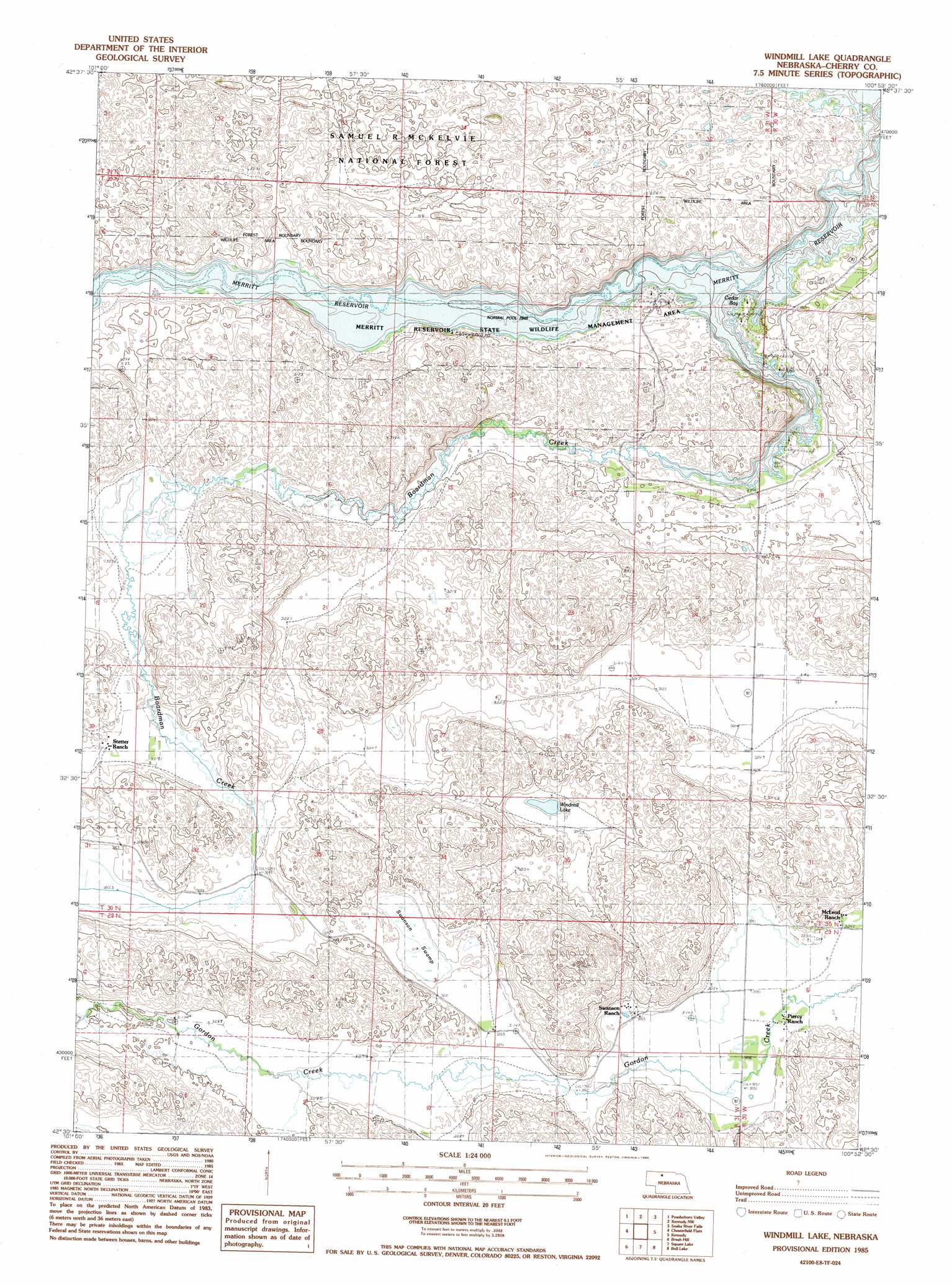
Windmill Lake Topo Map Nebraska
To zoom in, hover over the map of Windmill Lake
USGS Topo Quad 42100e8 - 1:24,000 scale
| Topo Map Name: | Windmill Lake |
| USGS Topo Quad ID: | 42100e8 |
| Print Size: | ca. 21 1/4" wide x 27" high |
| Southeast Coordinates: | 42.5° N latitude / 100.875° W longitude |
| Map Center Coordinates: | 42.5625° N latitude / 100.9375° W longitude |
| U.S. State: | NE |
| Filename: | O42100e8.jpg |
| Download Map JPG Image: | Windmill Lake topo map 1:24,000 scale |
| Map Type: | Topographic |
| Topo Series: | 7.5´ |
| Map Scale: | 1:24,000 |
| Source of Map Images: | United States Geological Survey (USGS) |
| Alternate Map Versions: |
Windmill Lake NE 1985, updated 1985 Download PDF Buy paper map Windmill Lake NE 2011 Download PDF Buy paper map Windmill Lake NE 2014 Download PDF Buy paper map |
| FStopo: | US Forest Service topo Windmill Lake is available: Download FStopo PDF Download FStopo TIF |
1:24,000 Topo Quads surrounding Windmill Lake
Spring Canyon |
Cody Se |
Cooper Canyon |
Kilgore Se |
Valentine Sw |
Spring Lake |
Powderhorn Valley |
Kennedy Nw |
Snake River Falls |
Hudson Lake |
Powderhorn Valley Sw |
Chesterfield Flats |
Windmill Lake |
Kennedy |
Simeon |
Big Falls |
Brush Hill |
Square Lake |
Bull Lake |
Mule Lake |
Coleman Lake |
Mayhew Lake |
Allen Valley |
Lowes Lake |
Brownlee Flats |
> Back to 42100e1 at 1:100,000 scale
> Back to 42100a1 at 1:250,000 scale
> Back to U.S. Topo Maps home
Windmill Lake topo map: Gazetteer
Windmill Lake: Bays
Cedar Bay elevation 899m 2949′Windmill Lake: Bridges
Parker Bridge elevation 898m 2946′Windmill Lake: Lakes
Windmill Lake elevation 926m 3038′Windmill Lake: Parks
Meritt Reservoir State Wildlife Management Area elevation 898m 2946′Windmill Lake: Streams
Boardman Creek elevation 898m 2946′Windmill Lake: Swamps
Swanson Swamp elevation 931m 3054′Windmill Lake digital topo map on disk
Buy this Windmill Lake topo map showing relief, roads, GPS coordinates and other geographical features, as a high-resolution digital map file on DVD: