Wood Lake Topo Map Nebraska
To zoom in, hover over the map of Wood Lake
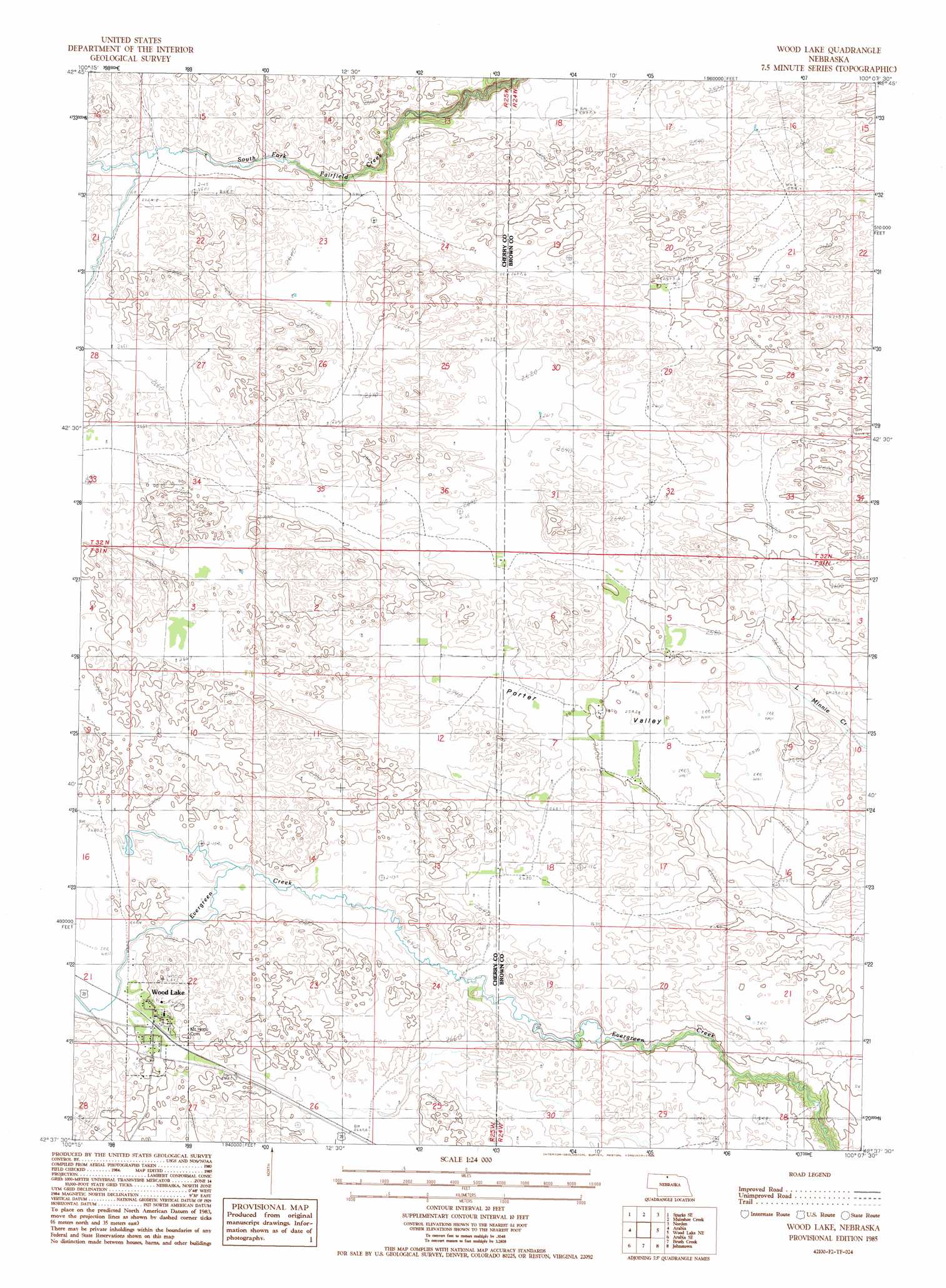
USGS Topo Quad 42100f2 - 1:24,000 scale
| Topo Map Name: | Wood Lake |
| USGS Topo Quad ID: | 42100f2 |
| Print Size: | ca. 21 1/4" wide x 27" high |
| Southeast Coordinates: | 42.625° N latitude / 100.125° W longitude |
| Map Center Coordinates: | 42.6875° N latitude / 100.1875° W longitude |
| U.S. State: | NE |
| Filename: | O42100f2.jpg |
| Download Map JPG Image: | Wood Lake topo map 1:24,000 scale |
| Map Type: | Topographic |
| Topo Series: | 7.5´ |
| Map Scale: | 1:24,000 |
| Source of Map Images: | United States Geological Survey (USGS) |
| Alternate Map Versions: |
Wood Lake NE 1985, updated 1985 Download PDF Buy paper map Wood Lake NE 2011 Download PDF Buy paper map Wood Lake NE 2014 Download PDF Buy paper map |
1:24,000 Topo Quads surrounding Wood Lake
Cornell Dam |
Sparks |
Norden Nw |
Haford Lake |
Meadville Nw |
Thatcher |
Sparks Se |
Muleshoe Creek |
Norden |
Huddle Table |
Arabia Nw |
Arabia |
Wood Lake |
Wood Lake Ne |
Ainsworth Nw |
Arabia Sw |
Arabia Se |
Brush Creek |
Johnstown |
Ainsworth Sw |
Long Lake |
Wilson Valley |
Harr Valley |
White Cap Hill |
Lost Lake Ranch |
> Back to 42100e1 at 1:100,000 scale
> Back to 42100a1 at 1:250,000 scale
> Back to U.S. Topo Maps home
Wood Lake topo map: Gazetteer
Wood Lake: Basins
Porter Valley elevation 791m 2595′Wood Lake: Parks
Wood Lake City Park elevation 821m 2693′Wood Lake: Populated Places
Wood Lake elevation 821m 2693′Wood Lake: Post Offices
Wood Lake Post Office elevation 821m 2693′Wood Lake digital topo map on disk
Buy this Wood Lake topo map showing relief, roads, GPS coordinates and other geographical features, as a high-resolution digital map file on DVD: