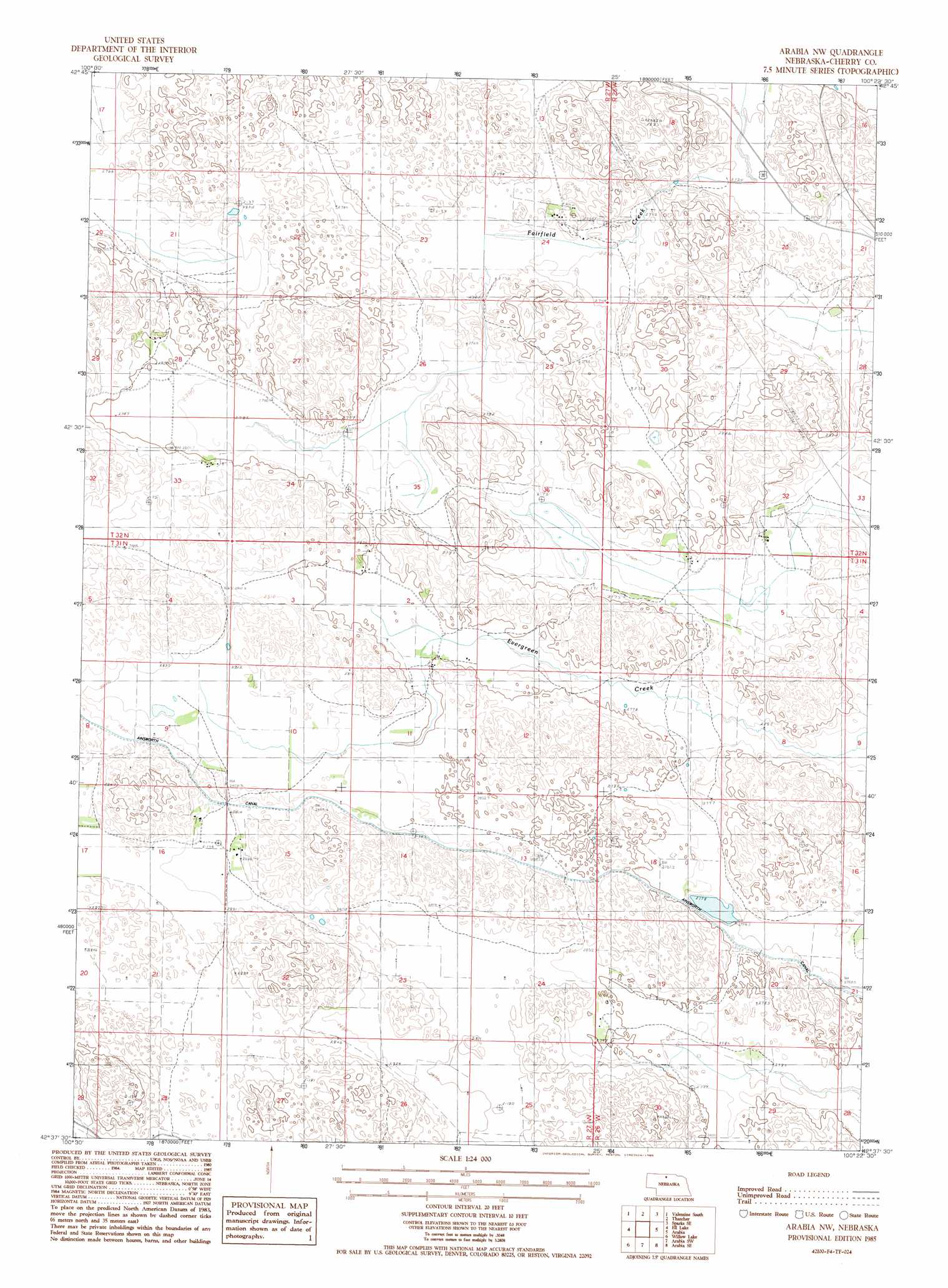
Arabia Nw Topo Map Nebraska
To zoom in, hover over the map of Arabia Nw
USGS Topo Quad 42100f4 - 1:24,000 scale
| Topo Map Name: | Arabia Nw |
| USGS Topo Quad ID: | 42100f4 |
| Print Size: | ca. 21 1/4" wide x 27" high |
| Southeast Coordinates: | 42.625° N latitude / 100.375° W longitude |
| Map Center Coordinates: | 42.6875° N latitude / 100.4375° W longitude |
| U.S. State: | NE |
| Filename: | O42100f4.jpg |
| Download Map JPG Image: | Arabia Nw topo map 1:24,000 scale |
| Map Type: | Topographic |
| Topo Series: | 7.5´ |
| Map Scale: | 1:24,000 |
| Source of Map Images: | United States Geological Survey (USGS) |
| Alternate Map Versions: |
Arabia NW NE 1985, updated 1985 Download PDF Buy paper map Arabia NW NE 2011 Download PDF Buy paper map Arabia NW NE 2014 Download PDF Buy paper map |
1:24,000 Topo Quads surrounding Arabia Nw
Crookston East |
Valentine North |
Cornell Dam |
Sparks |
Norden Nw |
Valentine Sw |
Valentine South |
Thatcher |
Sparks Se |
Muleshoe Creek |
Hudson Lake |
Ell Lake |
Arabia Nw |
Arabia |
Wood Lake |
Simeon |
Willow Lake |
Arabia Sw |
Arabia Se |
Brush Creek |
Mule Lake |
Pony Lake |
Long Lake |
Wilson Valley |
Harr Valley |
> Back to 42100e1 at 1:100,000 scale
> Back to 42100a1 at 1:250,000 scale
> Back to U.S. Topo Maps home
Arabia Nw topo map: Gazetteer
Arabia Nw: Canals
Ainsworth Canal elevation 861m 2824′Arabia Nw: Lakes
Swan Lake elevation 842m 2762′Arabia Nw digital topo map on disk
Buy this Arabia Nw topo map showing relief, roads, GPS coordinates and other geographical features, as a high-resolution digital map file on DVD: