Muleshoe Creek Topo Map Nebraska
To zoom in, hover over the map of Muleshoe Creek
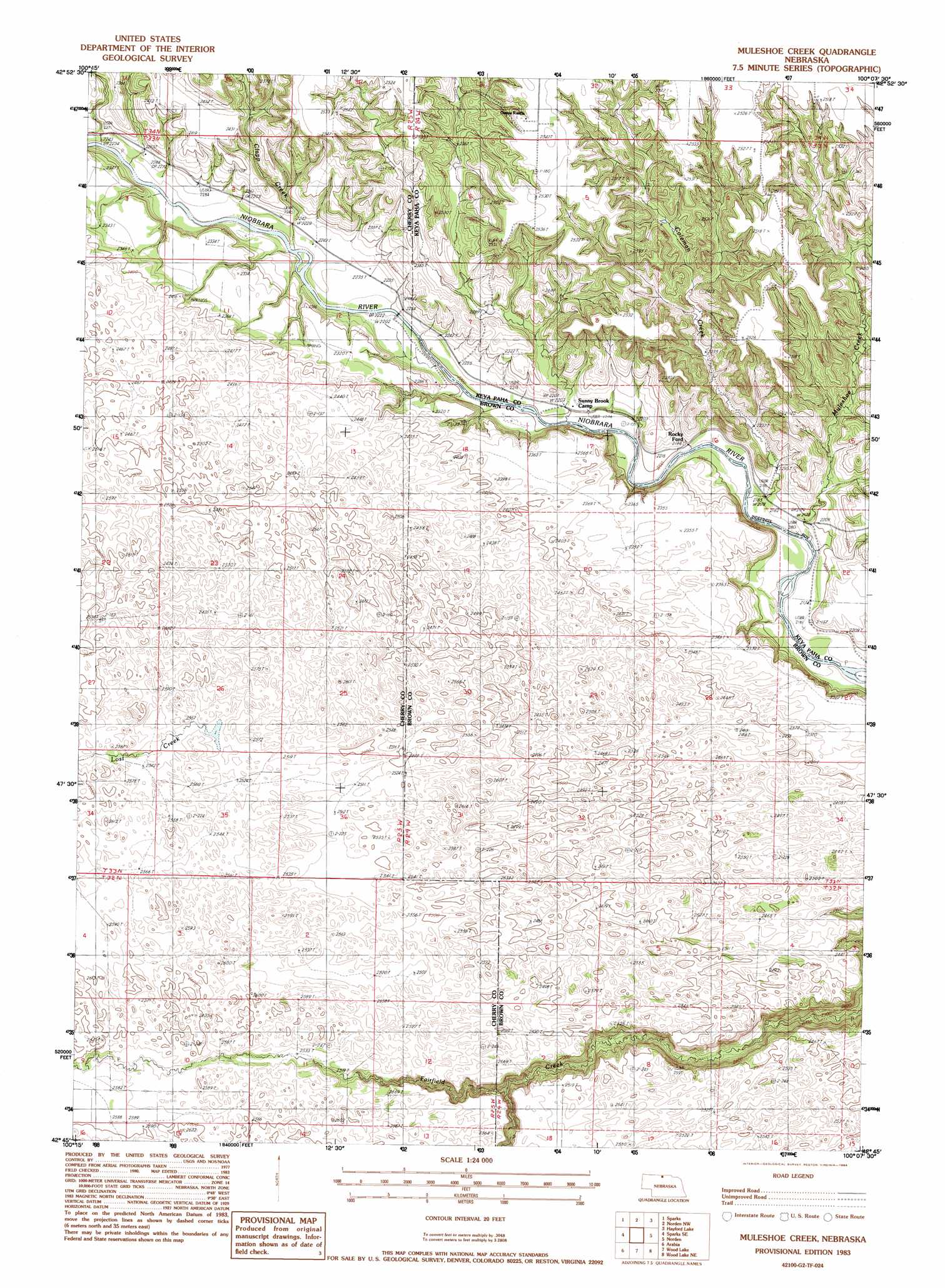
USGS Topo Quad 42100g2 - 1:24,000 scale
| Topo Map Name: | Muleshoe Creek |
| USGS Topo Quad ID: | 42100g2 |
| Print Size: | ca. 21 1/4" wide x 27" high |
| Southeast Coordinates: | 42.75° N latitude / 100.125° W longitude |
| Map Center Coordinates: | 42.8125° N latitude / 100.1875° W longitude |
| U.S. State: | NE |
| Filename: | O42100g2.jpg |
| Download Map JPG Image: | Muleshoe Creek topo map 1:24,000 scale |
| Map Type: | Topographic |
| Topo Series: | 7.5´ |
| Map Scale: | 1:24,000 |
| Source of Map Images: | United States Geological Survey (USGS) |
| Alternate Map Versions: |
Muleshoe Creek NE 1983, updated 1984 Download PDF Buy paper map Muleshoe Creek NE 1983, updated 1984 Download PDF Buy paper map Muleshoe Creek NE 2011 Download PDF Buy paper map Muleshoe Creek NE 2014 Download PDF Buy paper map |
1:24,000 Topo Quads surrounding Muleshoe Creek
Littleburg |
Hidden Timber Se |
Keyapaha |
Keyapaha Se |
Millboro |
Cornell Dam |
Sparks |
Norden Nw |
Haford Lake |
Meadville Nw |
Thatcher |
Sparks Se |
Muleshoe Creek |
Norden |
Huddle Table |
Arabia Nw |
Arabia |
Wood Lake |
Wood Lake Ne |
Ainsworth Nw |
Arabia Sw |
Arabia Se |
Brush Creek |
Johnstown |
Ainsworth Sw |
> Back to 42100e1 at 1:100,000 scale
> Back to 42100a1 at 1:250,000 scale
> Back to U.S. Topo Maps home
Muleshoe Creek topo map: Gazetteer
Muleshoe Creek: Bridges
County Line Bridge elevation 677m 2221′Muleshoe Creek: Channels
Egelhoffs Narrows elevation 658m 2158′Muleshoe Creek: Islands
Fritzs Island elevation 675m 2214′Muleshoe Creek: Rapids
Conners Rapid elevation 677m 2221′Egelhoffs Rapid elevation 657m 2155′
The Chute elevation 675m 2214′
Muleshoe Creek: Streams
Clapp Creek elevation 675m 2214′Coleman Creek elevation 663m 2175′
Lost Creek elevation 782m 2565′
Muleshoe Creek elevation 657m 2155′
South Fork Fairfield Creek elevation 729m 2391′
Muleshoe Creek digital topo map on disk
Buy this Muleshoe Creek topo map showing relief, roads, GPS coordinates and other geographical features, as a high-resolution digital map file on DVD: