Wild Mare Lake Sw Topo Map Nebraska
To zoom in, hover over the map of Wild Mare Lake Sw
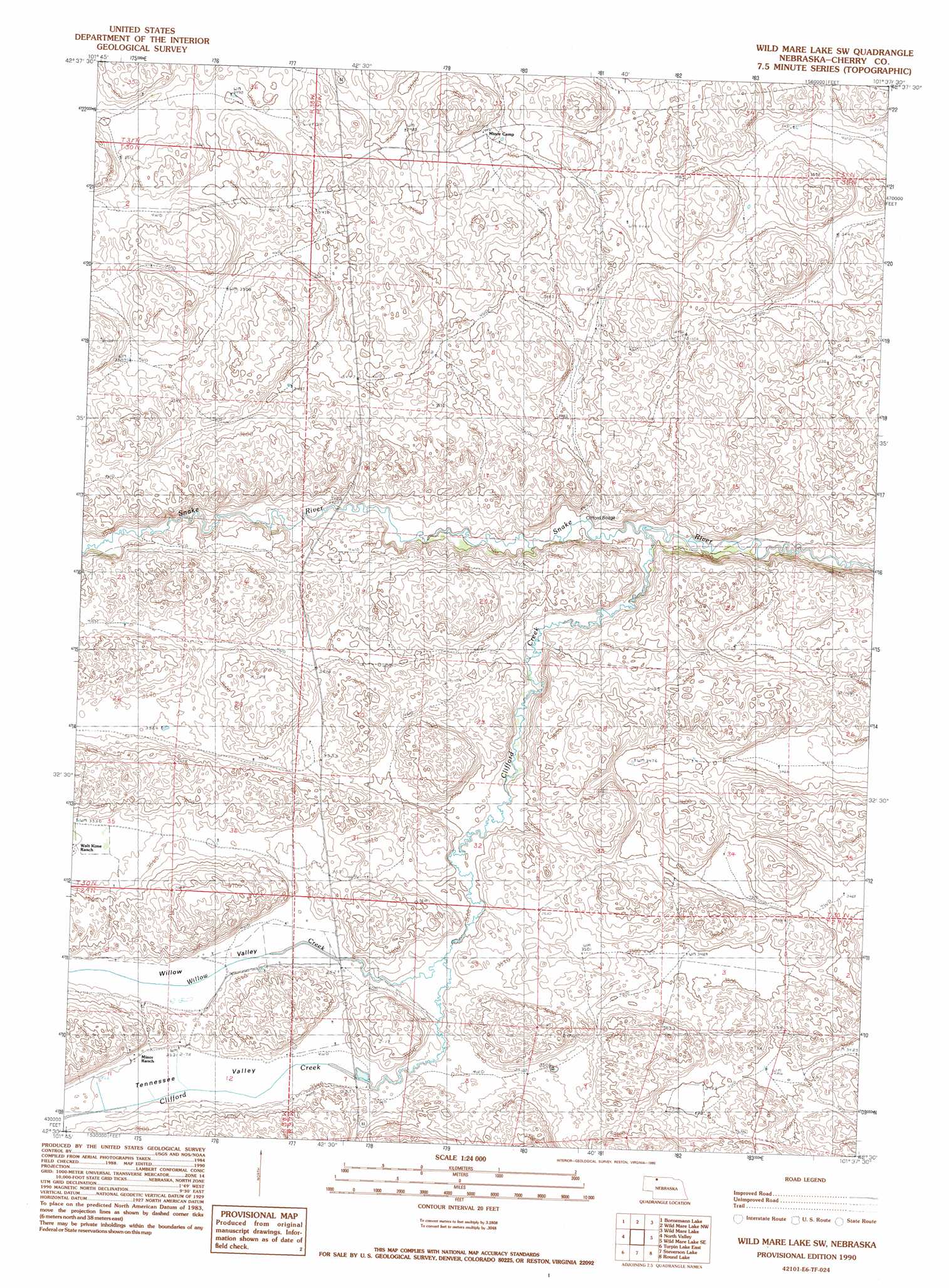
USGS Topo Quad 42101e6 - 1:24,000 scale
| Topo Map Name: | Wild Mare Lake Sw |
| USGS Topo Quad ID: | 42101e6 |
| Print Size: | ca. 21 1/4" wide x 27" high |
| Southeast Coordinates: | 42.5° N latitude / 101.625° W longitude |
| Map Center Coordinates: | 42.5625° N latitude / 101.6875° W longitude |
| U.S. State: | NE |
| Filename: | O42101E6.jpg |
| Download Map JPG Image: | Wild Mare Lake Sw topo map 1:24,000 scale |
| Map Type: | Topographic |
| Topo Series: | 7.5´ |
| Map Scale: | 1:24,000 |
| Source of Map Images: | United States Geological Survey (USGS) |
| Alternate Map Versions: |
Wild Mare Lake SW NE 1990, updated 1990 Download PDF Buy paper map Wild Mare Lake SW NE 2011 Download PDF Buy paper map Wild Mare Lake SW NE 2014 Download PDF Buy paper map |
1:24,000 Topo Quads surrounding Wild Mare Lake Sw
Irwin Sw |
Irwin Se |
Merriman Sw |
Merriman Se |
Eli Sw |
Pole Creek Valley |
Bornemann Lake |
Wild Mare Lake Nw |
Wild Mare Lake |
Medicine Lake |
Gypsy Valley |
North Valley |
Wild Mare Lake Sw |
Wild Mare Lake Se |
Indian Hill |
Turpin Lake West |
Turpin Lake East |
Steverson Lake |
Round Lake |
Wolf Lake |
Card Lake |
Bristol Lake |
School Section Lake |
Hill Lake |
Big Willow Lake |
> Back to 42101e1 at 1:100,000 scale
> Back to 42100a1 at 1:250,000 scale
> Back to U.S. Topo Maps home
Wild Mare Lake Sw topo map: Gazetteer
Wild Mare Lake Sw: Bridges
Clifford Bridge elevation 1036m 3398′Wild Mare Lake Sw: Streams
Clifford Creek elevation 1030m 3379′Willow Creek elevation 1070m 3510′
Wild Mare Lake Sw: Valleys
Willow Valley elevation 1077m 3533′Wild Mare Lake Sw digital topo map on disk
Buy this Wild Mare Lake Sw topo map showing relief, roads, GPS coordinates and other geographical features, as a high-resolution digital map file on DVD: