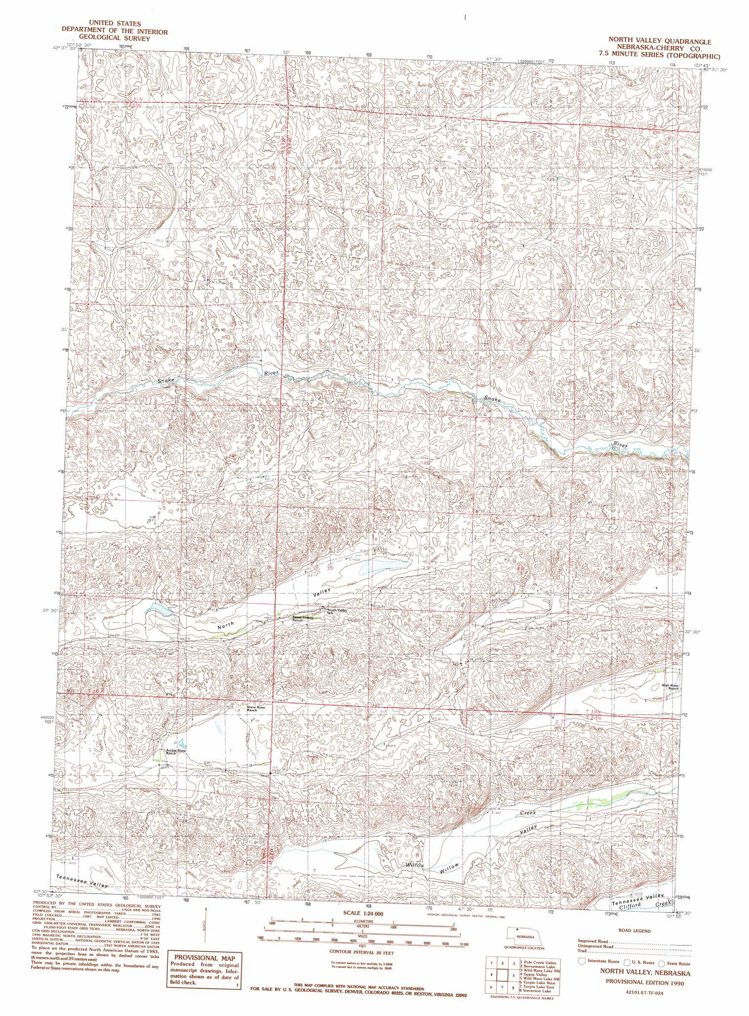
North Valley Topo Map Nebraska
To zoom in, hover over the map of North Valley
USGS Topo Quad 42101e7 - 1:24,000 scale
| Topo Map Name: | North Valley |
| USGS Topo Quad ID: | 42101e7 |
| Print Size: | ca. 21 1/4" wide x 27" high |
| Southeast Coordinates: | 42.5° N latitude / 101.75° W longitude |
| Map Center Coordinates: | 42.5625° N latitude / 101.8125° W longitude |
| U.S. State: | NE |
| Filename: | O42101E7.jpg |
| Download Map JPG Image: | North Valley topo map 1:24,000 scale |
| Map Type: | Topographic |
| Topo Series: | 7.5´ |
| Map Scale: | 1:24,000 |
| Source of Map Images: | United States Geological Survey (USGS) |
| Alternate Map Versions: |
North Valley NE 1990, updated 1990 Download PDF Buy paper map North Valley NE 2011 Download PDF Buy paper map North Valley NE 2014 Download PDF Buy paper map |
1:24,000 Topo Quads surrounding North Valley
Gordon Se |
Irwin Sw |
Irwin Se |
Merriman Sw |
Merriman Se |
Rushville 4 Ne |
Pole Creek Valley |
Bornemann Lake |
Wild Mare Lake Nw |
Wild Mare Lake |
Rushville 4 Se |
Gypsy Valley |
North Valley |
Wild Mare Lake Sw |
Wild Mare Lake Se |
Billys Lake |
Turpin Lake West |
Turpin Lake East |
Steverson Lake |
Round Lake |
Wolford Valley |
Card Lake |
Bristol Lake |
School Section Lake |
Hill Lake |
> Back to 42101e1 at 1:100,000 scale
> Back to 42100a1 at 1:250,000 scale
> Back to U.S. Topo Maps home
North Valley digital topo map on disk
Buy this North Valley topo map showing relief, roads, GPS coordinates and other geographical features, as a high-resolution digital map file on DVD: