Dolly Warden Lake Topo Map Nebraska
To zoom in, hover over the map of Dolly Warden Lake
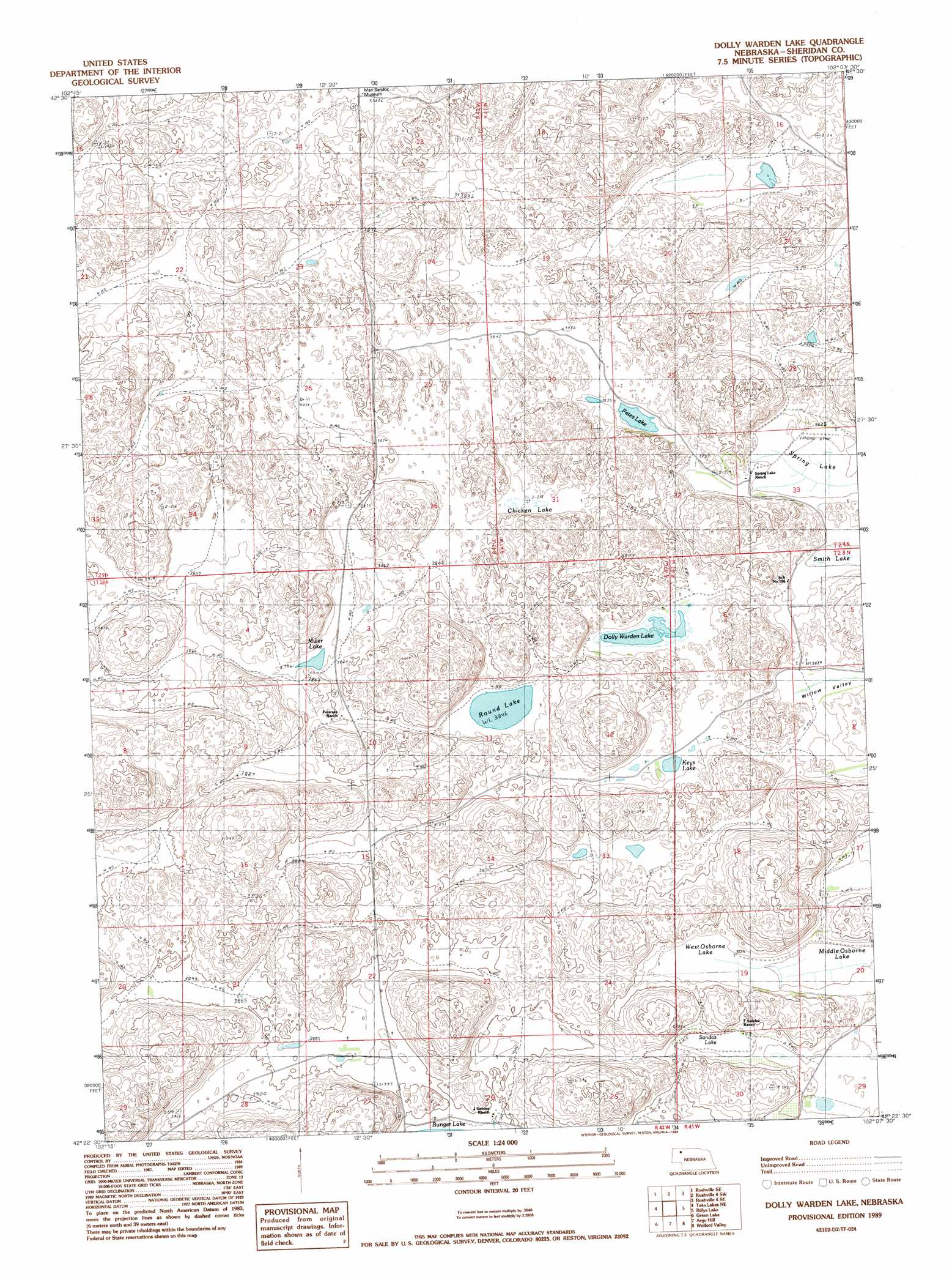
USGS Topo Quad 42102d2 - 1:24,000 scale
| Topo Map Name: | Dolly Warden Lake |
| USGS Topo Quad ID: | 42102d2 |
| Print Size: | ca. 21 1/4" wide x 27" high |
| Southeast Coordinates: | 42.375° N latitude / 102.125° W longitude |
| Map Center Coordinates: | 42.4375° N latitude / 102.1875° W longitude |
| U.S. State: | NE |
| Filename: | O42102D2.jpg |
| Download Map JPG Image: | Dolly Warden Lake topo map 1:24,000 scale |
| Map Type: | Topographic |
| Topo Series: | 7.5´ |
| Map Scale: | 1:24,000 |
| Source of Map Images: | United States Geological Survey (USGS) |
| Alternate Map Versions: |
Dolly Warden Lake NE 1989, updated 1989 Download PDF Buy paper map Dolly Warden Lake NE 2011 Download PDF Buy paper map Dolly Warden Lake NE 2014 Download PDF Buy paper map |
1:24,000 Topo Quads surrounding Dolly Warden Lake
Rushville |
Rushville Ne |
Rushville 4 Nw |
Rushville 4 Ne |
Pole Creek Valley |
Rushville Sw |
Rushville Se |
Rushville 4 Sw |
Rushville 4 Se |
Gypsy Valley |
Smith Lake |
Twin Lakes Ne |
Dolly Warden Lake |
Billys Lake |
Turpin Lake West |
Twin Lakes |
Green Lake |
Argo Hill |
Wolford Valley |
Card Lake |
Peter Long Lake |
White Lake |
Arnold Lake |
Lowe Valley |
Camp Valley |
> Back to 42102a1 at 1:100,000 scale
> Back to 42102a1 at 1:250,000 scale
> Back to U.S. Topo Maps home
Dolly Warden Lake topo map: Gazetteer
Dolly Warden Lake: Airports
Spring Lake Airport elevation 1164m 3818′Dolly Warden Lake: Lakes
Chicken Lake elevation 1176m 3858′Dolly Warden Lake elevation 1174m 3851′
Keys Lake elevation 1175m 3854′
Middle Osborne Lake elevation 1169m 3835′
Miller Lake elevation 1174m 3851′
Petes Lake elevation 1168m 3832′
Round Lake elevation 1173m 3848′
Sandoz Lake elevation 1176m 3858′
Spring Lake elevation 1163m 3815′
West Osborne Lake elevation 1175m 3854′
Dolly Warden Lake digital topo map on disk
Buy this Dolly Warden Lake topo map showing relief, roads, GPS coordinates and other geographical features, as a high-resolution digital map file on DVD:
Eastern Wyoming & Western South Dakota
Buy digital topo maps: Eastern Wyoming & Western South Dakota